MyTopo
Pier Lake Wisconsin US Topo Map
Couldn't load pickup availability
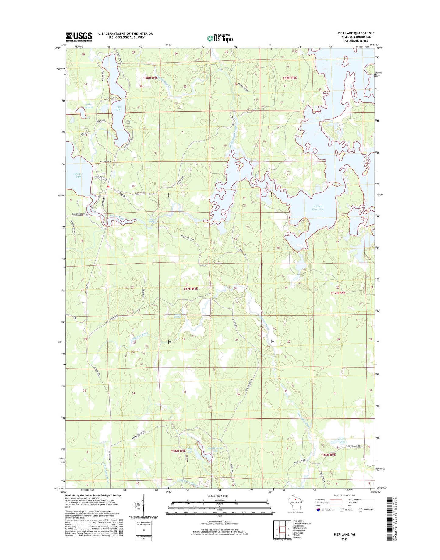
2022 topographic map quadrangle Pier Lake in the state of Wisconsin. Scale: 1:24000. Based on the newly updated USGS 7.5' US Topo map series, this map is in the following counties: Oneida. The map contains contour data, water features, and other items you are used to seeing on USGS maps, but also has updated roads and other features. This is the next generation of topographic maps. Printed on high-quality waterproof paper with UV fade-resistant inks.
Quads adjacent to this one:
West: Thunder Creek
Northwest: Pike Lake SE
North: Lac du Flambeau SW
Northeast: Mercer Lake
East: Burrows Lake
Southeast: Bradley
South: Tripoli
Southwest: Brantwood
This map covers the same area as the classic USGS quad with code o45089f8.
Contains the following named places: Bootjack Creek, Gobler Lake, Gobler Lake State Natural Area, Lake Junnie, Lamer Springs, Muskellunge Lake, Pier Lake, Saint Francis of Assisi Church, Swamsauger Creek, Town of Lynne, West Lake, Willow Lake, Willow Rapids, Willow Region Volunteer Fire Department, Willow Reservoir, Willow River