MyTopo
Lac du Flambeau Wisconsin US Topo Map
Couldn't load pickup availability
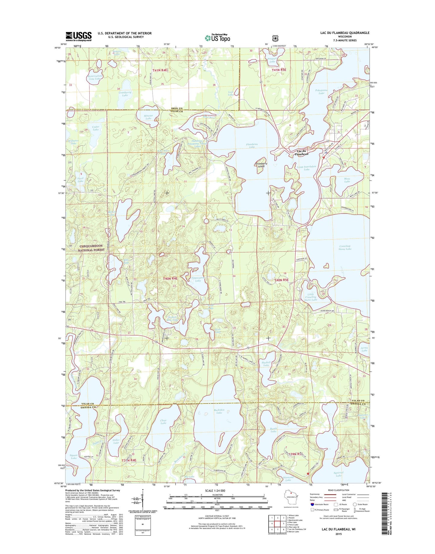
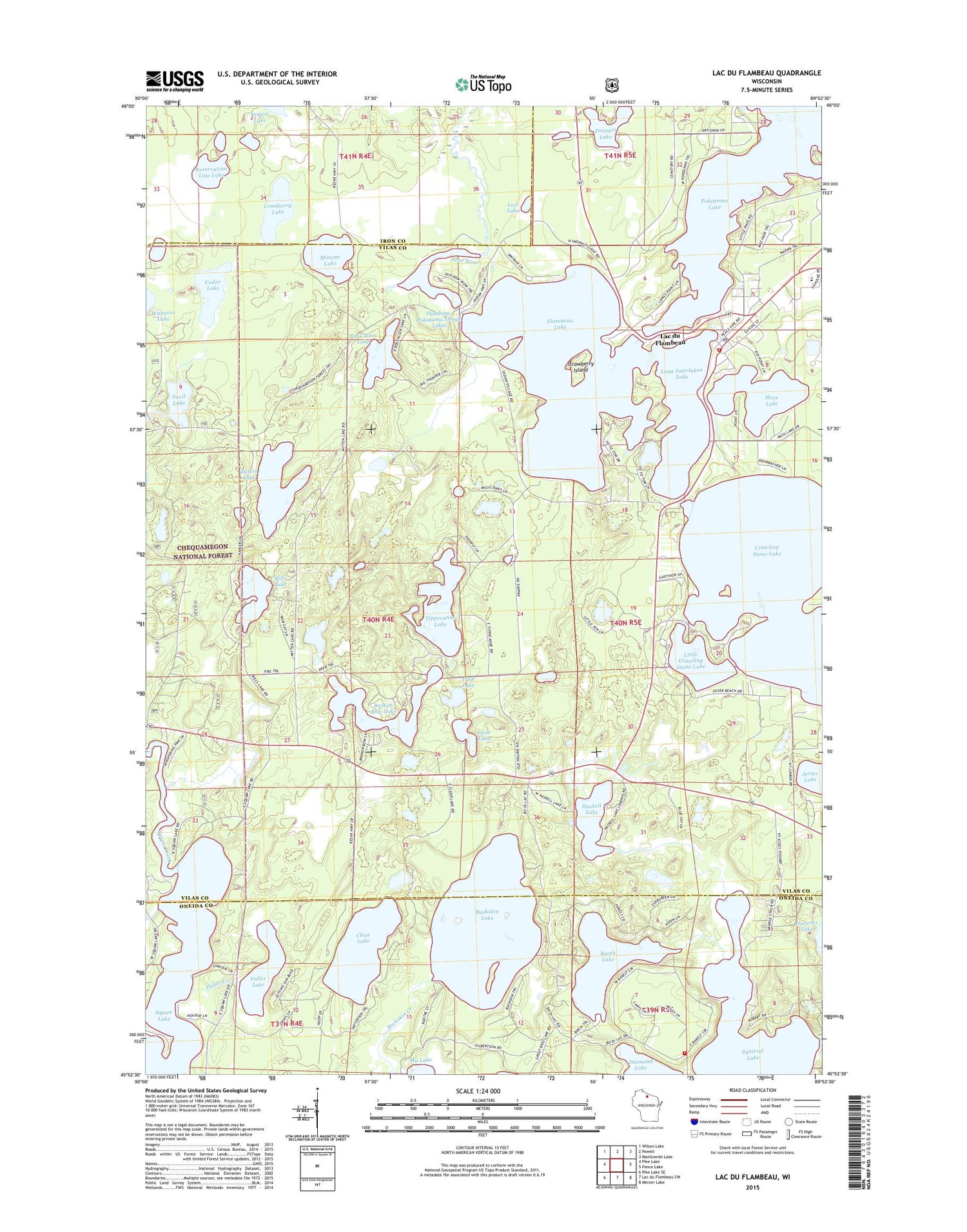
2018 topographic map quadrangle Lac du Flambeau in the state of Wisconsin. Scale: 1:24000. Based on the newly updated USGS 7.5' US Topo map series, this map is in the following counties: Vilas, Oneida, Iron. The map contains contour data, water features, and other items you are used to seeing on USGS maps, but also has updated roads and other features. This is the next generation of topographic maps. Printed on high-quality waterproof paper with UV fade-resistant inks.
Quads adjacent to this one:
West: Pike Lake
Northwest: Wilson Lake
North: Powell
Northeast: Manitowish Lake
East: Fence Lake
Southeast: Mercer Lake
South: Lac du Flambeau SW
Southwest: Pike Lake SE
Contains the following named places: Bills Lake, Booth Lake, Broken Bow Lake, Buckskin Lake, Cedar Lake, Clear Lake, Cranberry Lake, Crawling Stone Lake, Favil Lake, Flambeau Pokegama Long I Lakes, Flambeau Lake, Flambeau Lake Dam, Fuller Creek, Fuller Lake, Gene Lake, Haskell Lake, Havener Lake, Jerms Lake, Lac du Flambeau, Lac du Flambeau Census Designated Place, Lac du Flambeau Fire and Ambulance Department Station 1, Lac Du Flambeau Police Department, Lac Du Flambeau Post Office, Lac Du Flambeau Public School, Lac du Flambeau Reservation, Little Crawling Stone Lake, Little Ten Lake, Long Interlaken Lake, Lost Lake, Minette Lake, Minocqua Fire Department - Station 2, Mitten Lake, Moss Lake, Patterson Hemlocks State Natural Area, Pokegama Lake, Poupart Lake, Reservation Line Lake, Ross Allen Lake, Squaw Lake, Strawberry Island, Tank Lake, Tippecanoe Lake, Town of Lac du Flambeau, Wabasso Lake Campground, ZIP Code: 54538