MyTopo
Manitowish Lake Wisconsin US Topo Map
Couldn't load pickup availability
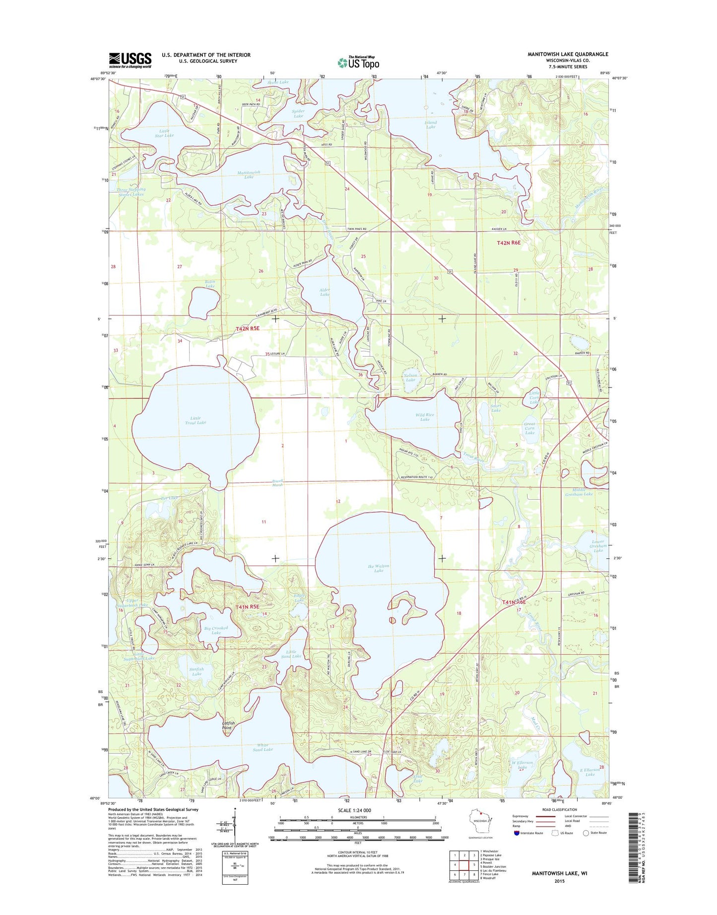
2022 topographic map quadrangle Manitowish Lake in the state of Wisconsin. Scale: 1:24000. Based on the newly updated USGS 7.5' US Topo map series, this map is in the following counties: Vilas. The map contains contour data, water features, and other items you are used to seeing on USGS maps, but also has updated roads and other features. This is the next generation of topographic maps. Printed on high-quality waterproof paper with UV fade-resistant inks.
Quads adjacent to this one:
West: Powell
Northwest: Winchester
North: Papoose Lake
Northeast: Presque Isle
East: Boulder Junction
Southeast: Woodruff
South: Fence Lake
Southwest: Lac du Flambeau
This map covers the same area as the classic USGS quad with code o46089a7.
Contains the following named places: Alder Lake, Big Crooked Lake, Bolin Lake, Camp Nawakwa, Camp Wipigaki, Catfish Point, Eagle Lake, East Camp Nawakwa, East Ellerson Lake, Elsie Lake, Great Corn Lake, Gresham Creek, Ike Walton Lake, Island Lake, Little Corn Lake, Little Sand Lake, Little Star Lake, Little Sugarbush Lake, Little Trout Lake, Lower Gresham Lake, Manito Island, Manitowish Lake, Manitowish Waters School, Middle Ellerson Lake, Mud Creek, Nelson Lake, Snort Lake, Spider Lake, Stepping Stone Lake Number 1, Sunfish Lake, Town of Manitowish Waters, Trout River, West Ellerson Lake, White Sand Lake, Wild Rice Lake, Zee Lake