MyTopo
Little Chicago Wisconsin US Topo Map
Couldn't load pickup availability
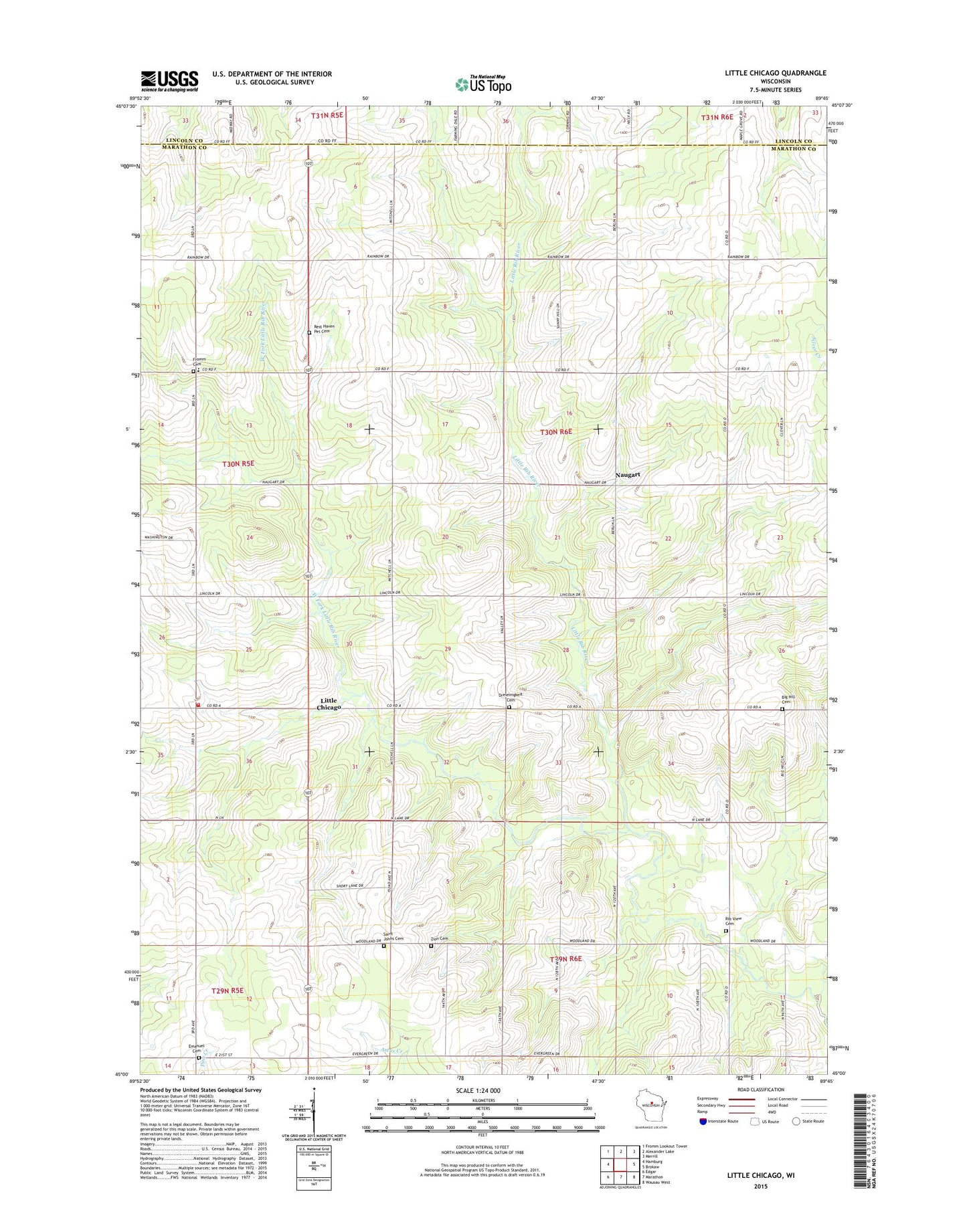
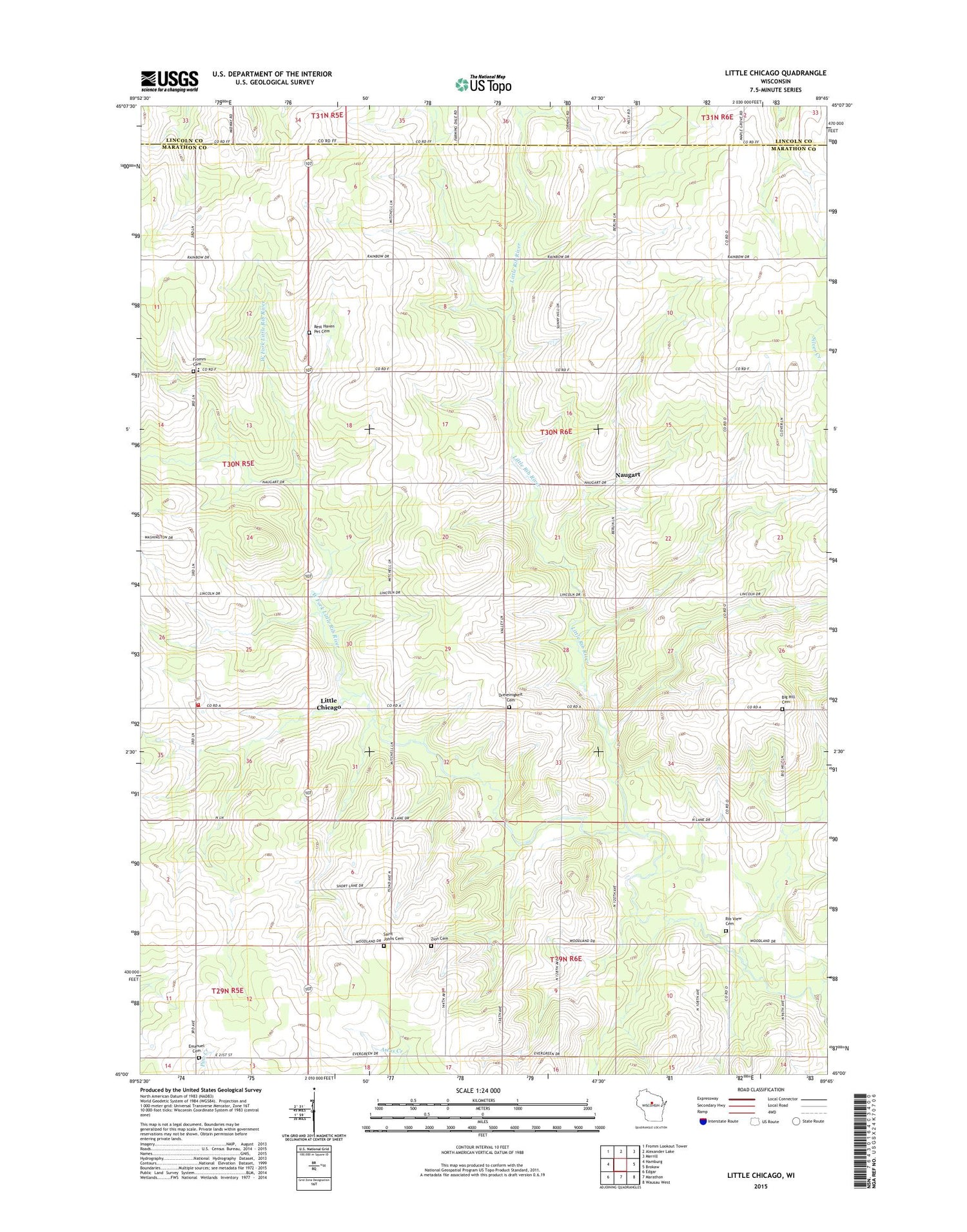
2018 topographic map quadrangle Little Chicago in the state of Wisconsin. Scale: 1:24000. Based on the newly updated USGS 7.5' US Topo map series, this map is in the following counties: Marathon, Lincoln. The map contains contour data, water features, and other items you are used to seeing on USGS maps, but also has updated roads and other features. This is the next generation of topographic maps. Printed on high-quality waterproof paper with UV fade-resistant inks.
Quads adjacent to this one:
West: Hamburg
Northwest: Fromm Lookout Tower
North: Alexander Lake
Northeast: Merrill
East: Brokaw
Southeast: Wausau West
South: Marathon
Southwest: Edgar
Contains the following named places: Big Hill Cemetery, Dreieinigkeit Church, Elk Valley Farms, Emanuel Lutheran Cemetery, Emmerich, Friedenshain Cemetery, Fromm Cemetery, Grandview School, Hamburg Volunteer Fire Department, La Follette School, Little Chicago, Madison School, Maple Grove Charter School, Misty Hollow Farms, Mitchell School, Naugart, Naugart School, Rest Haven Pet Cemetery, Rib View Cemetery, Saint John Lutheran Cemetery, Saint Peters Church, Salzman Farm, Silver Creek, Streis Farm, Stubbe Hill School, Teske Farms, Town of Berlin, Trinity Church, Washington Heights School, West Fork Little Rib River, Woodland Dale School, Zernicke Farms, Zion Cemetery, Zion Church