MyTopo
Brokaw Wisconsin US Topo Map
Couldn't load pickup availability
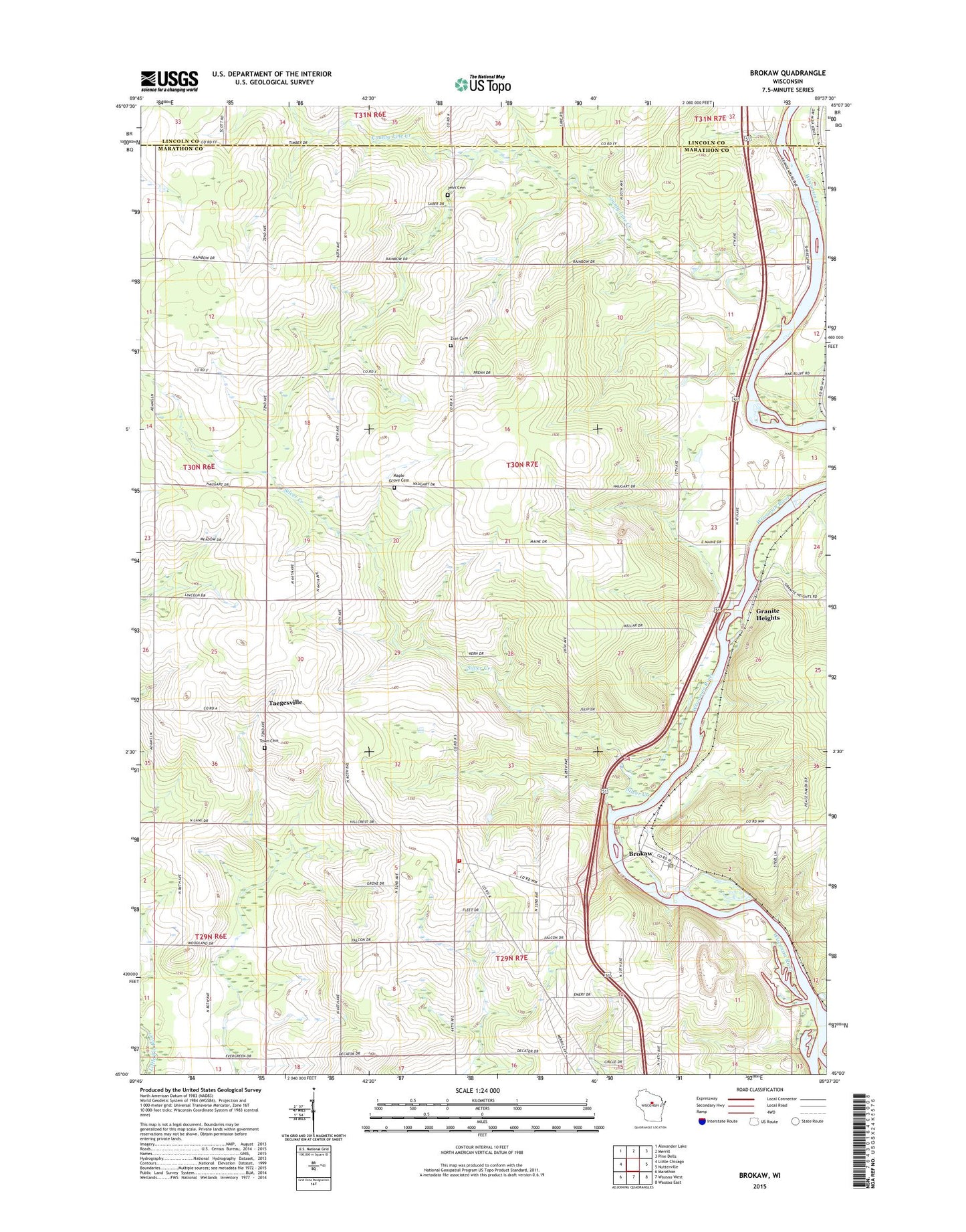
2022 topographic map quadrangle Brokaw in the state of Wisconsin. Scale: 1:24000. Based on the newly updated USGS 7.5' US Topo map series, this map is in the following counties: Marathon, Lincoln. The map contains contour data, water features, and other items you are used to seeing on USGS maps, but also has updated roads and other features. This is the next generation of topographic maps. Printed on high-quality waterproof paper with UV fade-resistant inks.
Quads adjacent to this one:
West: Little Chicago
Northwest: Alexander Lake
North: Merrill
Northeast: Pine Dells
East: Nutterville
Southeast: Wausau East
South: Wausau West
Southwest: Marathon
This map covers the same area as the classic USGS quad with code o45089a6.
Contains the following named places: Adams School, Baumann Farms, Berlin Cemetery, Brokaw, Brokaw Methodist Church, Brokaw Post Office, Bryan Valley School, Churchill School, County Line Creek, Down To Earth Greenhouse and Nursery, Endres Farm, Faith Cemetery North, Faith Church, Faith Lutheran Cemetery South, Falcon Valley Farms, Grace Lutheran Church, Granite Heights, Jackson School, Lentz Creek, Maine, Maine Elementary School, Maine Township Fire Department, Maple Grove Cemetery, Red Granite School, Rib Mountain Quarry, Ruby Red Quarry, Saint John Evangelical Lutheran Church, Sturm Farms, Taegesville, Taegesville School, Valley View School, Village of Brokaw, Village of Maine, WMZK-FM (Merrill), Zion Church, ZIP Code: 54417