MyTopo
New Franken Wisconsin US Topo Map
Couldn't load pickup availability
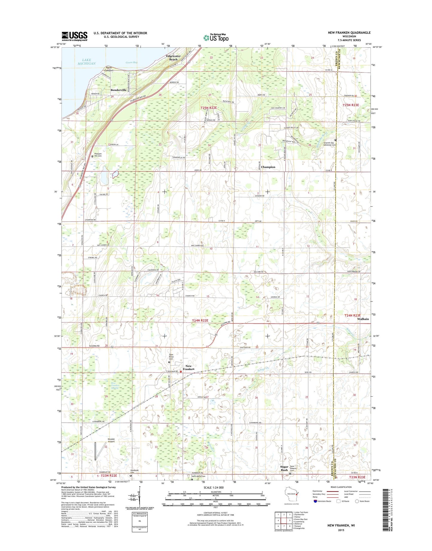
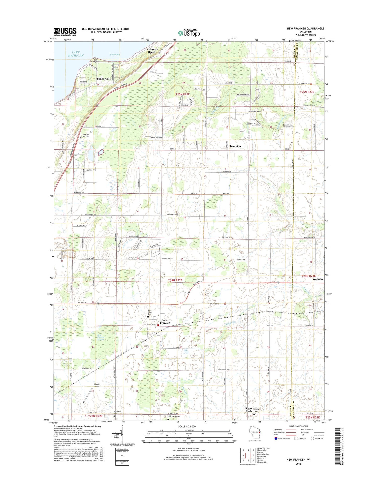
2018 topographic map quadrangle New Franken in the state of Wisconsin. Scale: 1:24000. Based on the newly updated USGS 7.5' US Topo map series, this map is in the following counties: Brown, Kewaunee. The map contains contour data, water features, and other items you are used to seeing on USGS maps, but also has updated roads and other features. This is the next generation of topographic maps. Printed on high-quality waterproof paper with UV fade-resistant inks.
Quads adjacent to this one:
West: Green Bay East
Northwest: Little Tail Point
North: Dyckesville
Northeast: Namur
East: Luxemburg
Southeast: Stangelville
South: Poland
Southwest: Bellevue
Contains the following named places: Bay Settlement Quarry, Benderville, Brick School, Champion, Cornette Dairy, Dyckesville School, Edgewater Beach, Humboldt, Humboldt Cemetery, Mount May School, New Franken, New Franken Fire Department, New Franken Post Office, New Franken Swamp, Nicolet Airport, Oak Grove School, Our Lady Chapel, Pleasant Hill Cemetery, Point Comfort, Red Banks, Robinsonville Church, Saint Amand Catholic Church, Saint Huberts Cemetery, Saint Joseph Catholic Church, Saint Kilian Cemetery, Saint Kilian Church, Saint Marys Cemetery, Seventh - Day Adventist Cemetery, Sugar Bush, Sugar Maple Dairy, Town of Green Bay, Town of Humboldt, Walhain, Wequiock Church, Wequiock Elementary School, ZIP Code: 54229