MyTopo
Poland Wisconsin US Topo Map
Couldn't load pickup availability
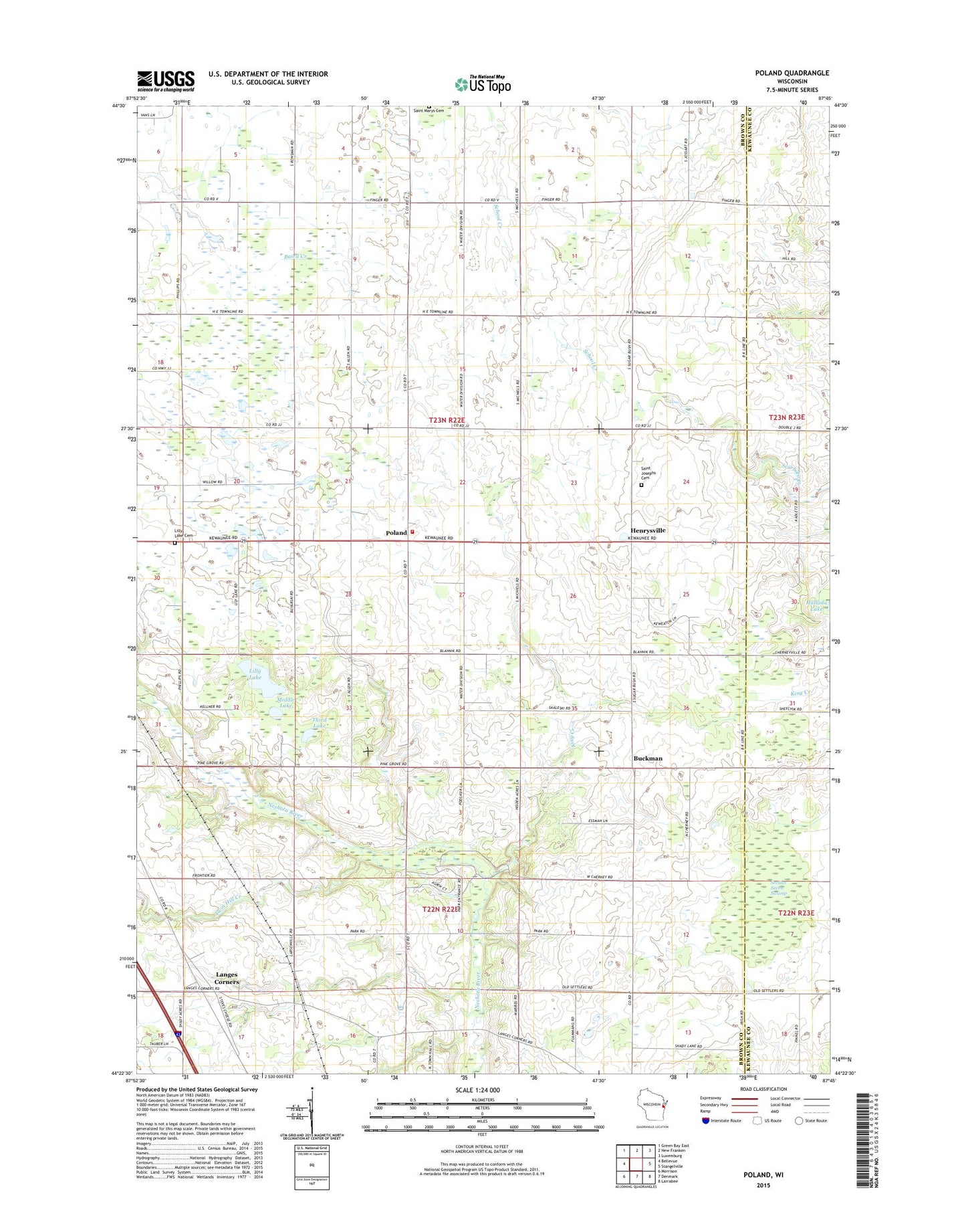
2022 topographic map quadrangle Poland in the state of Wisconsin. Scale: 1:24000. Based on the newly updated USGS 7.5' US Topo map series, this map is in the following counties: Brown, Kewaunee. The map contains contour data, water features, and other items you are used to seeing on USGS maps, but also has updated roads and other features. This is the next generation of topographic maps. Printed on high-quality waterproof paper with UV fade-resistant inks.
Quads adjacent to this one:
West: Bellevue
Northwest: Green Bay East
North: New Franken
Northeast: Luxemburg
East: Stangelville
Southeast: Larrabee
South: Denmark
Southwest: Morrison
This map covers the same area as the classic USGS quad with code o44087d7.
Contains the following named places: Buckman, Buresh Farms, Coppens Corner, Davister Farm, Denmark Volunteer Fire Department 2, Emanuel Church, Fontenoy School, Henrysville, King Creek, Langes Corners, Lilly Lake, Lilly Lake County Park, Lynch School, Martyville Dairy, Middle Lake, Neshota County Park, Our Saviors of Eaton Cemetery, Poland, Rosik Century Farms, Saint Josephs Cemetery, Section Seven Swamp, Third Lake, Town of Eaton, Twin Hill Creek, Twinbrook Farms, Water Division School, West Eaton School