MyTopo
Oulu Wisconsin US Topo Map
Couldn't load pickup availability
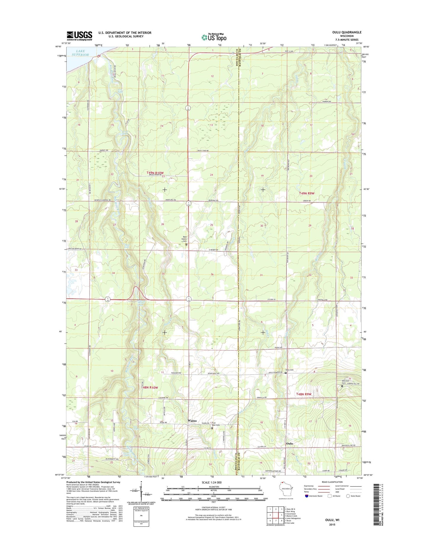
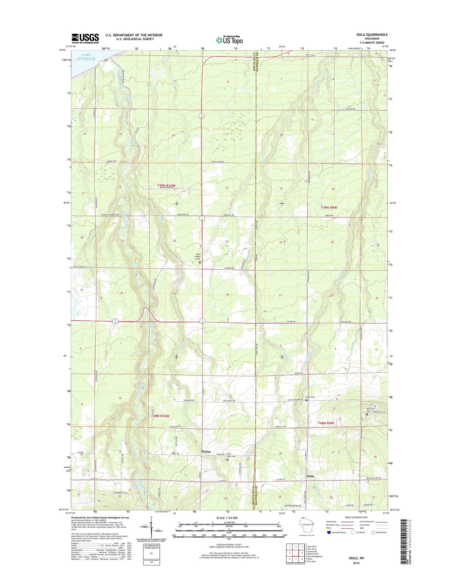
2018 topographic map quadrangle Oulu in the state of Wisconsin. Scale: 1:24000. Based on the newly updated USGS 7.5' US Topo map series, this map is in the following counties: Douglas, Bayfield. The map contains contour data, water features, and other items you are used to seeing on USGS maps, but also has updated roads and other features. This is the next generation of topographic maps. Printed on high-quality waterproof paper with UV fade-resistant inks.
Quads adjacent to this one:
West: Cloverland
North: Oulu OE N
Northeast: Port Wing
East: Blaine Creek
Southeast: Iron Lake
South: Brule
Southwest: Lake Nebagamon
Contains the following named places: Bois Brule River, Brule River Boreal Forest State Natural Area, Brule River State Forest Waterfowl Management Area, Ever Rest Cemetery, Highway Thirteen Rapids, Hillcrest Cemetery, Lenroot Ledges, Long Riffles, May Ledges, McNeil Landing, Oulu, Oulu Church, Oulu Luthern Cemetery, Resthaven Cemetery, Shale Falls, Trask Creek, Waino, Weir Riffles