MyTopo
Lake Nebagamon Wisconsin US Topo Map
Couldn't load pickup availability
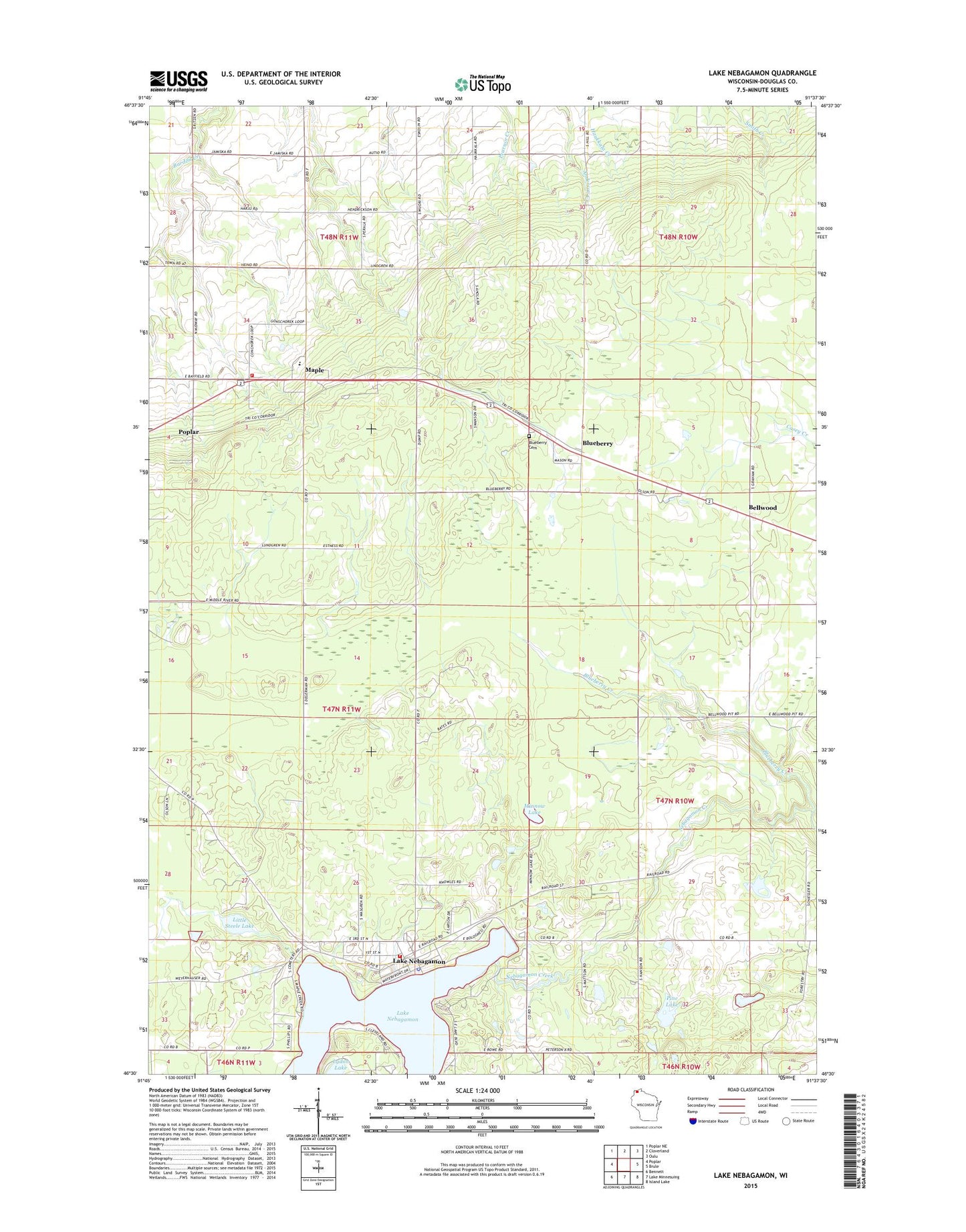
2022 topographic map quadrangle Lake Nebagamon in the state of Wisconsin. Scale: 1:24000. Based on the newly updated USGS 7.5' US Topo map series, this map is in the following counties: Douglas. The map contains contour data, water features, and other items you are used to seeing on USGS maps, but also has updated roads and other features. This is the next generation of topographic maps. Printed on high-quality waterproof paper with UV fade-resistant inks.
Quads adjacent to this one:
West: Poplar
Northwest: Poplar NE
North: Cloverland
Northeast: Oulu
East: Brule
Southeast: Island Lake
South: Lake Minnesuing
Southwest: Bennett
This map covers the same area as the classic USGS quad with code o46091e6.
Contains the following named places: Bellwood, Blueberry, Blueberry Creek, Corner School, Finnish Church, Lake Nebagamon, Lake Nebagamon Church, Lake Nebagamon Police Department, Lake Nebagamon Post Office, Lake Nebagamon Volunteer Fire Department, Little Steele Lake, Lydon Lake, Maple, Maple Fire Department, Maple Post Office, Minnow Lake, Northwestern High School, Pine Lake, Saint Anns Cemetery, Town of Maple, Village of Lake Nebagamon