MyTopo
Pike Lake SE Wisconsin US Topo Map
Couldn't load pickup availability
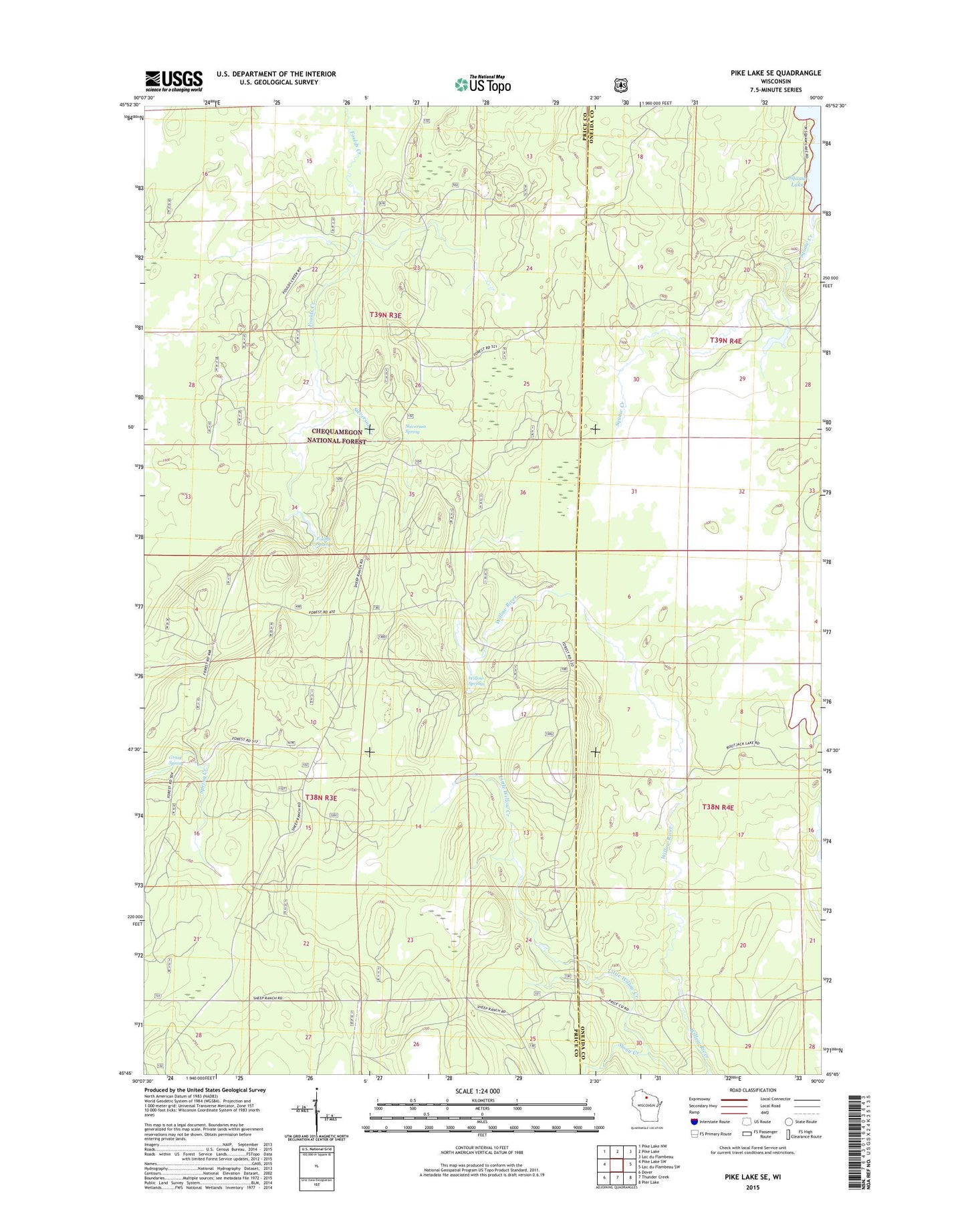
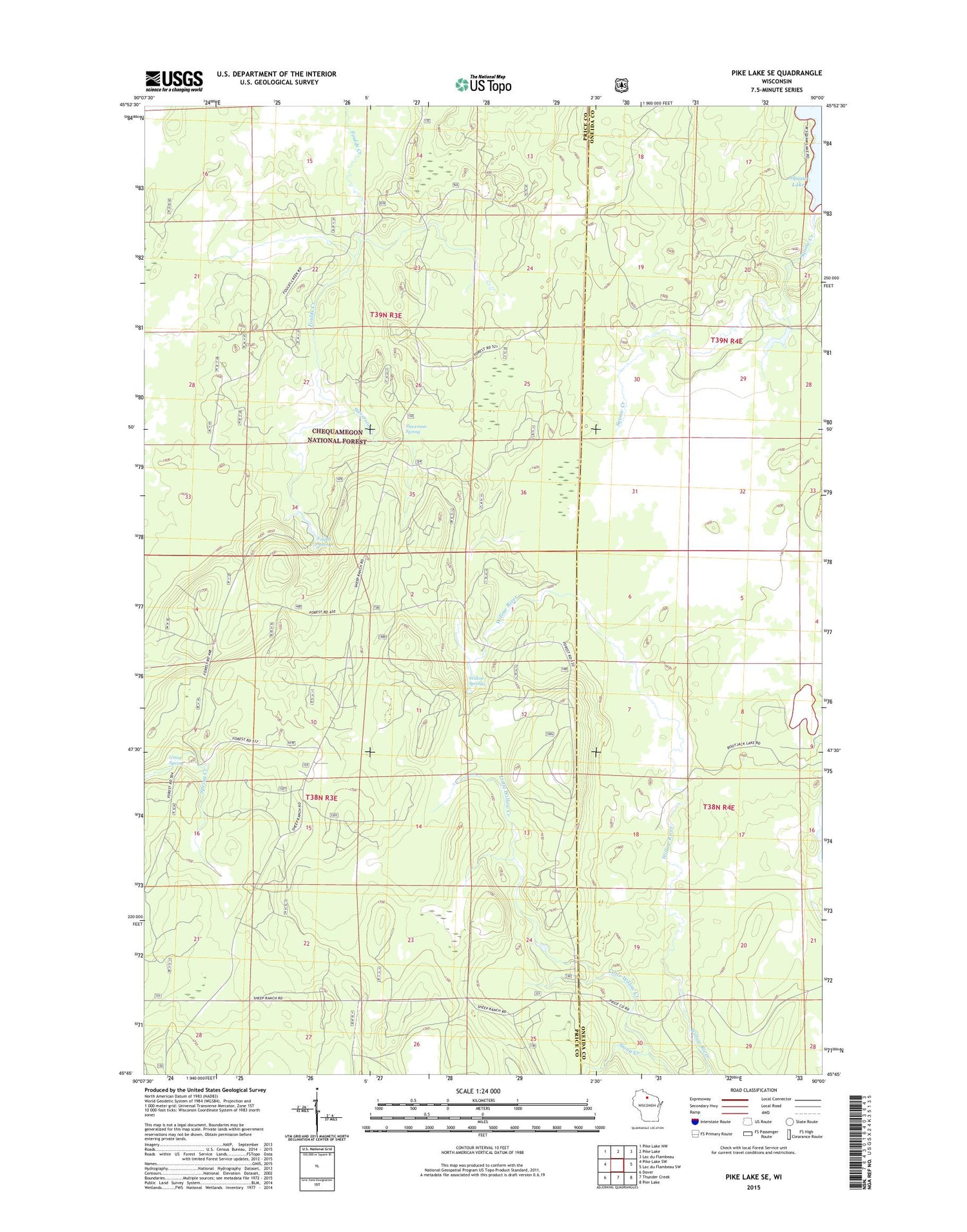
2018 topographic map quadrangle Pike Lake SE in the state of Wisconsin. Scale: 1:24000. Based on the newly updated USGS 7.5' US Topo map series, this map is in the following counties: Price, Oneida. The map contains contour data, water features, and other items you are used to seeing on USGS maps, but also has updated roads and other features. This is the next generation of topographic maps. Printed on high-quality waterproof paper with UV fade-resistant inks.
Quads adjacent to this one:
West: Pike Lake SW
Northwest: Pike Lake NW
North: Pike Lake
Northeast: Lac du Flambeau
East: Lac du Flambeau SW
Southeast: Pier Lake
South: Thunder Creek
Southwest: Dover
Contains the following named places: Bootjack Lake, Elk River Lookout Tower, Foulds Springs, Four Corners Camp Ground, Grant Spring, Sieverson Creek, Sieverson Spring, Stony Creek, Willow Springs, Willow Springs Camp Ground