MyTopo
Pike Lake Wisconsin US Topo Map
Couldn't load pickup availability
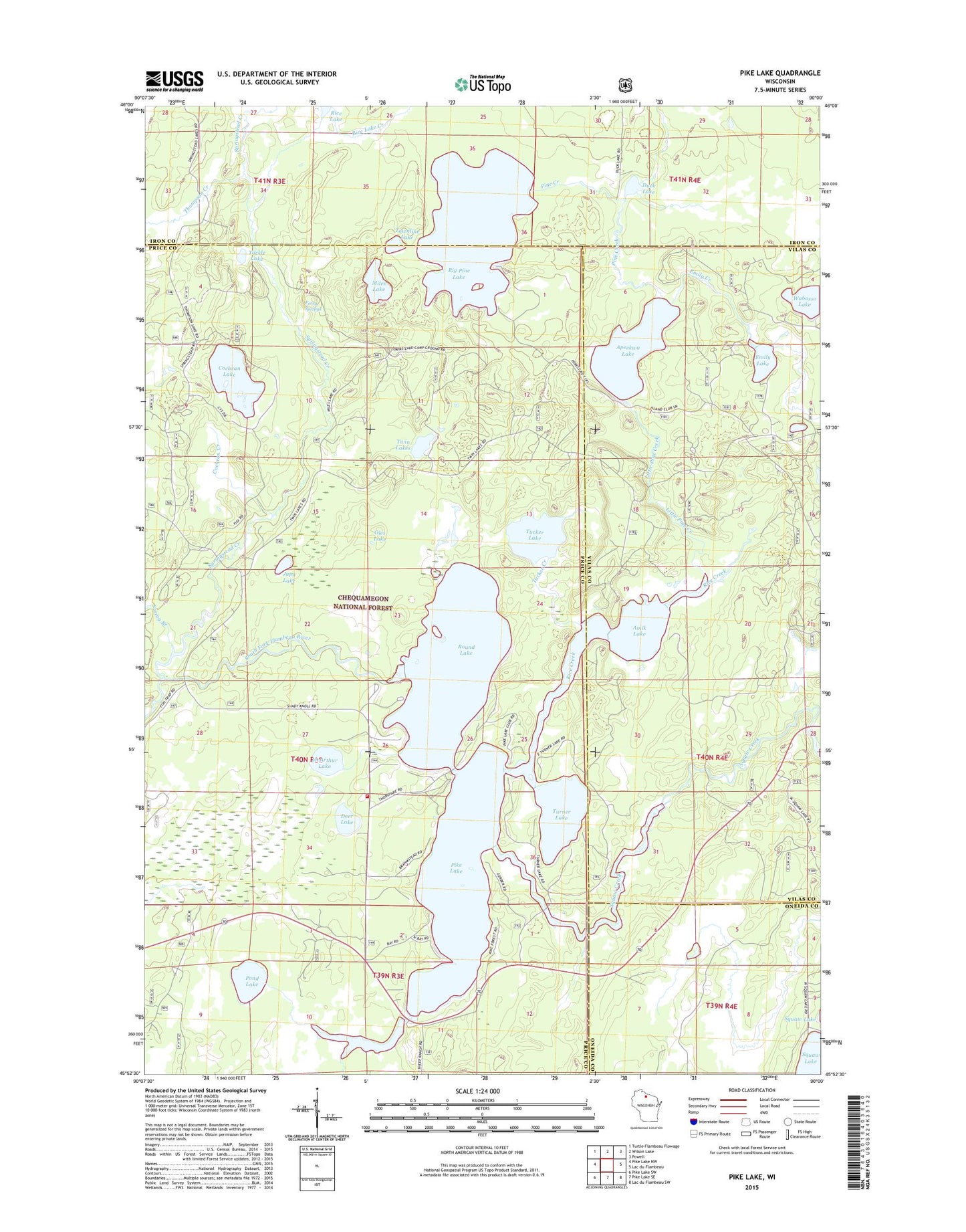
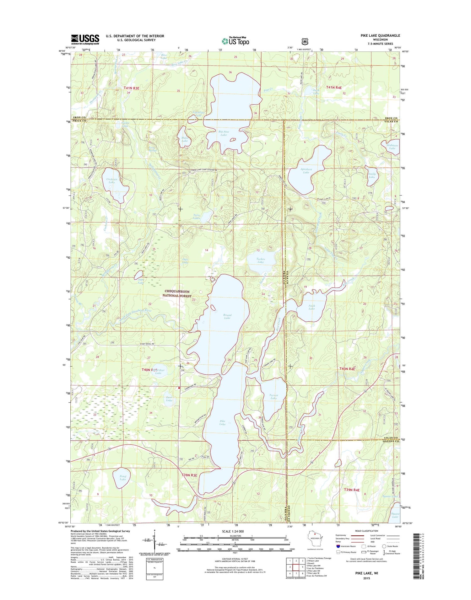
2018 topographic map quadrangle Pike Lake in the state of Wisconsin. Scale: 1:24000. Based on the newly updated USGS 7.5' US Topo map series, this map is in the following counties: Price, Vilas, Iron, Oneida. The map contains contour data, water features, and other items you are used to seeing on USGS maps, but also has updated roads and other features. This is the next generation of topographic maps. Printed on high-quality waterproof paper with UV fade-resistant inks.
Quads adjacent to this one:
West: Pike Lake NW
Northwest: Turtle-Flambeau Flowage
North: Wilson Lake
Northeast: Powell
East: Lac du Flambeau
Southeast: Lac du Flambeau SW
South: Pike Lake SE
Southwest: Pike Lake SW
Contains the following named places: Amik Lake, Apeekwa Lake, Bass Lake Preserve State Natural Area, Big Pine Lake, Caro Timber Picnic Ground, Cochran Creek, Cochran Lake, Deer Lake, Duck Lake, Emily Creek, Emily Lake, Emily Lake Campground, Ferry Springs, Fishtrap Campground, Foulds Creek, Franks Seaplane Base, Jupa Lake, Little Pine Creek, McArthur Lake, Memorial Grove Hemlocks State Natural Area, Memorial Grove Picnic Area, Miles Lake, Oles Lake, Pike Lake, Pike Lake Fire Department, Pine Creek, Pond Lake, Rice Creek, Rice Lake, Rice Lake Creek, Round Lake, Sentinal Point Lookout Tower, Spring Branch, Springstead Creek, Squaw Creek, Tackle Lake, Thompson Creek, Townline Lake, Tucker Creek, Tucker Lake, Tucker Lake Hemlocks State Natural Area, Turner Lake, Twin Lakes, Twin Lakes Campground, Wabasso Lake