MyTopo
Turtle-Flambeau Flowage Wisconsin US Topo Map
Couldn't load pickup availability
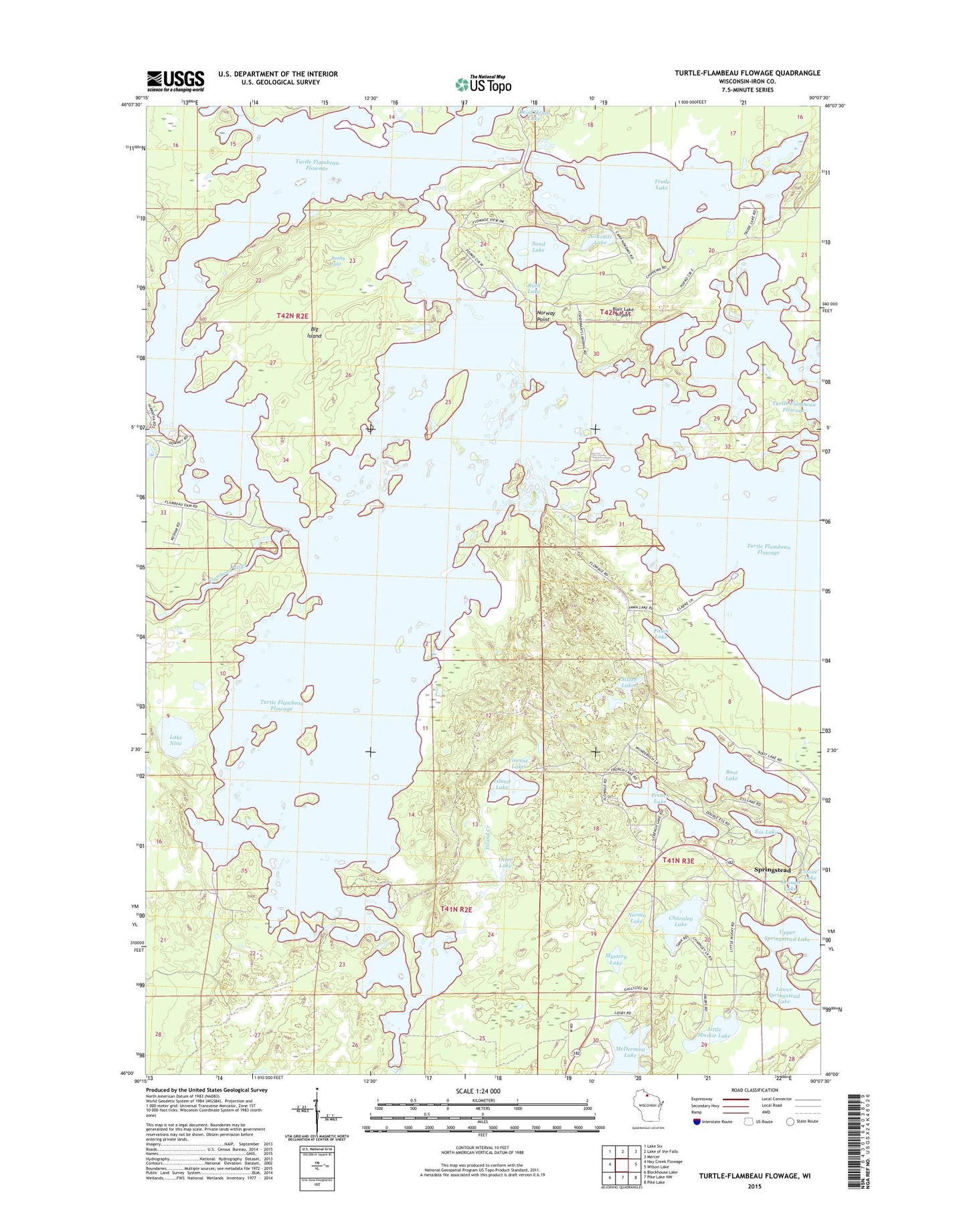
2022 topographic map quadrangle Turtle-Flambeau Flowage in the state of Wisconsin. Scale: 1:24000. Based on the newly updated USGS 7.5' US Topo map series, this map is in the following counties: Iron. The map contains contour data, water features, and other items you are used to seeing on USGS maps, but also has updated roads and other features. This is the next generation of topographic maps. Printed on high-quality waterproof paper with UV fade-resistant inks.
Quads adjacent to this one:
West: Hay Creek Flowage
Northwest: Lake Six
North: Lake of the Falls
Northeast: Mercer
East: Wilson Lake
Southeast: Pike Lake
South: Pike Lake NW
Southwest: Blockhouse Lake
This map covers the same area as the classic USGS quad with code o46090a2.
Contains the following named places: Big Island, Big Island State Wildlife Area, Blair Lake Airport, Boot Lake, Charnley Lake, Ess Lake, Fawn Lake, Fishermans Landing, Flambeau Flowage 666, Flambeau Reservoir WP268 Dam, Fourmile Creek, French Lake, Hay Creek-Hoffman Lake State Wildlife Area, Island Creek, Island Lake, Keough Lake, Lake Nine, Little Muskie Lake, Lower Springstead Lake, McDermott Lake, Mystery Lake, Nokomis Lake, Norma Lake, Norway Point, Otter Creek, Otter Lake, Realty Lake, Ruth Lake, Sand Lake, Sherman Townhall, Sister Lakes, Springstead, Springstead Landing, Springstead Lookout Tower, Springstead School, Trude Lake, Turtle Dam, Turtle River, Turtle-Flambeau Flowage, Upper Springstead Lake, Vincent Lake