MyTopo
Ringle Wisconsin US Topo Map
Couldn't load pickup availability
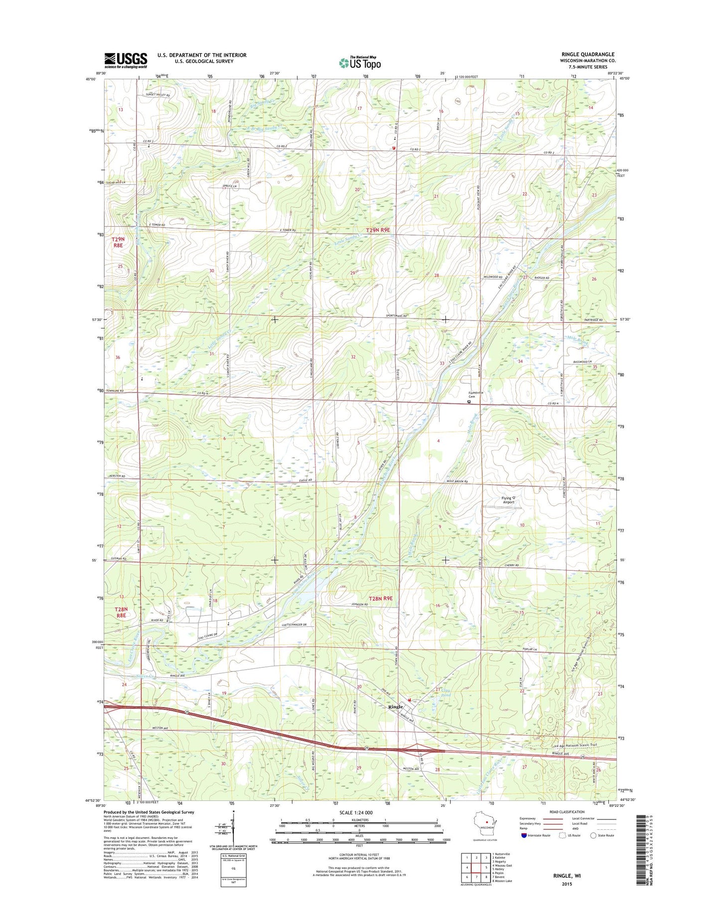
2018 topographic map quadrangle Ringle in the state of Wisconsin. Scale: 1:24000. Based on the newly updated USGS 7.5' US Topo map series, this map is in the following counties: Marathon. The map contains contour data, water features, and other items you are used to seeing on USGS maps, but also has updated roads and other features. This is the next generation of topographic maps. Printed on high-quality waterproof paper with UV fade-resistant inks.
Quads adjacent to this one:
West: Wausau East
Northwest: Nutterville
North: Kalinke
Northeast: Hogarty
East: Hatley
Southeast: Mission Lake
South: Bevent
Southwest: Peplin
Contains the following named places: Barstow School, Carpenter School, Clay Pond, Dewey School, East Branch Big Sandy Creek, Easton Center School, Easton Elementary School, Easton Volunteer Fire Department, Faith Christian Academy, Flying 'O' Airport, Forestville Cemetery, Forestville School, Marathon County Landfill, Mole Brook, New Hope Church, Ringle, Ringle Fire Department, Ringle Post Office, Riverside Elementary School, Saint John Lutheran School, Stam Farms, Town of Easton, Town of Ringle, ZIP Code: 54471