MyTopo
Hatley Wisconsin US Topo Map
Couldn't load pickup availability
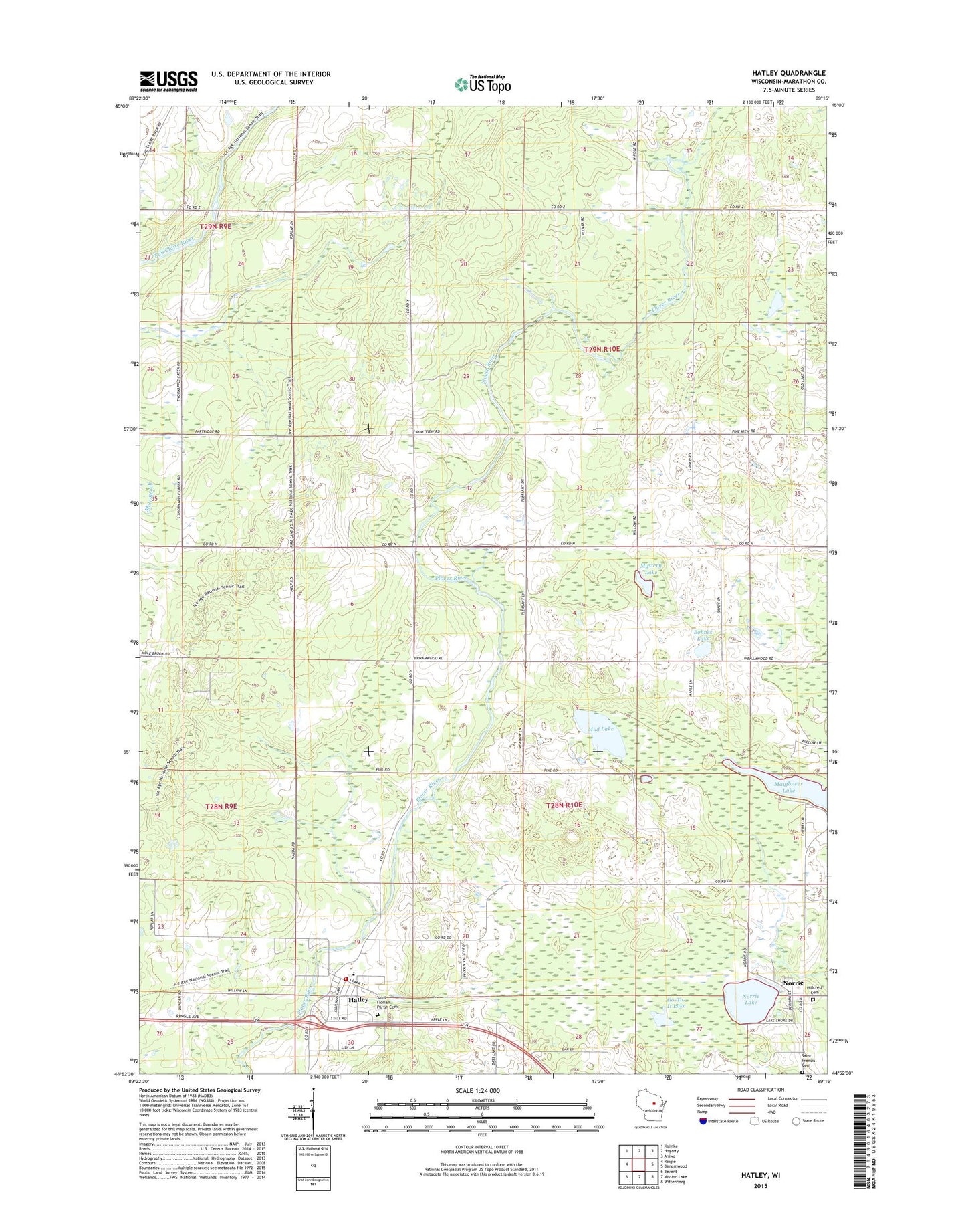
2022 topographic map quadrangle Hatley in the state of Wisconsin. Scale: 1:24000. Based on the newly updated USGS 7.5' US Topo map series, this map is in the following counties: Marathon. The map contains contour data, water features, and other items you are used to seeing on USGS maps, but also has updated roads and other features. This is the next generation of topographic maps. Printed on high-quality waterproof paper with UV fade-resistant inks.
Quads adjacent to this one:
West: Ringle
Northwest: Kalinke
North: Hogarty
Northeast: Aniwa
East: Birnamwood
Southeast: Wittenberg
South: Mission Lake
Southwest: Bevent
This map covers the same area as the classic USGS quad with code o44089h3.
Contains the following named places: Birnamwood Church, Bluegill Lake, Bohnes Lake, Forestville Church, Go-To-It Lake, Hatley, Hatley Area Fire and Ambulance District, Hatley Elementary School, Hatley Post Office, Hillcrest Cemetery, Marathon County Public Library Hatley Branch, Mayflower Lake, Mud Lake, Mystery Lake, Norrie, Norrie Lake, Plover Valley School, Saint Florian Parish Cemetery, Saint Florians Grade School, Saint Francis Cemetery, Town of Norrie, Town of Plover, Trunk Line School, Village of Hatley, Wayside Park, Woodland School