MyTopo
Rockdale Wisconsin US Topo Map
Couldn't load pickup availability
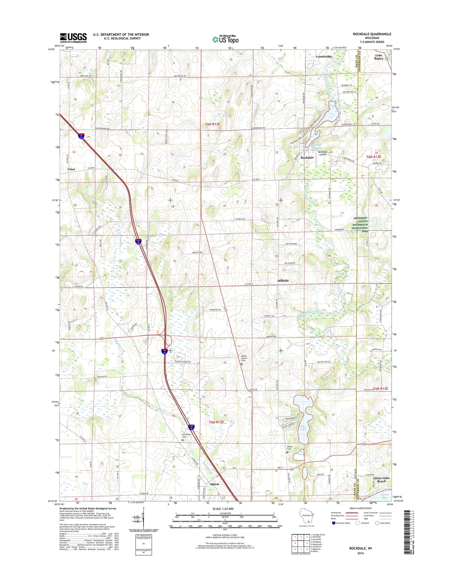
2018 topographic map quadrangle Rockdale in the state of Wisconsin. Scale: 1:24000. Based on the newly updated USGS 7.5' US Topo map series, this map is in the following counties: Dane, Jefferson. The map contains contour data, water features, and other items you are used to seeing on USGS maps, but also has updated roads and other features. This is the next generation of topographic maps. Printed on high-quality waterproof paper with UV fade-resistant inks.
Quads adjacent to this one:
West: Stoughton
Northwest: Cottage Grove
North: Deerfield
Northeast: Lake Mills
East: Busseyville
Southeast: Milton
South: Edgerton
Southwest: Cooksville
Contains the following named places: Albion, Albion Prairie Cemetery, Albion Prairie Church, Albion Prairie School, Busseyville School, East Koshkonkong Church, East Koshkonong Cemetery, Evergreen Cemetery, Hickory Hill Girl Scout Camp, Hillside, Hillside School, Kaupanger-Ramsey Quarry, Pioneer Norwegian Cemetery, Rice Lake, Rockdale, Rockdale Airport, Rockdale Dam, Rockdale Lutheran Church Cemetery, Rockdale Millpond, Rockdale Millpond 134, RockGen Energy Center, Smithback School, Sweet Cemetery, Sweet Lake, Town of Albion, Town of Christiana, Tru Field, Turtle Lake, Utica, Village of Rockdale, ZIP Code: 53523