MyTopo
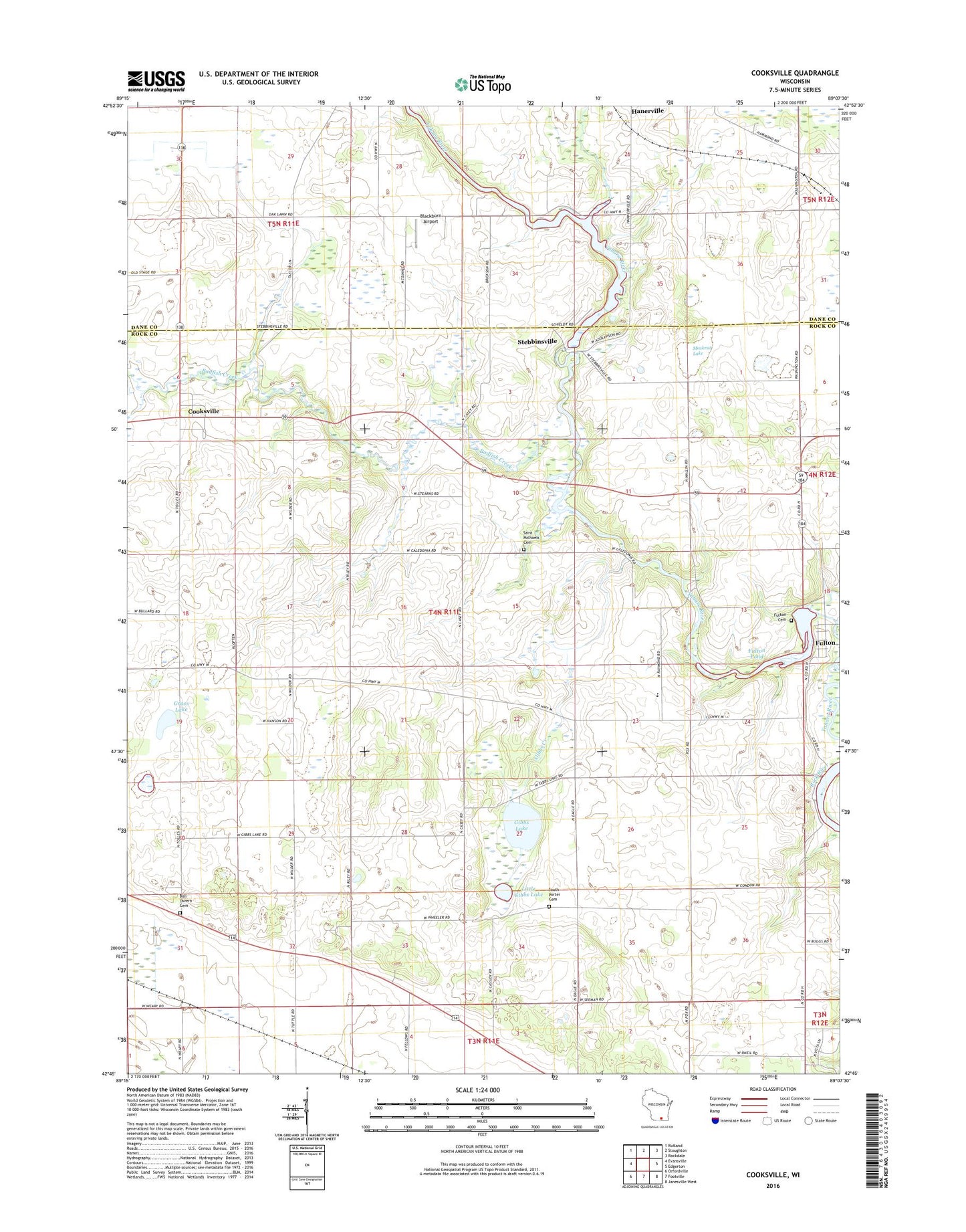
Cooksville Wisconsin US Topo Map
Couldn't load pickup availability
2022 topographic map quadrangle Cooksville in the state of Wisconsin. Scale: 1:24000. Based on the newly updated USGS 7.5' US Topo map series, this map is in the following counties: Rock, Dane. The map contains contour data, water features, and other items you are used to seeing on USGS maps, but also has updated roads and other features. This is the next generation of topographic maps. Printed on high-quality waterproof paper with UV fade-resistant inks.
Quads adjacent to this one:
West: Evansville
Northwest: Rutland
North: Stoughton
Northeast: Rockdale
East: Edgerton
Southeast: Janesville West
South: Footville
Southwest: Orfordville
This map covers the same area as the classic USGS quad with code o42089g2.
Contains the following named places: 450 Reservoir, Badfish Creek, Ball Tavern Cemetery, Blackburn Airport, Cooksville, Cooksville Lutheran Church, Fellows Airport, Fulton, Fulton Cemetery, Fulton Census Designated Place, Fulton Dam, Fulton Pond 553, Gibbs Creek, Gibbs Lake, Grass Lake, Hanerville Post Office, Little Gibbs Lake, Muskrat Lake, Saint Michaels Cemetery, South Porter Cemetery, Spring Creek, Stebbinsville, Stebbinsville WP 51 Dam, Town of Porter, Towns Farms, Yahara Elementary School