MyTopo
West Salem Wisconsin US Topo Map
Couldn't load pickup availability
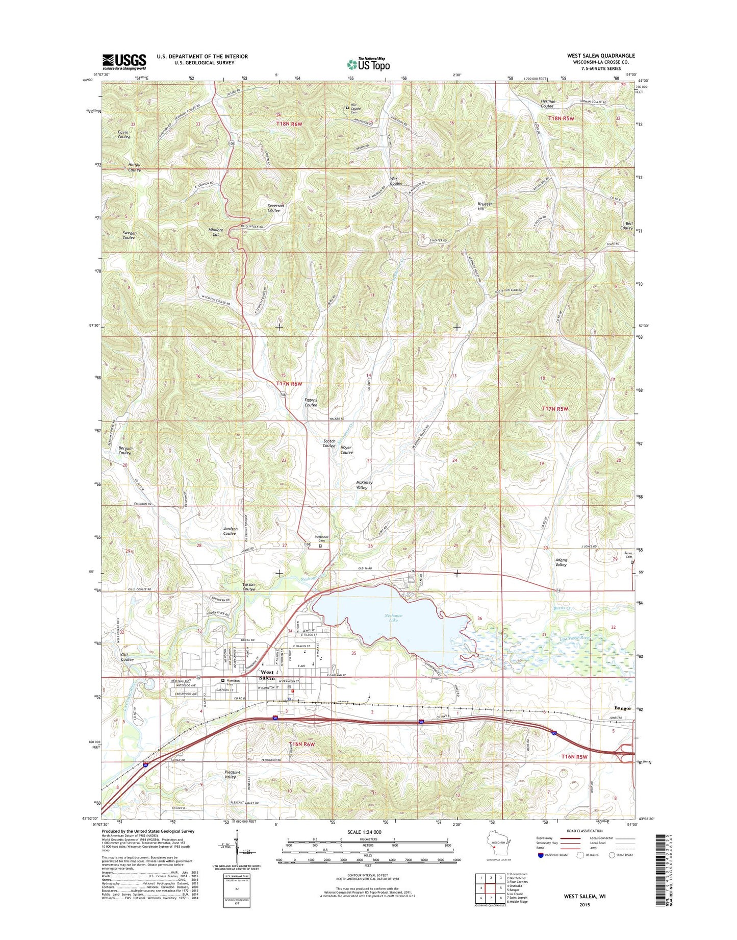
2018 topographic map quadrangle West Salem in the state of Wisconsin. Scale: 1:24000. Based on the newly updated USGS 7.5' US Topo map series, this map is in the following counties: La Crosse. The map contains contour data, water features, and other items you are used to seeing on USGS maps, but also has updated roads and other features. This is the next generation of topographic maps. Printed on high-quality waterproof paper with UV fade-resistant inks.
Quads adjacent to this one:
West: Onalaska
Northwest: Stevenstown
North: North Bend
Northeast: Four Corners
East: Bangor
Southeast: Middle Ridge
South: Saint Joseph
Southwest: La Crosse
Contains the following named places: Adams Creek, Adams Valley, Adams Valley School, Bell Coulee Church, Bell Coulee School, Bergum Coulee, Brookside School, Burns Cemetery, Burns Corners, Burns Creek, Christ - Saint John's Lutheran School, Christ Lutheran Church, Coulee Christian School, Eggens Coulee, Gill Coulee, Hamilton Cemetery, Herman Coulee, Hoyer Coulee, Jordson Coulee, Krueger Hill, La Crosse County, Larson Coulee, McKinley Valley, Mindoro Cut, Neshonoc 2WP44239 Dam, Neshonoc Cemetery, Neshonoc Creek, Neshonoc Lake, Neshonoc School, Our Saviours Lutheran Church, Phillips Ridge School, Pleasant Valley, Saint Leo the Great Church, Scotch Coulee, Swarthout Park, Town of Hamilton, Village of West Salem, Walker School, West Salem, West Salem Baptist Church, West Salem Elementary School, West Salem Fire Department, West Salem High School, West Salem Middle School, West Salem Police Department, West Salem Post Office, West Salem Rod and Gun Club, West Salem Wastewater Treatment Facility, Wet Coulee Cemetery, ZIP Code: 54669