MyTopo
Appel Butte Wyoming US Topo Map
Couldn't load pickup availability
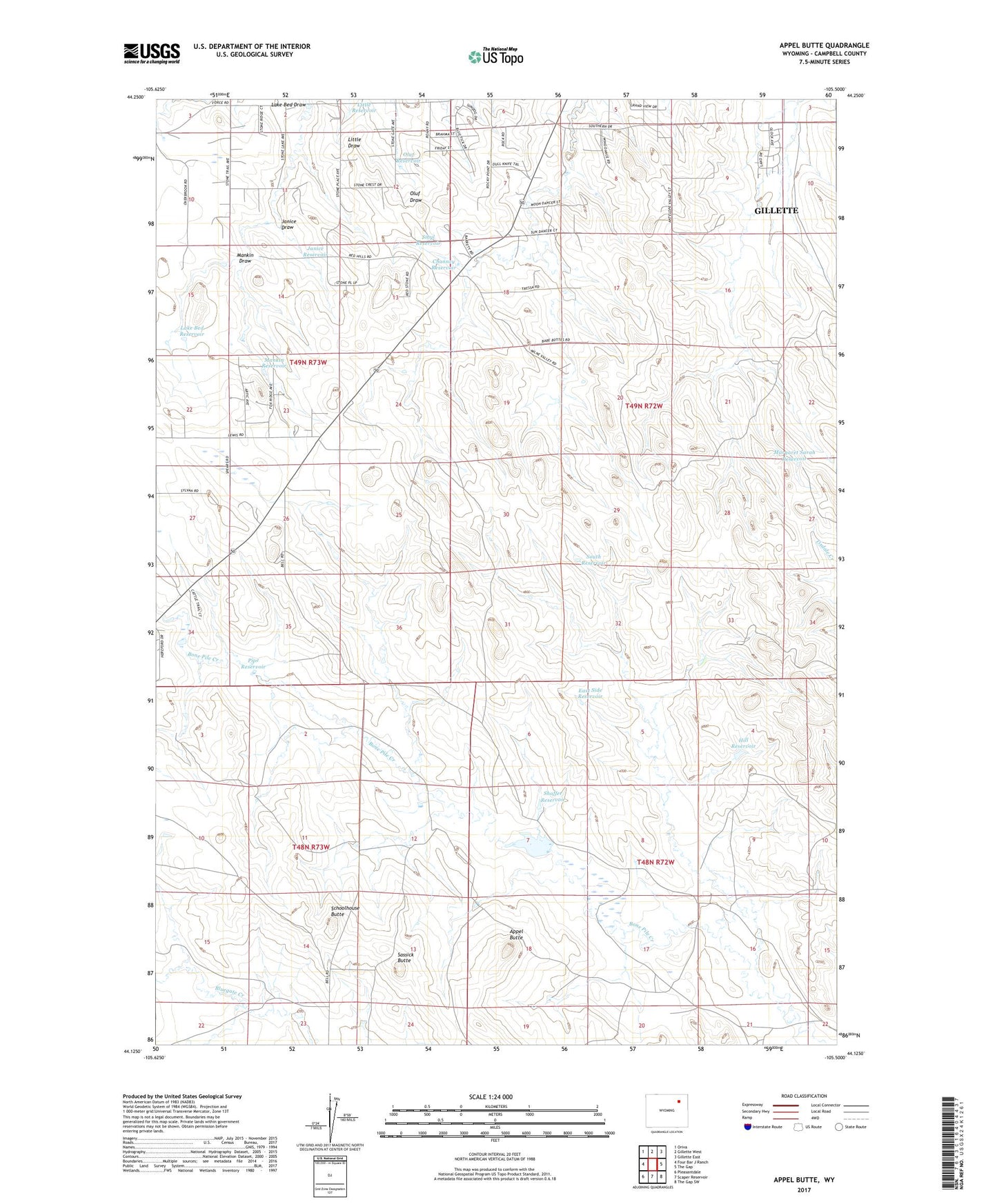
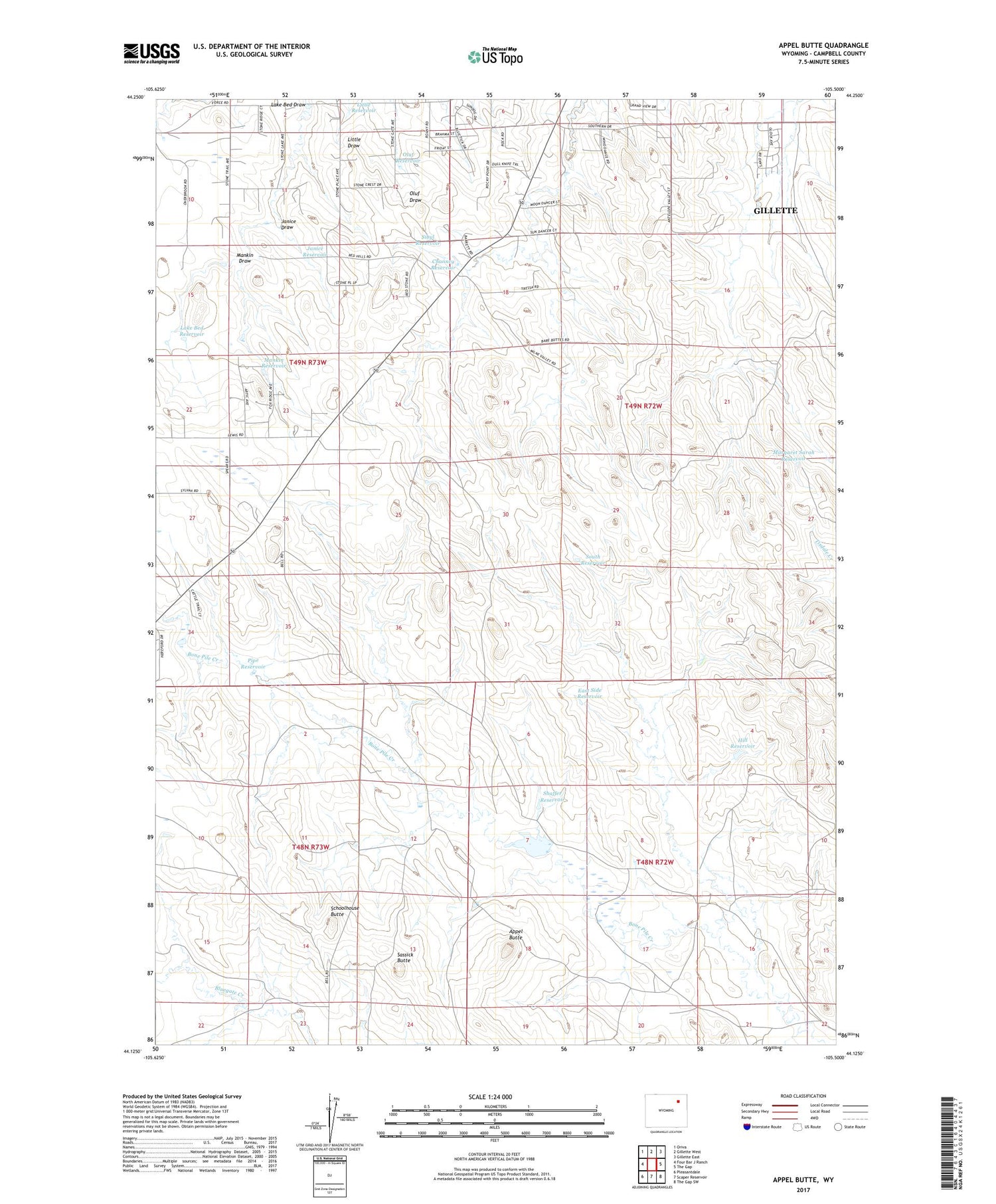
2021 topographic map quadrangle Appel Butte in the state of Wyoming. Scale: 1:24000. Based on the newly updated USGS 7.5' US Topo map series, this map is in the following counties: Campbell. The map contains contour data, water features, and other items you are used to seeing on USGS maps, but also has updated roads and other features. This is the next generation of topographic maps. Printed on high-quality waterproof paper with UV fade-resistant inks.
Quads adjacent to this one:
West: Four Bar J Ranch
Northwest: Oriva
North: Gillette West
Northeast: Gillette East
East: The Gap
Southeast: The Gap SW
South: Scaper Reservoir
Southwest: Pleasantdale
Contains the following named places: Appel Butte, Campbell County, Channey Reservoir, East Side Reservoir, Hill Reservoir, Janice Draw, Janice Reservoir, KGWY-FM (Gillette), Knob Reservoir, Lake Bed Draw, Lake Bed Reservoir, Little Reservoir, Mankin Draw, Mankin Reservoir, Margaret Sarah Reservoir, Mary Alice Reservoir, Oluf Reservoir, Pipe Reservoir, Rocky Reservoir, Sassick Butte, Schoolhouse Butte, Shaffer Reservoir, Sibyl Reservoir, South Reservoir, Stone Number 2 Dam, Stone Number 2 Reservoir