MyTopo
Four Bar J Ranch Wyoming US Topo Map
Couldn't load pickup availability
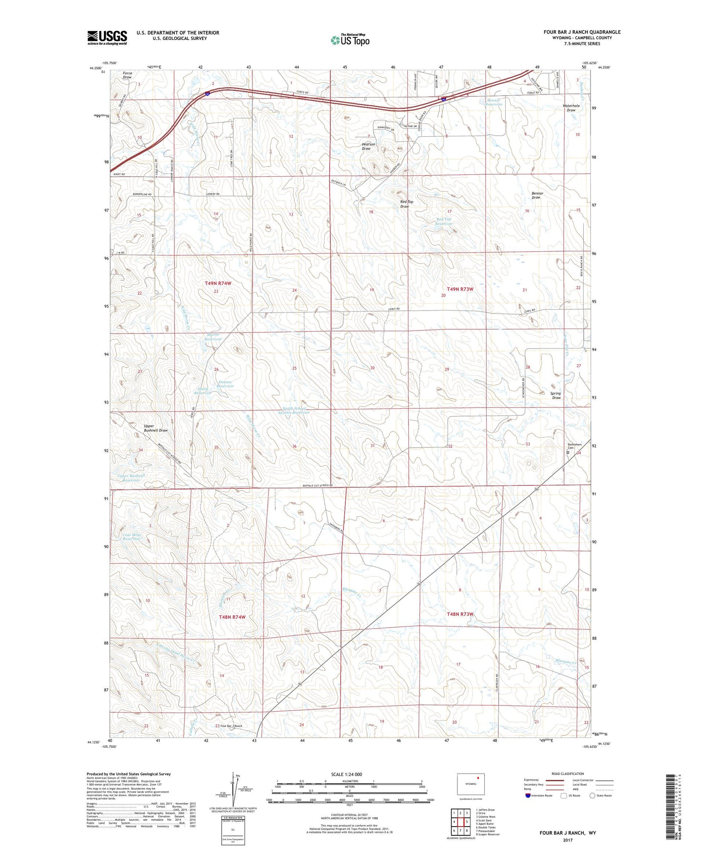
2021 topographic map quadrangle Four Bar J Ranch in the state of Wyoming. Scale: 1:24000. Based on the newly updated USGS 7.5' US Topo map series, this map is in the following counties: Campbell. The map contains contour data, water features, and other items you are used to seeing on USGS maps, but also has updated roads and other features. This is the next generation of topographic maps. Printed on high-quality waterproof paper with UV fade-resistant inks.
Quads adjacent to this one:
West: Scott Dam
Northwest: Jeffers Draw
North: Oriva
Northeast: Gillette West
East: Appel Butte
Southeast: Scaper Reservoir
South: Pleasantdale
Southwest: Double Tanks
This map covers the same area as the classic USGS quad with code o44105b6.
Contains the following named places: Bennor Reservoir, Bethlehem Cemetery, Bethlehem Church, Coat Mine Reservoir, Denton Reservoir, Four Bar J Ranch, Myrtle Dam, Myrtle Reservoir, North School Section Reservoir, Pearson Dam, Pearson Draw, Red Top Draw, Red Top Reservoir, Smith Reservoir, Spring Draw, Upper Bushnell Reservoir, Waterhole Draw