MyTopo
Bamforth Lake Wyoming US Topo Map
Couldn't load pickup availability
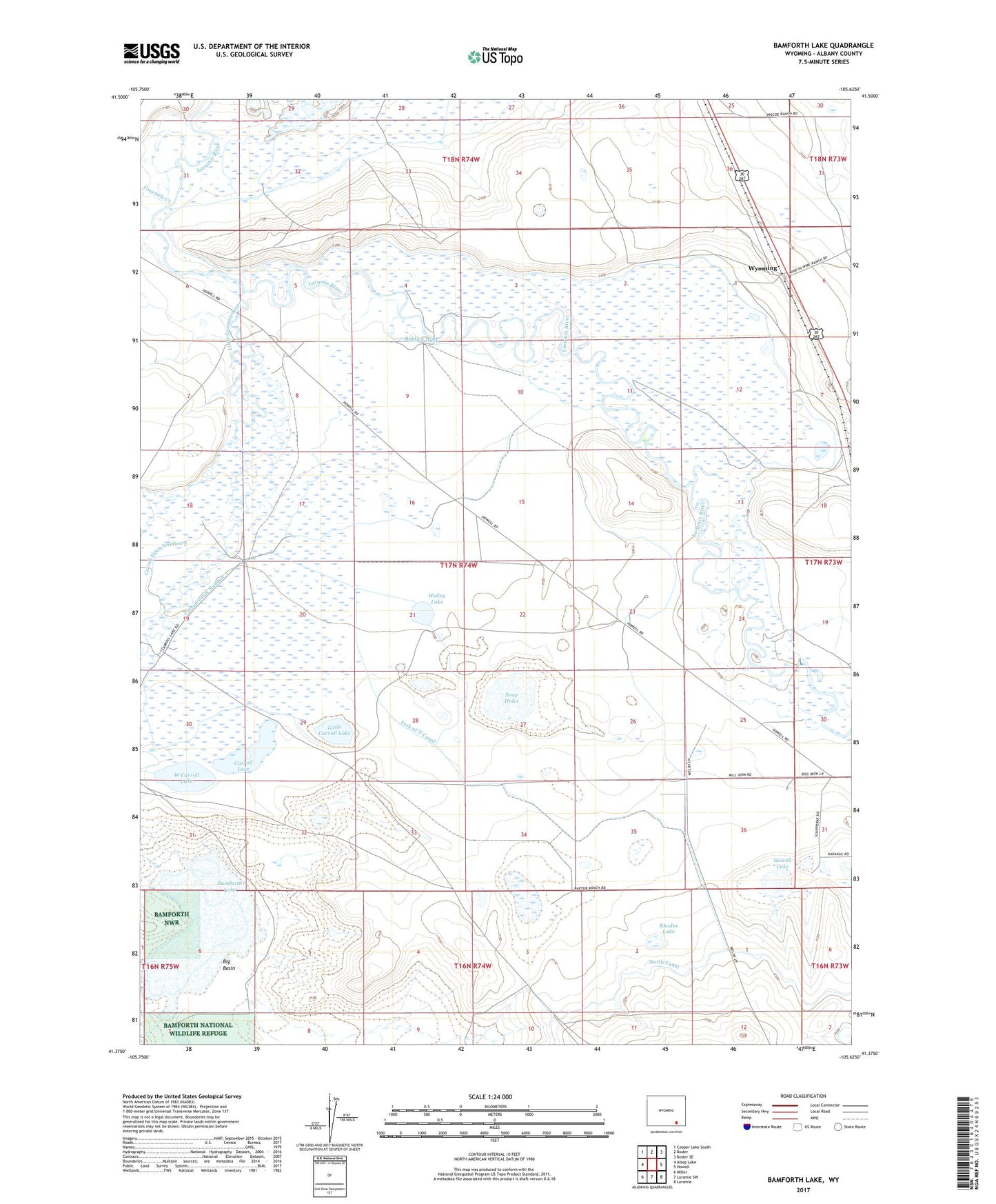
2021 topographic map quadrangle Bamforth Lake in the state of Wyoming. Scale: 1:24000. Based on the newly updated USGS 7.5' US Topo map series, this map is in the following counties: Albany. The map contains contour data, water features, and other items you are used to seeing on USGS maps, but also has updated roads and other features. This is the next generation of topographic maps. Printed on high-quality waterproof paper with UV fade-resistant inks.
Quads adjacent to this one:
West: Alsop Lake
Northwest: Cooper Lake South
North: Bosler
Northeast: Bosler SE
East: Howell
Southeast: Laramie
South: Laramie SW
Southwest: Miller
Contains the following named places: Bamforth Lake, Biddick Ditch, Biddick Ranch, Big Basin, Browns Creek, Carroll Ditch Number 1, Carroll Ditch Number 2, Carroll Lake, Carroll Ranch, Fork of North Canal, Fourmile Creek, Gearhart Ranch, Hailey Lake, Howell Lake, Little Carroll Lake, Little Laramie River, Loyd Ranch, McKechnie River Ranch, North Canal, Oasis Ranch, Page Ranch, Rhodes Lake, Soap Holes, West Carroll Lake, Wyoming