MyTopo
Benton Basin Wyoming US Topo Map
Couldn't load pickup availability
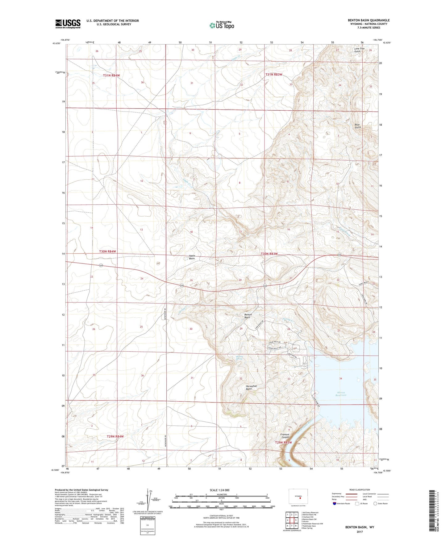
2021 topographic map quadrangle Benton Basin in the state of Wyoming. Scale: 1:24000. Based on the newly updated USGS 7.5' US Topo map series, this map is in the following counties: Natrona. The map contains contour data, water features, and other items you are used to seeing on USGS maps, but also has updated roads and other features. This is the next generation of topographic maps. Printed on high-quality waterproof paper with UV fade-resistant inks.
Quads adjacent to this one:
West: Benton Basin SW
Northwest: McCleary Reservoir
North: Benton Basin NE
Northeast: Clarkson Hill
East: Alcova
Southeast: Bear Spring
South: Pathfinder Dam
Southwest: Pathfinder Reservoir NW
Contains the following named places: Agate Basin, Benton Basin, Casper Boat Club, Childers Place, Childers Reservoir, Eagle Canyon Dam, Eagle Canyon Reservoir, Fremont Canyon, Horseshoe Basin, McCain Spring, Spring Creek