MyTopo
Big Park Wyoming US Topo Map
Couldn't load pickup availability
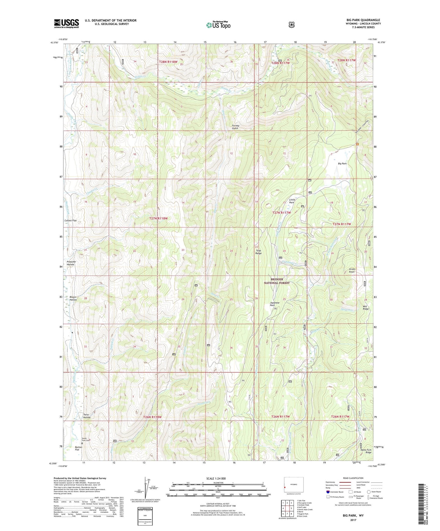
2021 topographic map quadrangle Big Park in the state of Wyoming. Scale: 1:24000. Based on the newly updated USGS 7.5' US Topo map series, this map is in the following counties: Lincoln. The map contains contour data, water features, and other items you are used to seeing on USGS maps, but also has updated roads and other features. This is the next generation of topographic maps. Printed on high-quality waterproof paper with UV fade-resistant inks.
Quads adjacent to this one:
West: Huff Lake
Northwest: Salt Flat
North: Porcupine Creek
Northeast: Graham Peak
East: Devils Hole Creek
Southeast: Pole Creek
South: Nugent Park
Southwest: Marse
Contains the following named places: Big Park, Big Park Prospect, Bird Creek, Bloom Hollow, Button Flat, Cliff Creek, Coantag Creek, Dry Fork Smiths Fork, Ferney Gulch, Ferney Gulch Prospects Mine, Green Knoll, Grindstone Creek, Hams Fork Ridge, Hock Creek, Japanese Park, Kelley Guard Station, Little Park, Little Park Creek, Middle Ridge, Sams Creek, Smith Fork Cemetery, Squirrel Creek, Tuffield Creek, Twiss Hollow