MyTopo
Bill SE Wyoming US Topo Map
Couldn't load pickup availability
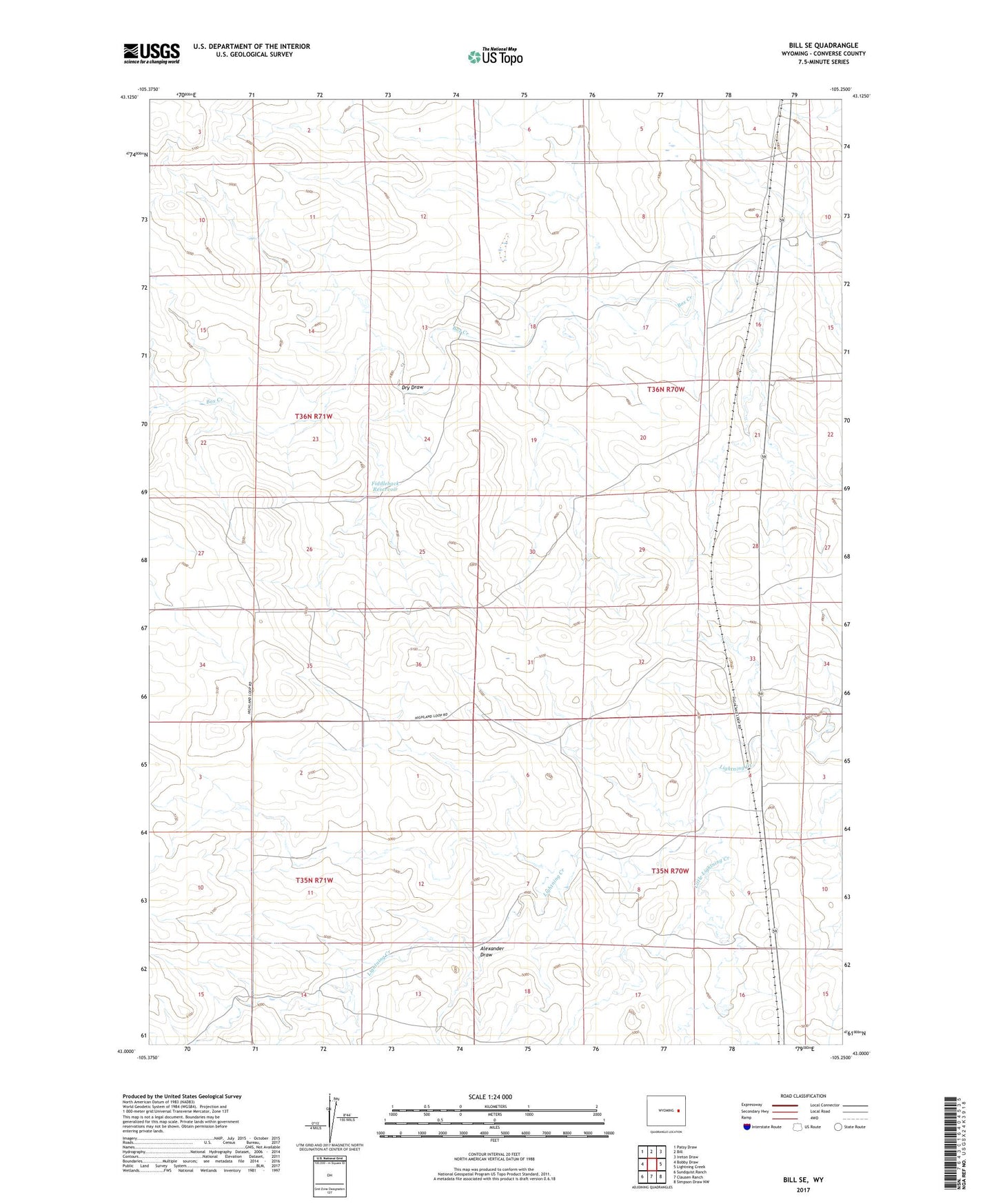
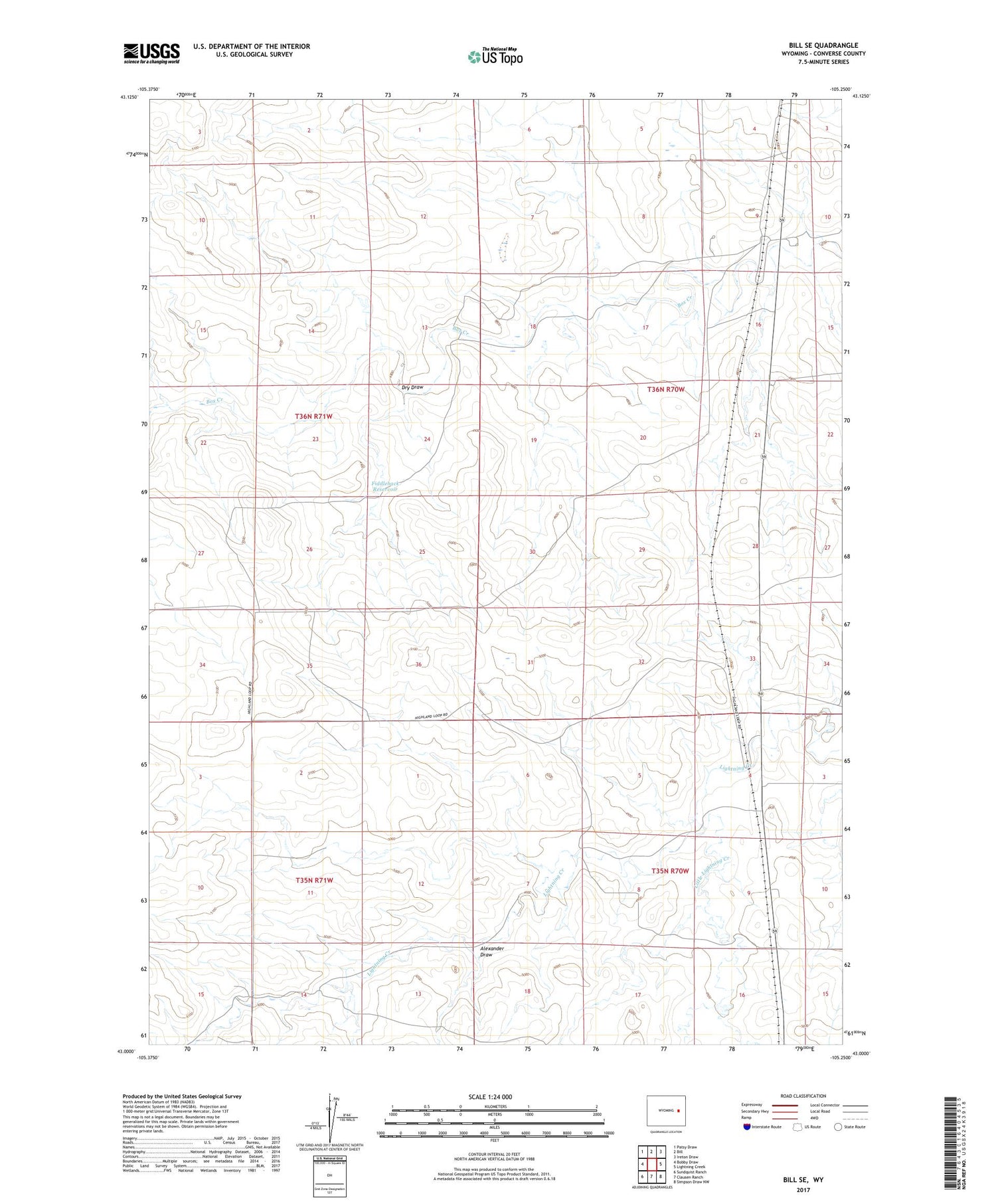
2021 topographic map quadrangle Bill SE in the state of Wyoming. Scale: 1:24000. Based on the newly updated USGS 7.5' US Topo map series, this map is in the following counties: Converse. The map contains contour data, water features, and other items you are used to seeing on USGS maps, but also has updated roads and other features. This is the next generation of topographic maps. Printed on high-quality waterproof paper with UV fade-resistant inks.
Quads adjacent to this one:
West: Bobby Draw
Northwest: Patsy Draw
North: Bill
Northeast: Ireton Draw
East: Lightning Creek
Southeast: Simpson Draw NW
South: Clausen Ranch
Southwest: Sundquist Ranch
Contains the following named places: Alexander Draw, Ballard Ranch, Dry Draw, Fiddleback Reservoir, Johnson Ranch, Little Lightning Creek