MyTopo
Buffalo Wyoming US Topo Map
Couldn't load pickup availability
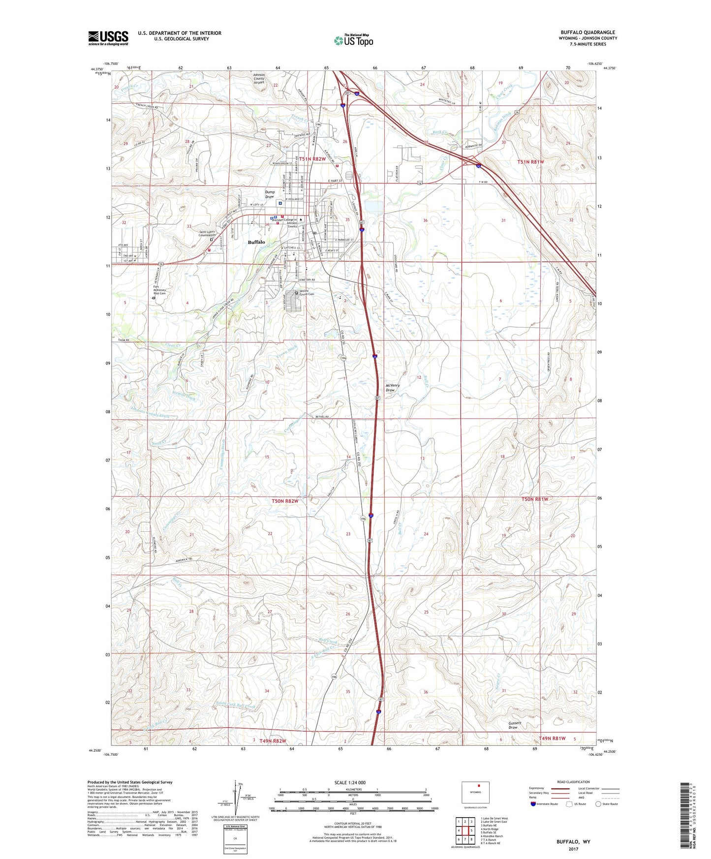
2021 topographic map quadrangle Buffalo in the state of Wyoming. Scale: 1:24000. Based on the newly updated USGS 7.5' US Topo map series, this map is in the following counties: Johnson. The map contains contour data, water features, and other items you are used to seeing on USGS maps, but also has updated roads and other features. This is the next generation of topographic maps. Printed on high-quality waterproof paper with UV fade-resistant inks.
Quads adjacent to this one:
West: North Ridge
Northwest: Lake De Smet West
North: Lake De Smet East
Northeast: Buffalo NE
East: Buffalo SE
Southeast: T A Ranch NE
South: T A Ranch
Southwest: Klondike Ranch
Contains the following named places: Amie Holt Care Center, Arno Pit, Bighorn National Forest Powder River Ranger District Fire Engine Crew, Billy Creek School, Buffalo, Buffalo - Johnson County Emergency Medical Services, Buffalo High School, Buffalo Mine, Buffalo Police Department, Buffalo Post Office, Buffalo Sand and Gravel Pit, Buffalo Volunteer Fire Department, Bull Creek, Carter Pit Mine, City of Buffalo, Clear Creek Middle School, Clear Creek Mine, Clear Creek School, Cross H Mesa D Pit, Cross H Mesa Pit C, Cross H Pit Number Two, Crown Ditch, Cummings Creek, Cummings Ditch, Dump Draw, Fort McKinney Post Cemetery, French Creek, Hepp Pit Mine, Johnson County Fire Control District 1, Johnson County Healthcare Center, Johnson County Search and Rescue, KBBS-AM (Buffalo), Keith Pit Number One, KLGT-FM (Buffalo), McVenry Draw, Mitchell Mine, Munkry Mine, Pelloux Pit, Prosinski Park, Rock Creek, Saint Luke's Columbarium, Sand Creek, Shambaugh Number Two Mine, Sixmile Ditch, Smith Pit Number One, Soldiers and Sailors Pit Number Three, South Fork Bull Creek, State Pit, Veterans Home of Wyoming, Willow Grove Cemetery