MyTopo
T A Ranch Wyoming US Topo Map
Couldn't load pickup availability
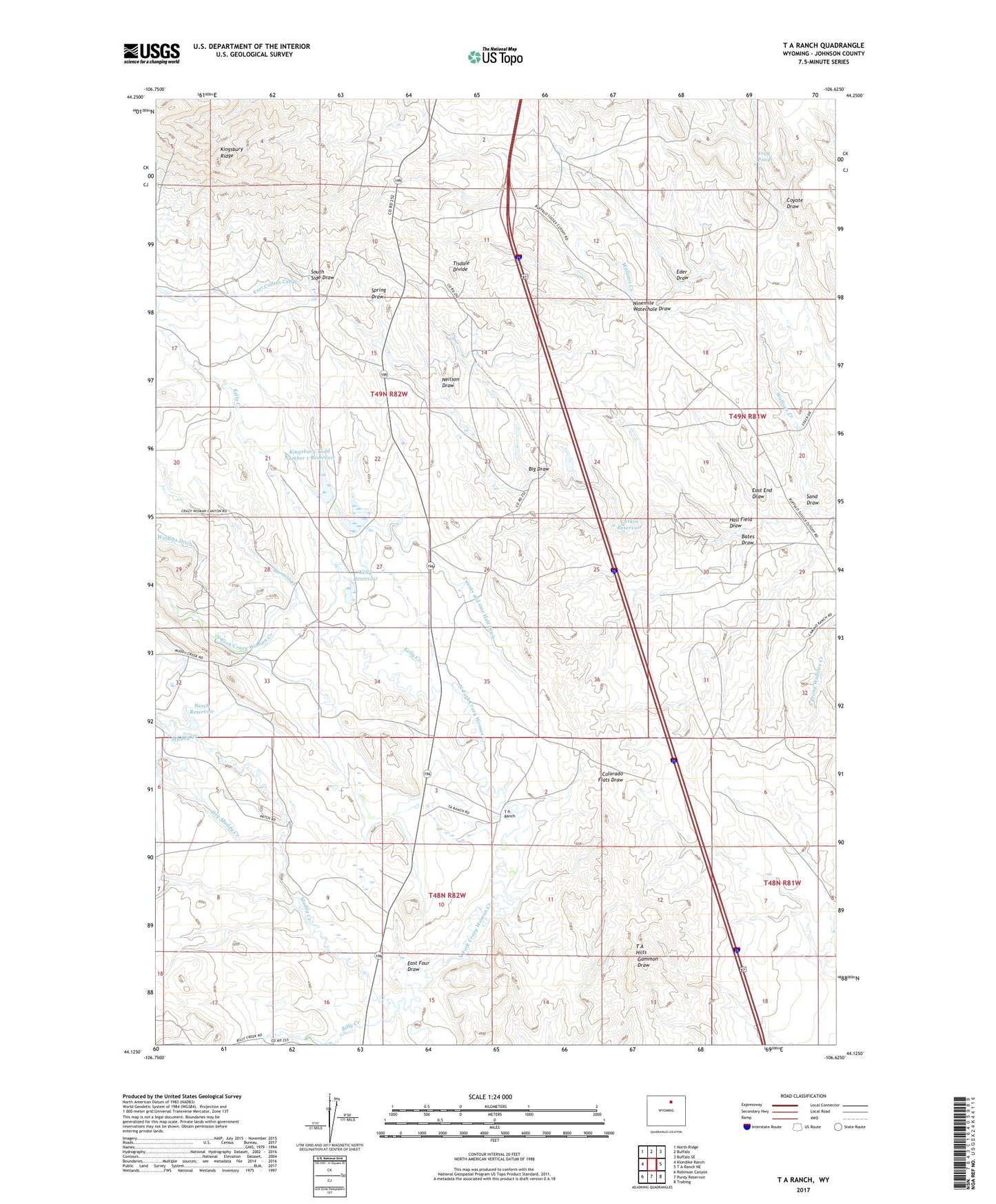
2021 topographic map quadrangle T A Ranch in the state of Wyoming. Scale: 1:24000. Based on the newly updated USGS 7.5' US Topo map series, this map is in the following counties: Johnson. The map contains contour data, water features, and other items you are used to seeing on USGS maps, but also has updated roads and other features. This is the next generation of topographic maps. Printed on high-quality waterproof paper with UV fade-resistant inks.
Quads adjacent to this one:
West: Klondike Ranch
Northwest: North Ridge
North: Buffalo
Northeast: Buffalo SE
East: T A Ranch NE
Southeast: Trabing
South: Purdy Reservoir
Southwest: Robinson Canyon
This map covers the same area as the classic USGS quad with code o44106b6.
Contains the following named places: Basch Dam, Basch Reservoir, Bates Draw, Big Draw, Billy Creek, Billy Creek School, Burnett Creek, Coyote Draw, Dowlin Reservoir, Dry Muddy Creek, East End Draw, East Four Draw, Eder Draw, Fort Collins Canal, Frog Pond, Gerkin Reservoir, Hall Field Draw, Highway Dam, Highway Reservoir, Kelly Creek, Kelly Dam, Kelly Reservoir, Kingsbury Todd Number 1 Dam, Kingsbury Todd Number 1 Reservoir, Kingsbury Todd Number 2 Dam, Kingsbury Todd Number 2 Reservoir, Muddy Creek, Neilson Draw, Ninemile Waterhole Draw, Ridge Place Number 2 Dam, Ridge Place Number 2 Reservoir, Sand Draw, South Side Draw, Spring Draw, T A Hills, T A Ranch, Tisdale Divide, Twenty and One Half Ditch, Watkins Ditch, ZIP Code: 82834