MyTopo
Burns Wyoming US Topo Map
Couldn't load pickup availability
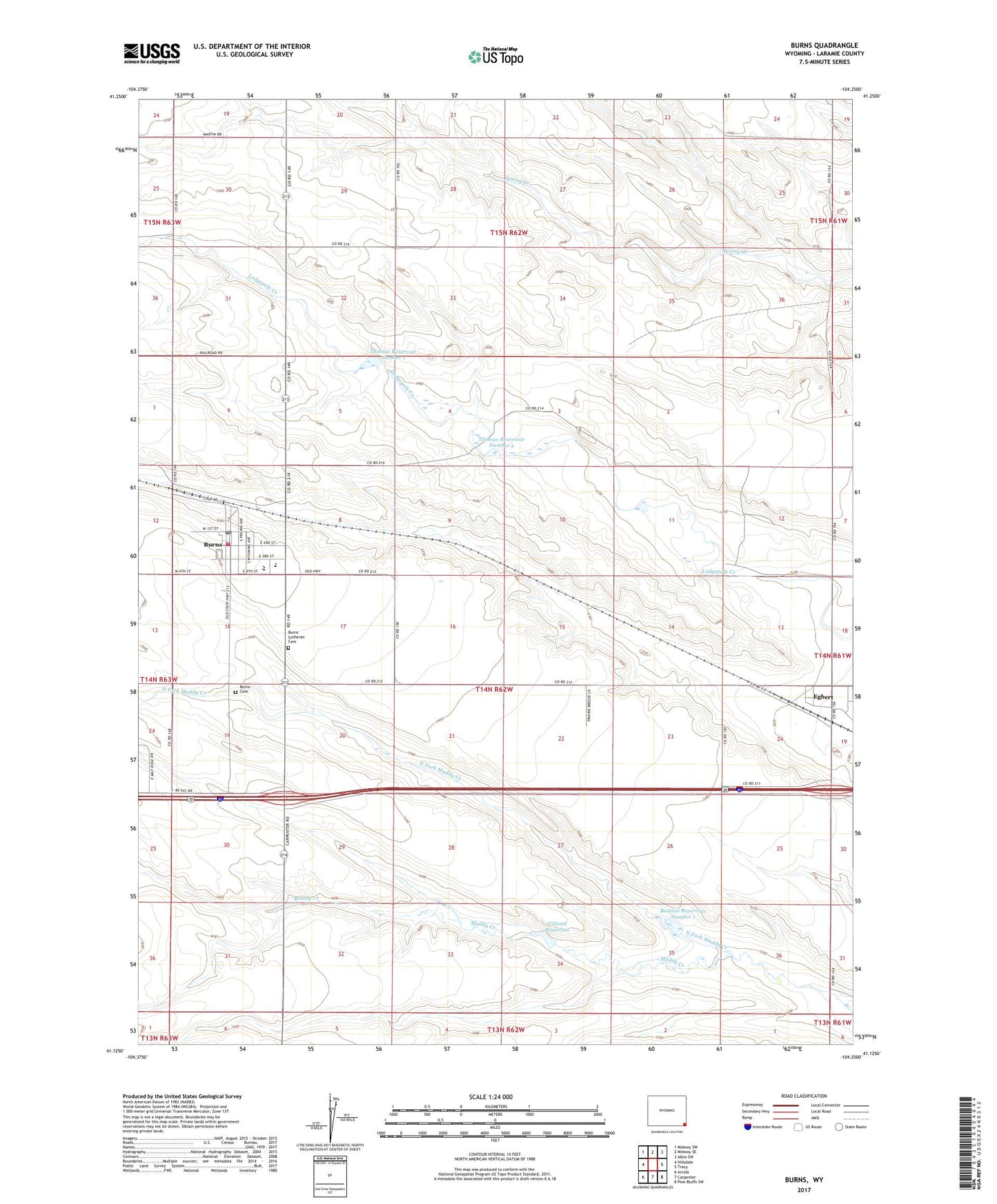
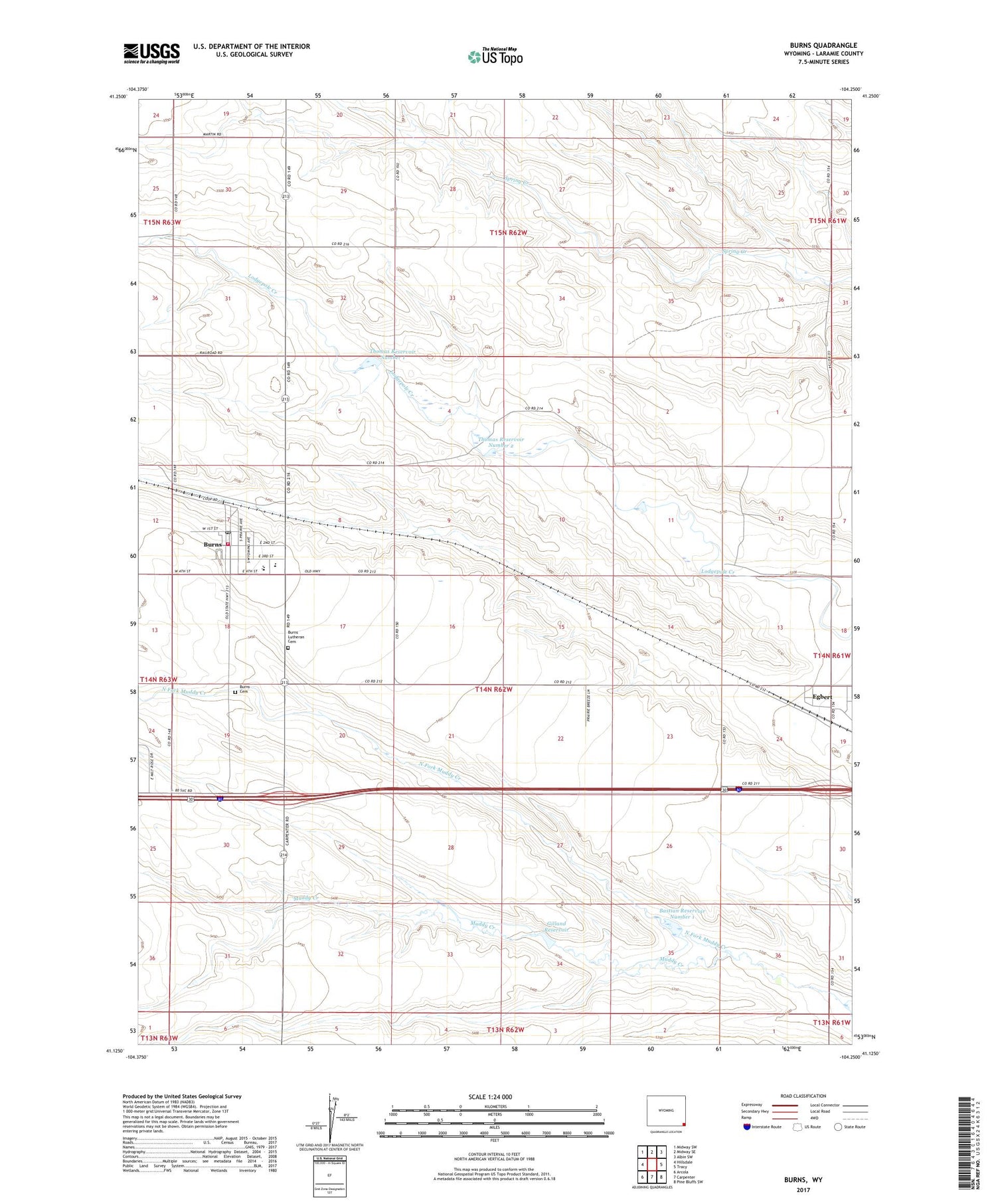
2021 topographic map quadrangle Burns in the state of Wyoming. Scale: 1:24000. Based on the newly updated USGS 7.5' US Topo map series, this map is in the following counties: Laramie. The map contains contour data, water features, and other items you are used to seeing on USGS maps, but also has updated roads and other features. This is the next generation of topographic maps. Printed on high-quality waterproof paper with UV fade-resistant inks.
Quads adjacent to this one:
West: Hillsdale
Northwest: Midway SW
North: Midway SE
Northeast: Albin SW
East: Tracy
Southeast: Pine Bluffs SW
South: Carpenter
Southwest: Arcola
Contains the following named places: Bastian Reservoir Number 1, Burns, Burns Cemetery, Burns Elementary School, Burns Emergency Medical Services, Burns Junior - Senior High School, Burns Junior High School, Burns Lutheran Cemetery, Burns Post Office, C W Dam, C W Reservoir, Egbert, Gilland Dam, Gilland Reservoir, Kunau Pit, Laramie County Fire District 6 - Burns, North Fork Muddy Creek, Thomas Number 2 Dam, Thomas Number 2 Reservoir, Thomas Reservoir Number 1, Thomas Reservoir Number 2, Town of Burns