MyTopo
Hillsdale Wyoming US Topo Map
Couldn't load pickup availability
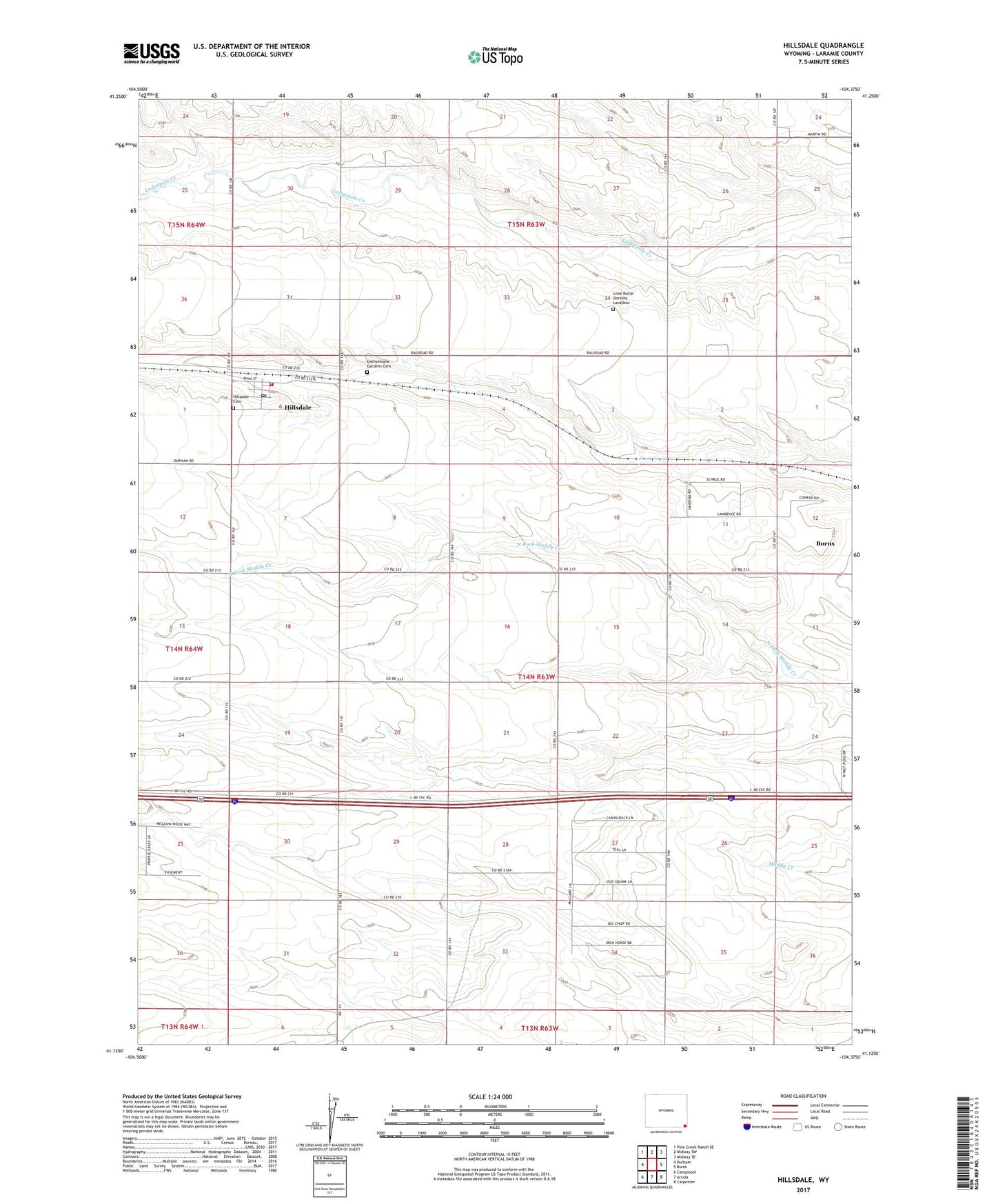
2023 topographic map quadrangle Hillsdale in the state of Wyoming. Scale: 1:24000. Based on the newly updated USGS 7.5' US Topo map series, this map is in the following counties: Laramie. The map contains contour data, water features, and other items you are used to seeing on USGS maps, but also has updated roads and other features. This is the next generation of topographic maps. Printed on high-quality waterproof paper with UV fade-resistant inks.
Quads adjacent to this one:
West: Durham
Northwest: Pole Creek Ranch SE
North: Midway SW
Northeast: Midway SE
East: Burns
Southeast: Carpenter
South: Arcola
Southwest: Campstool
This map covers the same area as the classic USGS quad with code o41104b4.
Contains the following named places: Gethsemane Gardens Cemetery, Hillsdale, Hillsdale Cemetery, Hillsdale Census Designated Place, Hillsdale Post Office, Laramie County Fire District 6 Hillsdale Station 2