MyTopo
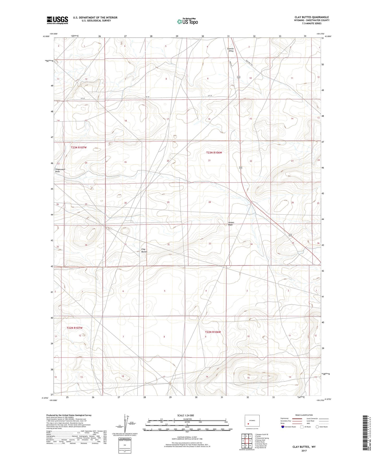
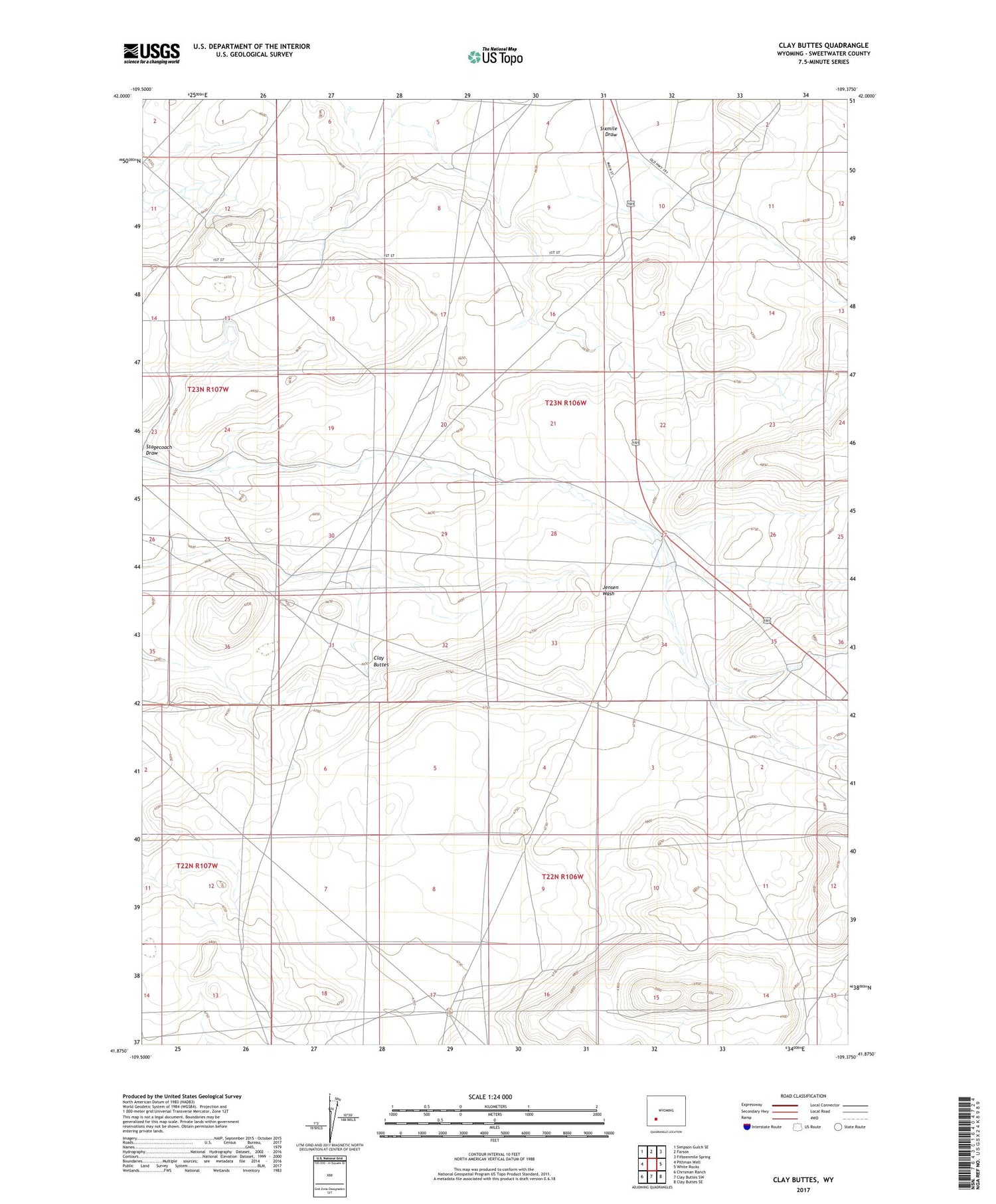
Clay Buttes Wyoming US Topo Map
Couldn't load pickup availability
2021 topographic map quadrangle Clay Buttes in the state of Wyoming. Scale: 1:24000. Based on the newly updated USGS 7.5' US Topo map series, this map is in the following counties: Sweetwater. The map contains contour data, water features, and other items you are used to seeing on USGS maps, but also has updated roads and other features. This is the next generation of topographic maps. Printed on high-quality waterproof paper with UV fade-resistant inks.
Quads adjacent to this one:
West: Pittman Well
Northwest: Simpson Gulch SE
North: Farson
Northeast: Fifteenmile Spring
East: White Rocks
Southeast: Clay Buttes SE
South: Clay Buttes SW
Southwest: Chrisman Ranch
Contains the following named places: Chilton Well, Clay Buttes, Jensen Well, Sixmile Draw