MyTopo
Farson Wyoming US Topo Map
Couldn't load pickup availability
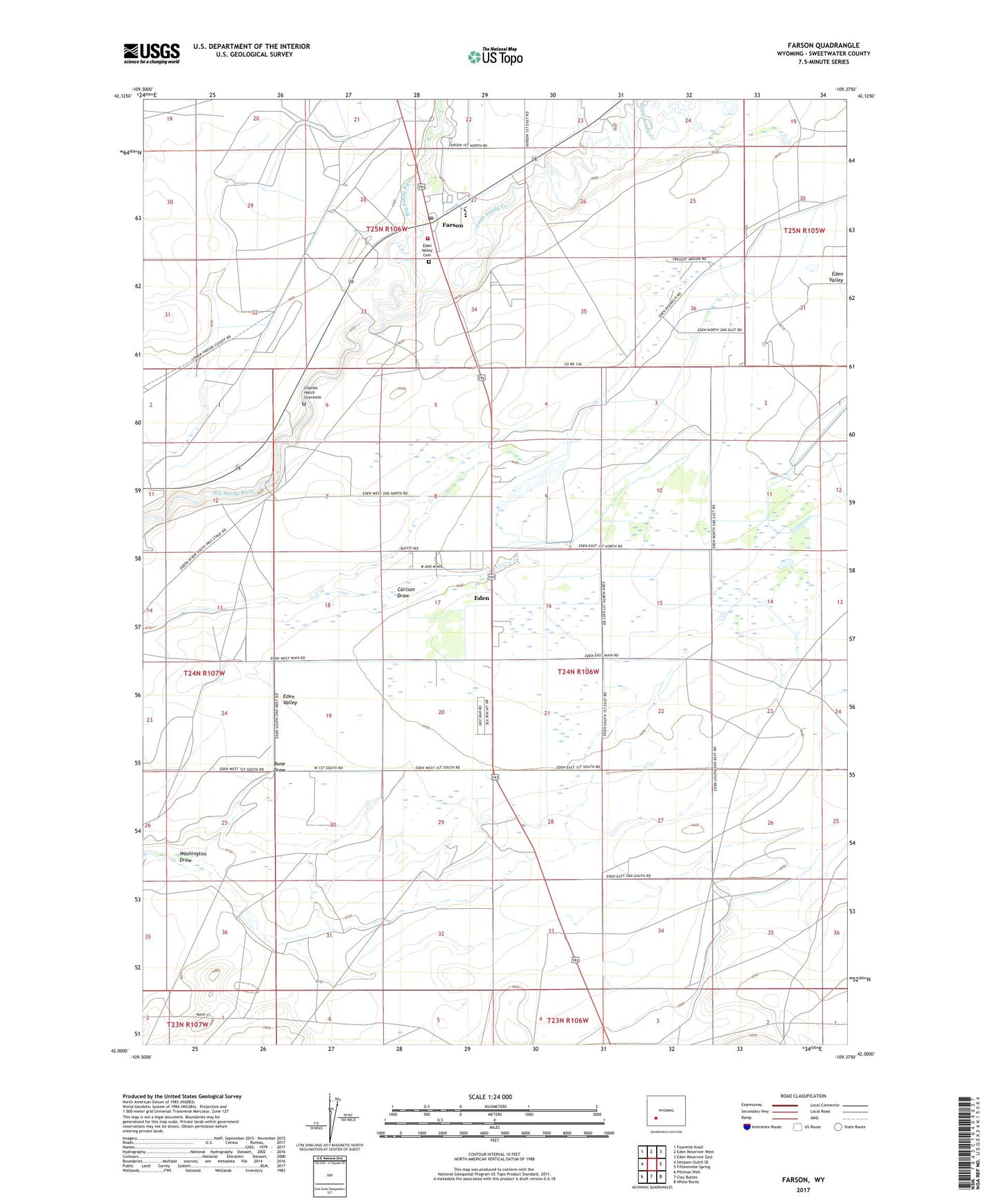
2021 topographic map quadrangle Farson in the state of Wyoming. Scale: 1:24000. Based on the newly updated USGS 7.5' US Topo map series, this map is in the following counties: Sweetwater. The map contains contour data, water features, and other items you are used to seeing on USGS maps, but also has updated roads and other features. This is the next generation of topographic maps. Printed on high-quality waterproof paper with UV fade-resistant inks.
Quads adjacent to this one:
West: Simpson Gulch SE
Northwest: Fourmile Knoll
North: Eden Reservoir West
Northeast: Eden Reservoir East
East: Fifteenmile Spring
Southeast: White Rocks
South: Clay Buttes
Southwest: Pittman Well
This map covers the same area as the classic USGS quad with code o42109a4.
Contains the following named places: Charles Hatch Gravesite, Eden, Eden - Farson Fire Control District, Eden Census Designated Place, Eden Lateral, Eden Valley, Eden Valley Ambulance Service, Eden Valley Cemetery, Farson, Farson Post Office, Farson-Eden High School, Farson-Eden Middle School, Farson-Eden School, Little Sandy Creek, State Highway Department Mine, Washington Draw