MyTopo
Coal Mine Ridge Wyoming US Topo Map
Couldn't load pickup availability
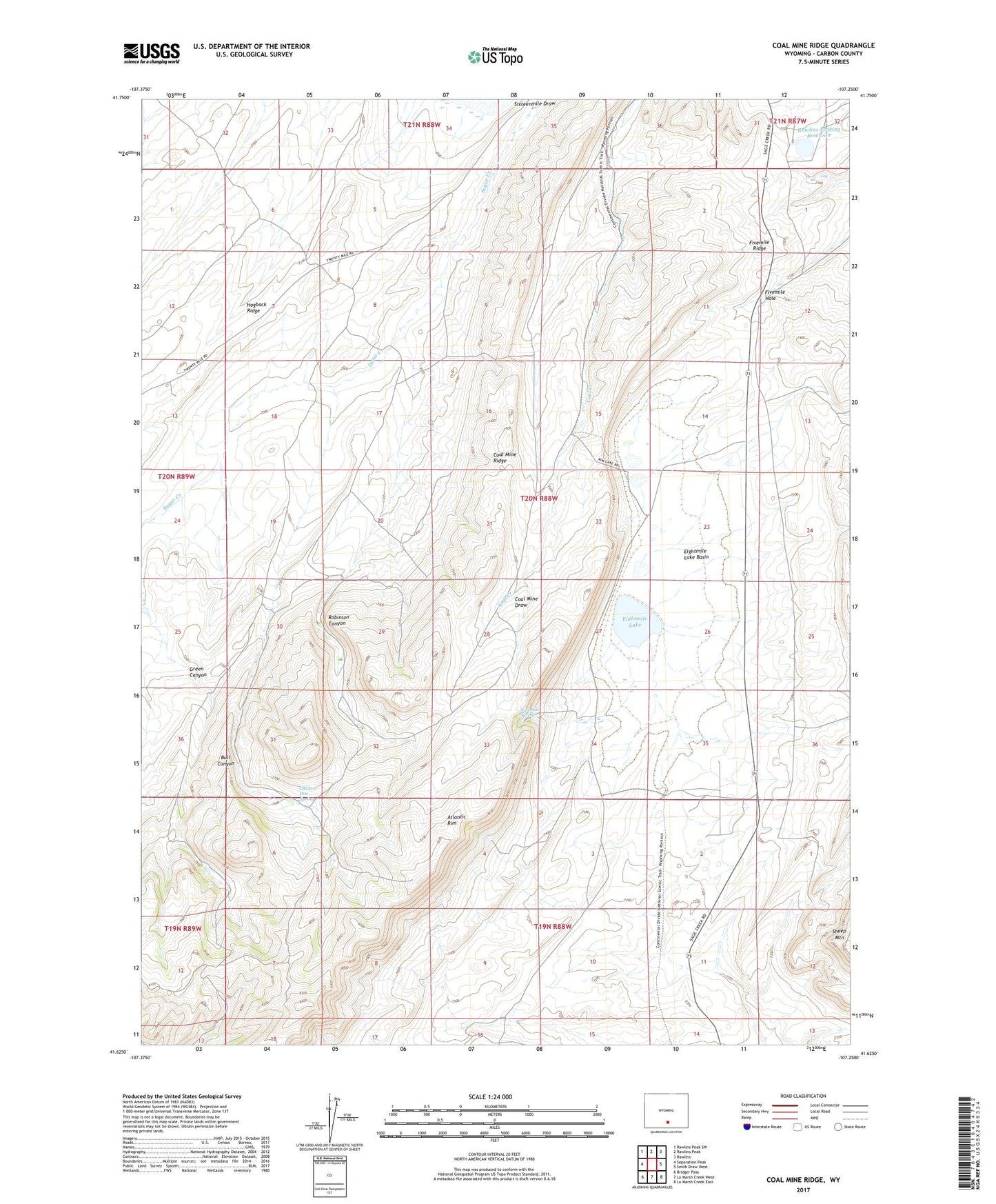
2021 topographic map quadrangle Coal Mine Ridge in the state of Wyoming. Scale: 1:24000. Based on the newly updated USGS 7.5' US Topo map series, this map is in the following counties: Carbon. The map contains contour data, water features, and other items you are used to seeing on USGS maps, but also has updated roads and other features. This is the next generation of topographic maps. Printed on high-quality waterproof paper with UV fade-resistant inks.
Quads adjacent to this one:
West: Separation Peak
Northwest: Rawlins Peak SW
North: Rawlins Peak
Northeast: Rawlins
East: Smith Draw West
Southeast: La Marsh Creek East
South: La Marsh Creek West
Southwest: Bridger Pass
Contains the following named places: Bull Canyon, Chicken Pete Spring, Coal Mine Ridge, Eightmile Lake, Eightmile Lake Basin, Fivemile Hole, Fivemile Ridge, Green Canyon, Hatfield Oil Field, Ninemile Spring, Rawlins Peaking Dam, Rawlins Peaking Reservoir, Robinson Canyon