MyTopo
Devils Hole Creek Wyoming US Topo Map
Couldn't load pickup availability
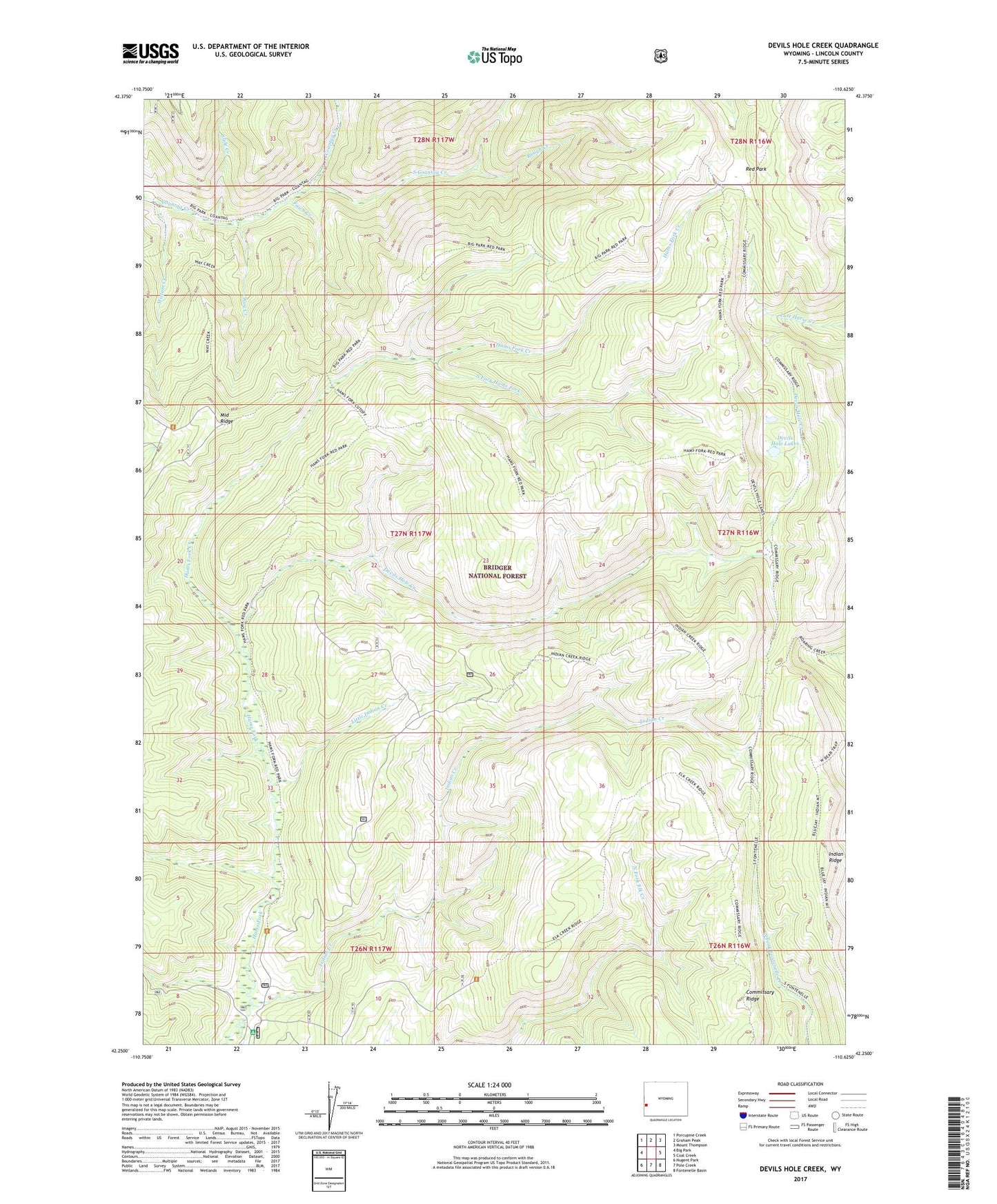
2021 topographic map quadrangle Devils Hole Creek in the state of Wyoming. Scale: 1:24000. Based on the newly updated USGS 7.5' US Topo map series, this map is in the following counties: Lincoln. The map contains contour data, water features, and other items you are used to seeing on USGS maps, but also has updated roads and other features. This is the next generation of topographic maps. Printed on high-quality waterproof paper with UV fade-resistant inks.
Quads adjacent to this one:
West: Big Park
Northwest: Porcupine Creek
North: Graham Peak
Northeast: Mount Thompson
East: Coal Creek
Southeast: Fontenelle Basin
South: Pole Creek
Southwest: Nugent Park
Contains the following named places: Devils Hole Creek, Devils Hole Lakes, Fawn Creek, Hams Fork Campground, Hams Fork Creek, Indian Creek, Indian Ridge, Lincoln County, Little Indian Creek, Mistum Creek, Red Park, Rough Creek, Slide Creek, South Coantag Creek, South Fork Hams Fork, Way Creek