MyTopo
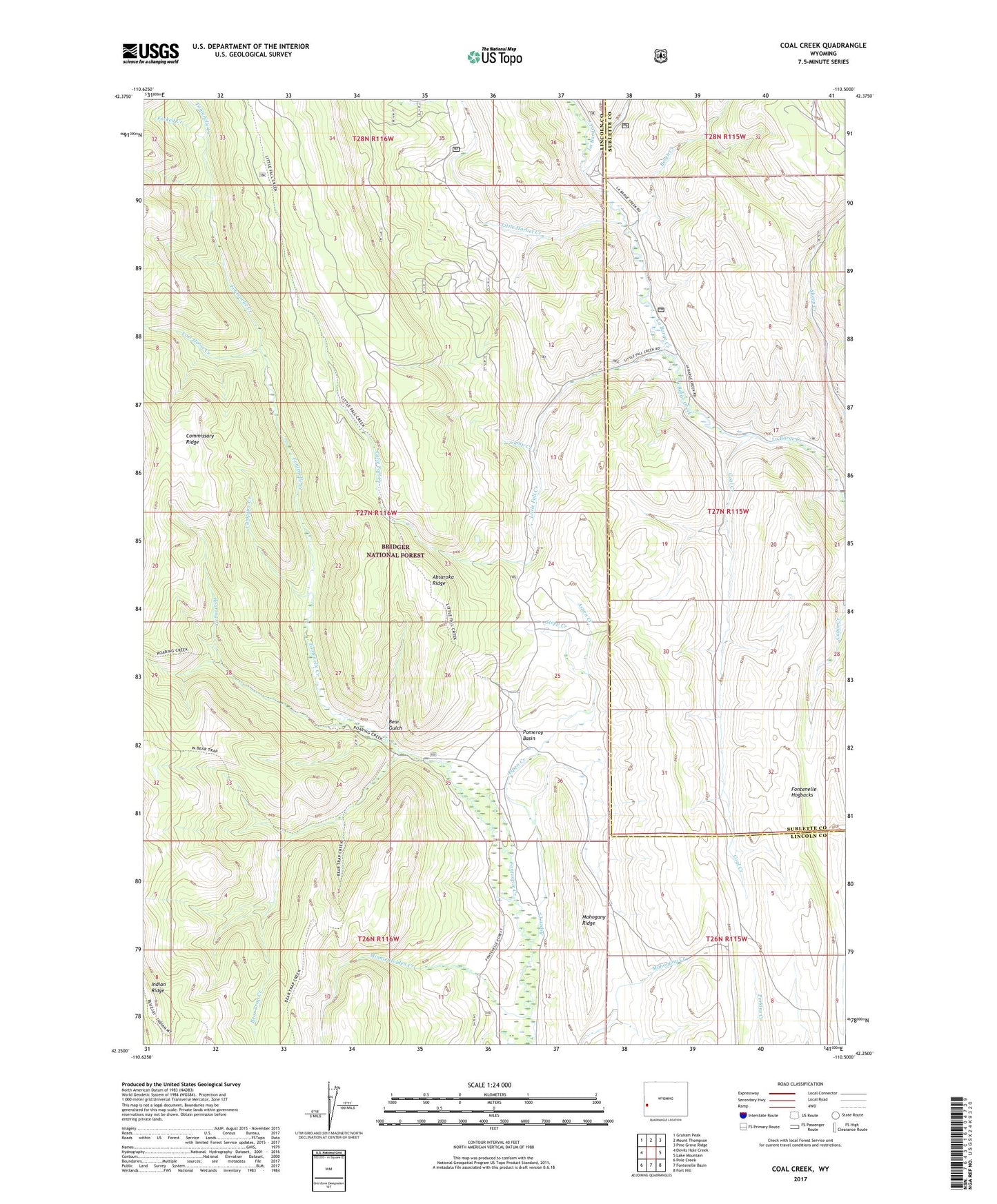
Coal Creek Wyoming US Topo Map
Couldn't load pickup availability
Also explore the Coal Creek Forest Service Topo of this same quad for updated USFS data
2021 topographic map quadrangle Coal Creek in the state of Wyoming. Scale: 1:24000. Based on the newly updated USGS 7.5' US Topo map series, this map is in the following counties: Lincoln, Sublette. The map contains contour data, water features, and other items you are used to seeing on USGS maps, but also has updated roads and other features. This is the next generation of topographic maps. Printed on high-quality waterproof paper with UV fade-resistant inks.
Quads adjacent to this one:
West: Devils Hole Creek
Northwest: Graham Peak
North: Mount Thompson
Northeast: Pine Grove Ridge
East: Lake Mountain
Southeast: Fort Hill
South: Fontenelle Basin
Southwest: Pole Creek
This map covers the same area as the classic USGS quad with code o42110c5.
Contains the following named places: Aspen Creek, Bear Gulch, Bear Trap Creek, Big Fall Creek, Booth Creek, Camp Creek, Campfire Creek, Coal Creek, Fontenelle Hogbacks, Forked Creek, Little Fall Creek, Little Hornet Creek, Lost Horse Creek, Mahogany Ridge, Minnie Holden Creek, PIKL Coal Mine, Pomeroy Basin, Roaring Creek, Sheep Creek, Stepp Creek