MyTopo
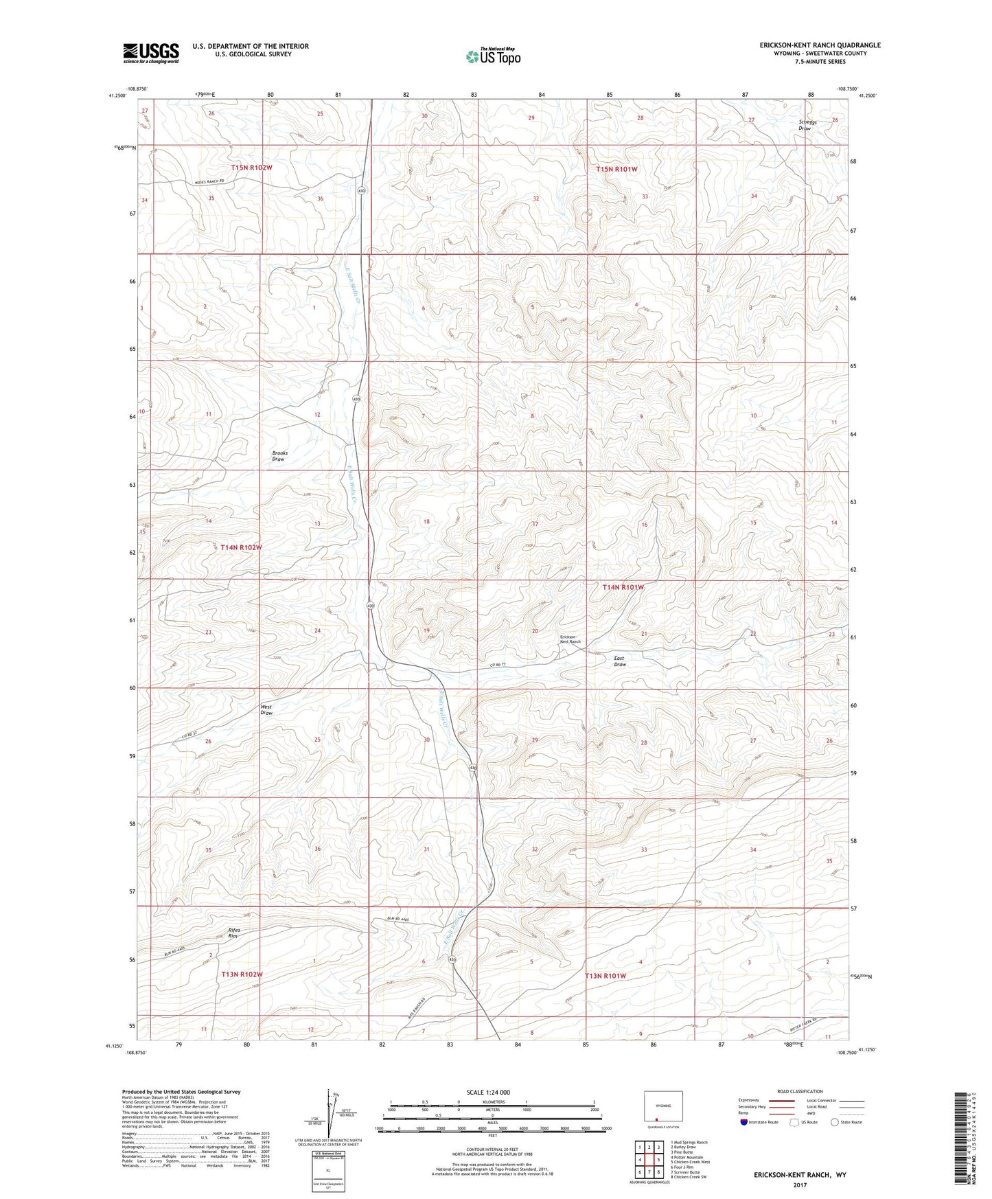
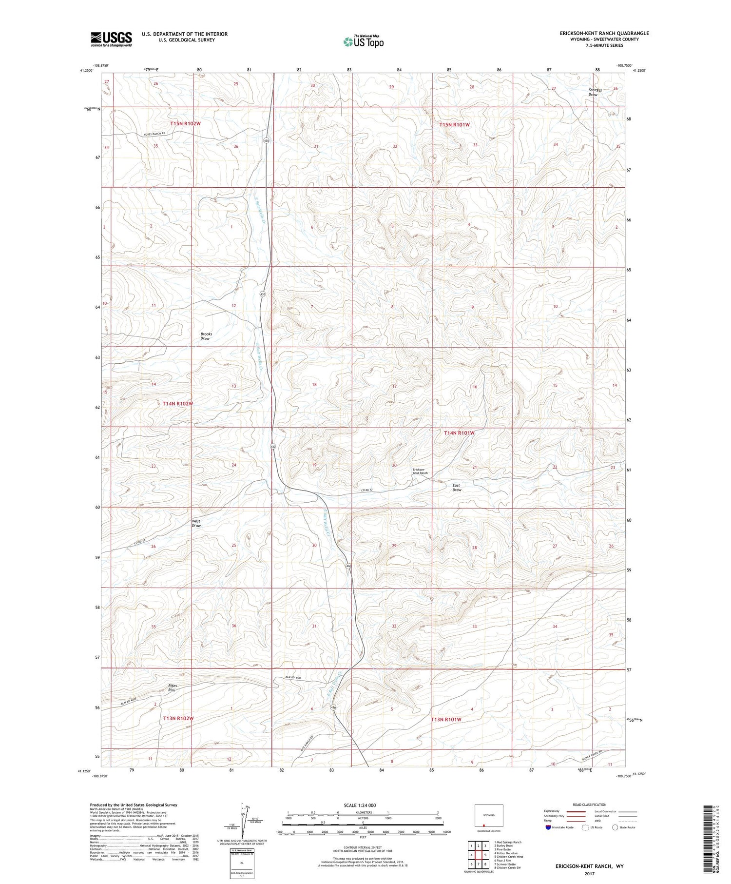
Erickson-Kent Ranch Wyoming US Topo Map
Couldn't load pickup availability
2021 topographic map quadrangle Erickson-Kent Ranch in the state of Wyoming. Scale: 1:24000. Based on the newly updated USGS 7.5' US Topo map series, this map is in the following counties: Sweetwater. The map contains contour data, water features, and other items you are used to seeing on USGS maps, but also has updated roads and other features. This is the next generation of topographic maps. Printed on high-quality waterproof paper with UV fade-resistant inks.
Quads adjacent to this one:
West: Potter Mountain
Northwest: Mud Springs Ranch
North: Burley Draw
Northeast: Pine Butte
East: Chicken Creek West
Southeast: Chicken Creek SW
South: Scrivner Butte
Southwest: Four J Rim
Contains the following named places: Brooks Draw, East Draw, Erickson-Kent Ranch, Rife Windmill, Rifes Rim, West Draw