MyTopo
Scrivner Butte Wyoming US Topo Map
Couldn't load pickup availability
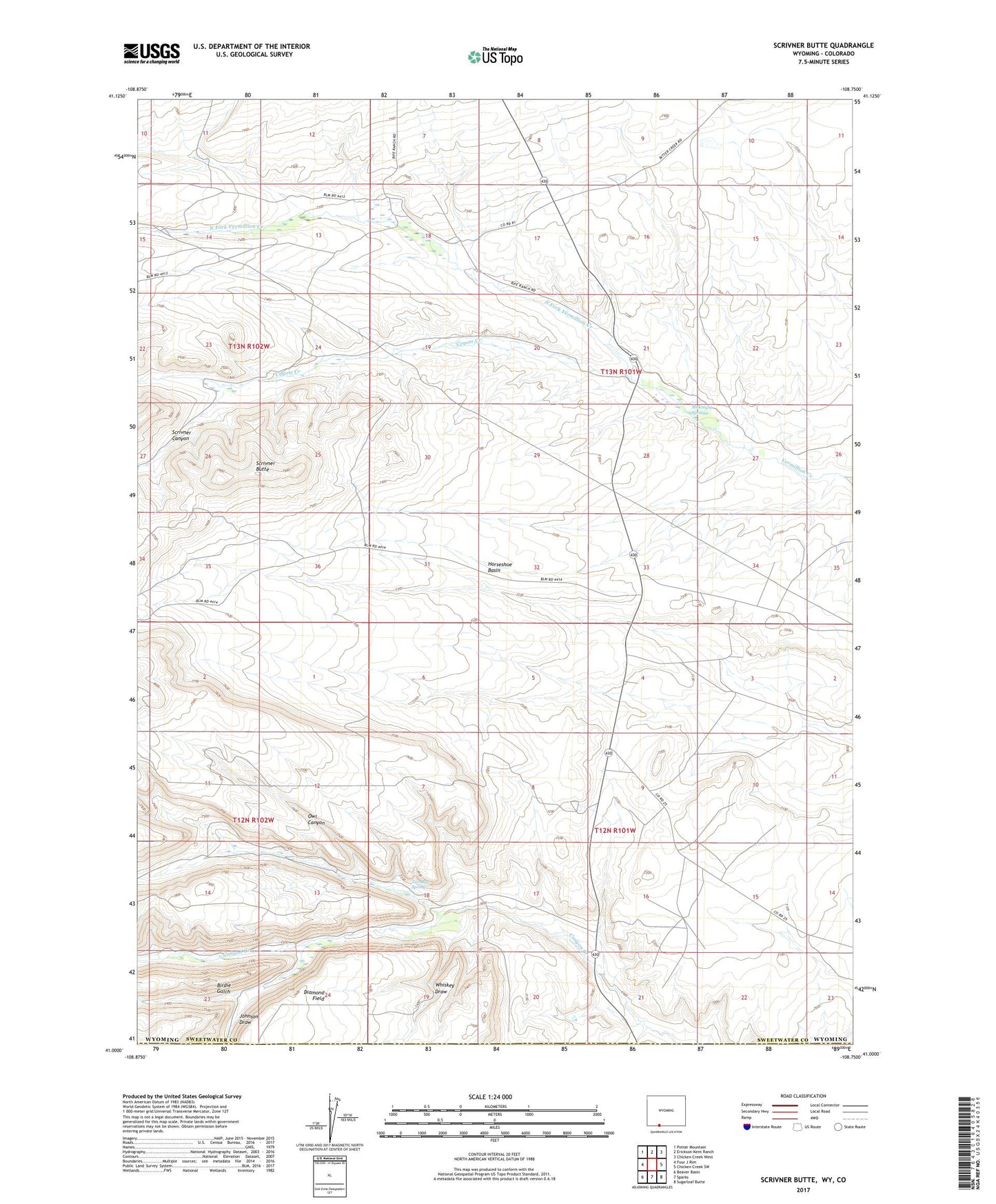
2021 topographic map quadrangle Scrivner Butte in the states of Wyoming, Colorado. Scale: 1:24000. Based on the newly updated USGS 7.5' US Topo map series, this map is in the following counties: Sweetwater, Moffat. The map contains contour data, water features, and other items you are used to seeing on USGS maps, but also has updated roads and other features. This is the next generation of topographic maps. Printed on high-quality waterproof paper with UV fade-resistant inks.
Quads adjacent to this one:
West: Four J Rim
Northwest: Potter Mountain
North: Erickson-Kent Ranch
Northeast: Chicken Creek West
East: Chicken Creek SW
Southeast: Sugarloaf Butte
South: Sparks
Southwest: Beaver Basin
This map covers the same area as the classic USGS quad with code o41108a7.
Contains the following named places: Birdie Gulch, Canyon Creek, Canyon Creek Camp, Canyon Creek Gas Field, Canyon Creek Mine, Canyon Creek Ranch, Coyote Creek, Diamond Field, Fisher Creek, Graham Ranch, Guy Rife Ranch, Horseshoe Basin, Johnson Draw, Koskie Prospect, McKnight Spring, North Fork Vermillion Creek, Owl Canyon, Rife Ranch, Scofield Ranch, Scrivner Butte, Scrivner Canyon, Two Bar Spring, Whiskey Draw