MyTopo
Ervay Basin Wyoming US Topo Map
Couldn't load pickup availability
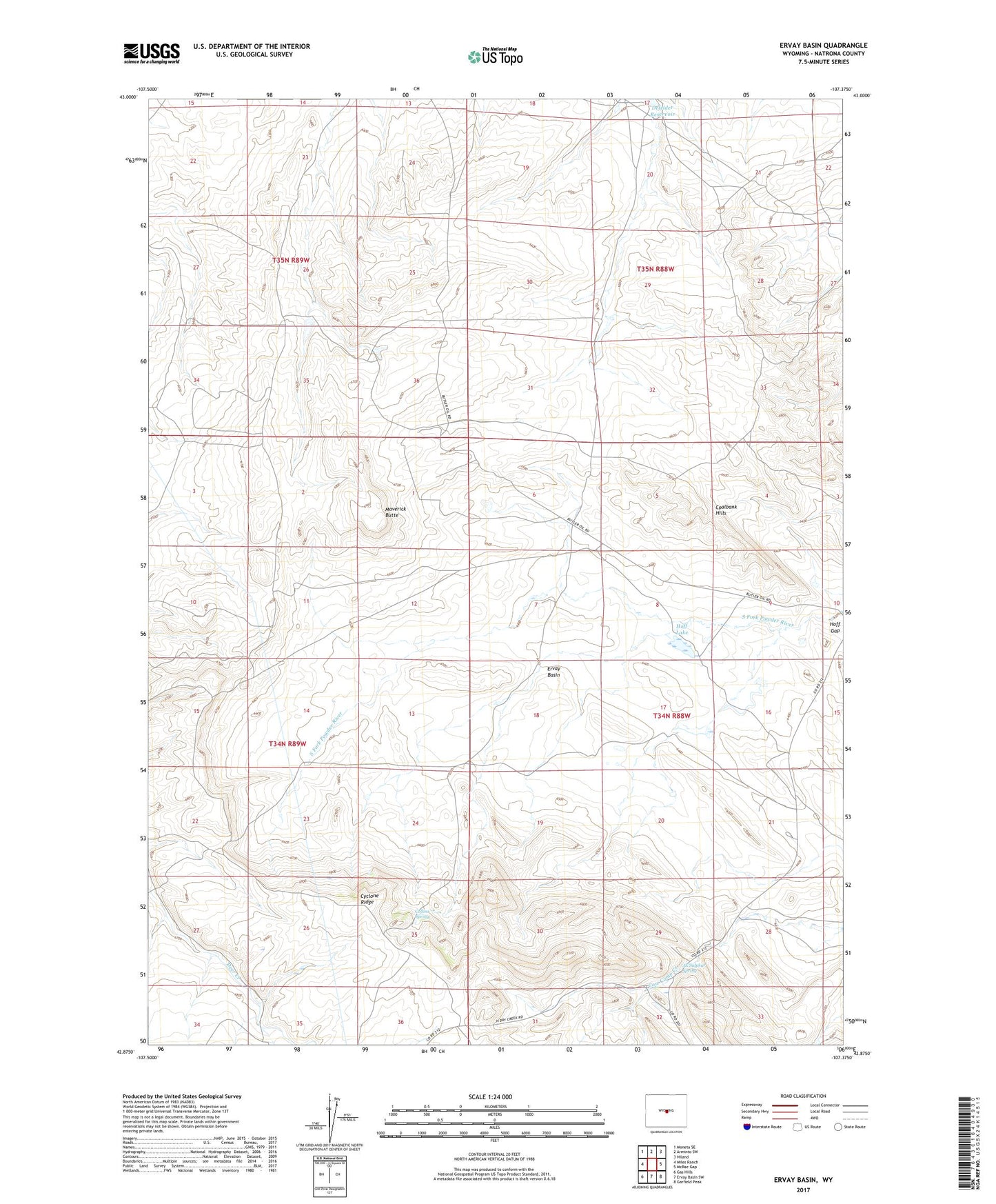
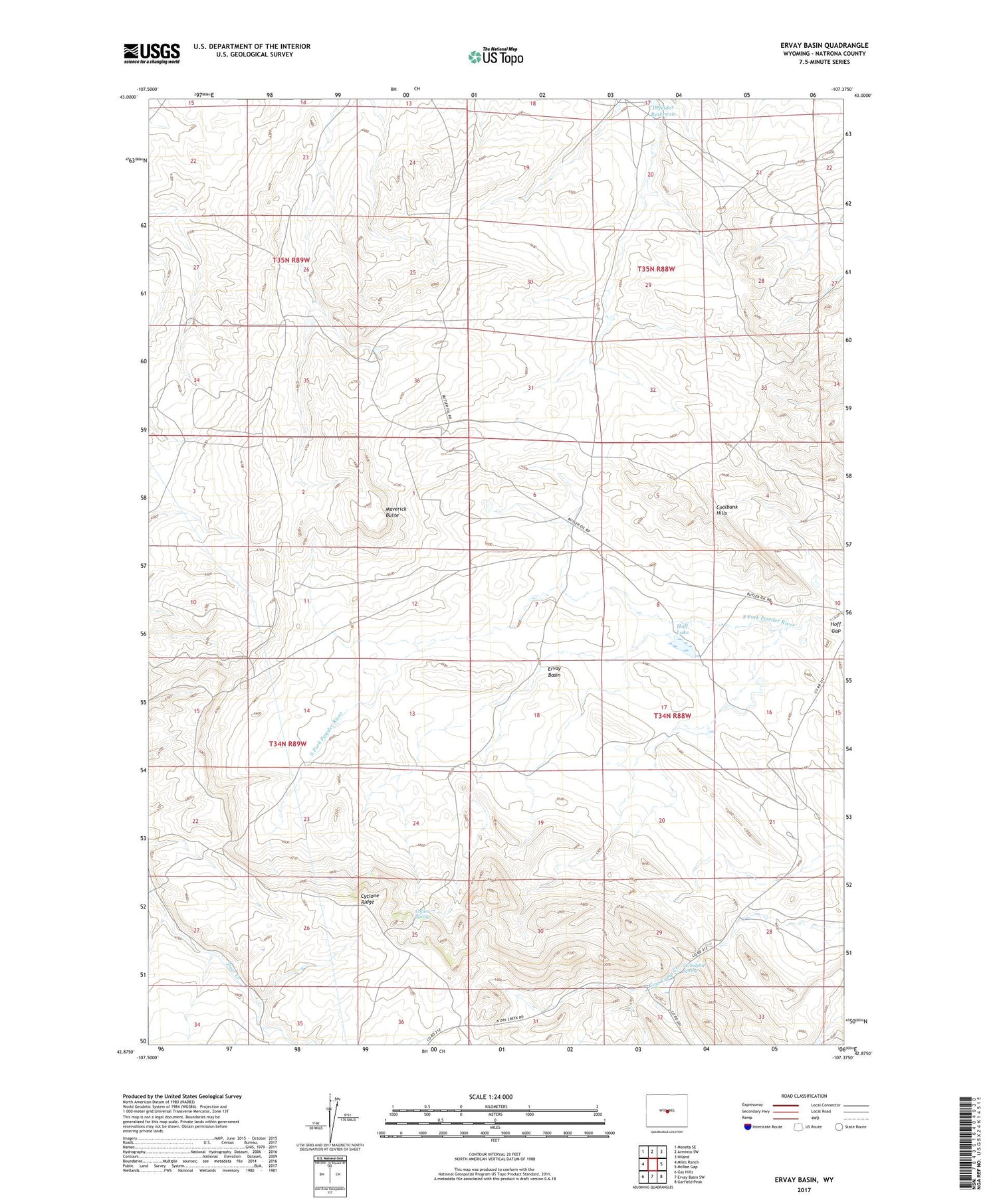
2021 topographic map quadrangle Ervay Basin in the state of Wyoming. Scale: 1:24000. Based on the newly updated USGS 7.5' US Topo map series, this map is in the following counties: Natrona. The map contains contour data, water features, and other items you are used to seeing on USGS maps, but also has updated roads and other features. This is the next generation of topographic maps. Printed on high-quality waterproof paper with UV fade-resistant inks.
Quads adjacent to this one:
West: Miles Ranch
Northwest: Moneta SE
North: Arminto SW
Northeast: Hiland
East: McRae Gap
Southeast: Garfield Peak
South: Ervay Basin SW
Southwest: Gas Hills
Contains the following named places: Boss Mine, Bridge Number One Mine, Coalbank Hills Mine, Collins Spring, Cyclone Ridge, Defelder Reservoir, Dick Number Six Mine, Doc Number Thirteen Mine, Ervay Basin, Hart Well, Hoff Lake, JE Ranch, JE School, JE Sulphur Spring, Lee Mine, Maverick Butte, Niball Number Eleven Mine, Niball Number Twelve Mine, Raderville, Raderville Post Office, Ridge Number One Mine, Sagebrush Number Fifteen Mine, Skyline Mine, Teton Mine, Wagner Well, Wentz Mine