MyTopo
Hiland Wyoming US Topo Map
Couldn't load pickup availability
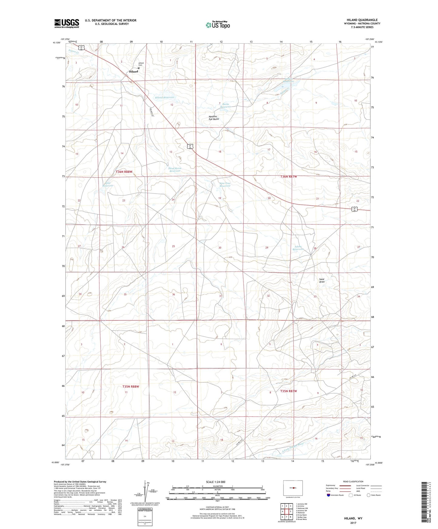
2021 topographic map quadrangle Hiland in the state of Wyoming. Scale: 1:24000. Based on the newly updated USGS 7.5' US Topo map series, this map is in the following counties: Natrona. The map contains contour data, water features, and other items you are used to seeing on USGS maps, but also has updated roads and other features. This is the next generation of topographic maps. Printed on high-quality waterproof paper with UV fade-resistant inks.
Quads adjacent to this one:
West: Arminto SW
Northwest: Arminto NW
North: Arminto
Northeast: Waltman NW
East: Waltman
Southeast: Broad Mesa
South: McRae Gap
Southwest: Ervay Basin
This map covers the same area as the classic USGS quad with code o43107a3.
Contains the following named places: Adobe Reservoir, Burke Reservoir, Dead Horse Reservoir, Gay Claim, Hiland, Hiland Cemetery, Hiland Reservoir, Neal Reservoir, Needles Eye Butte, Old Wolton Ruins, Pine Tree Reservoir, Poison Creek Dam, Poison Creek Reservoir, Wolton Reservoir, ZIP Code: 82638