MyTopo
Garfield Peak Wyoming US Topo Map
Couldn't load pickup availability
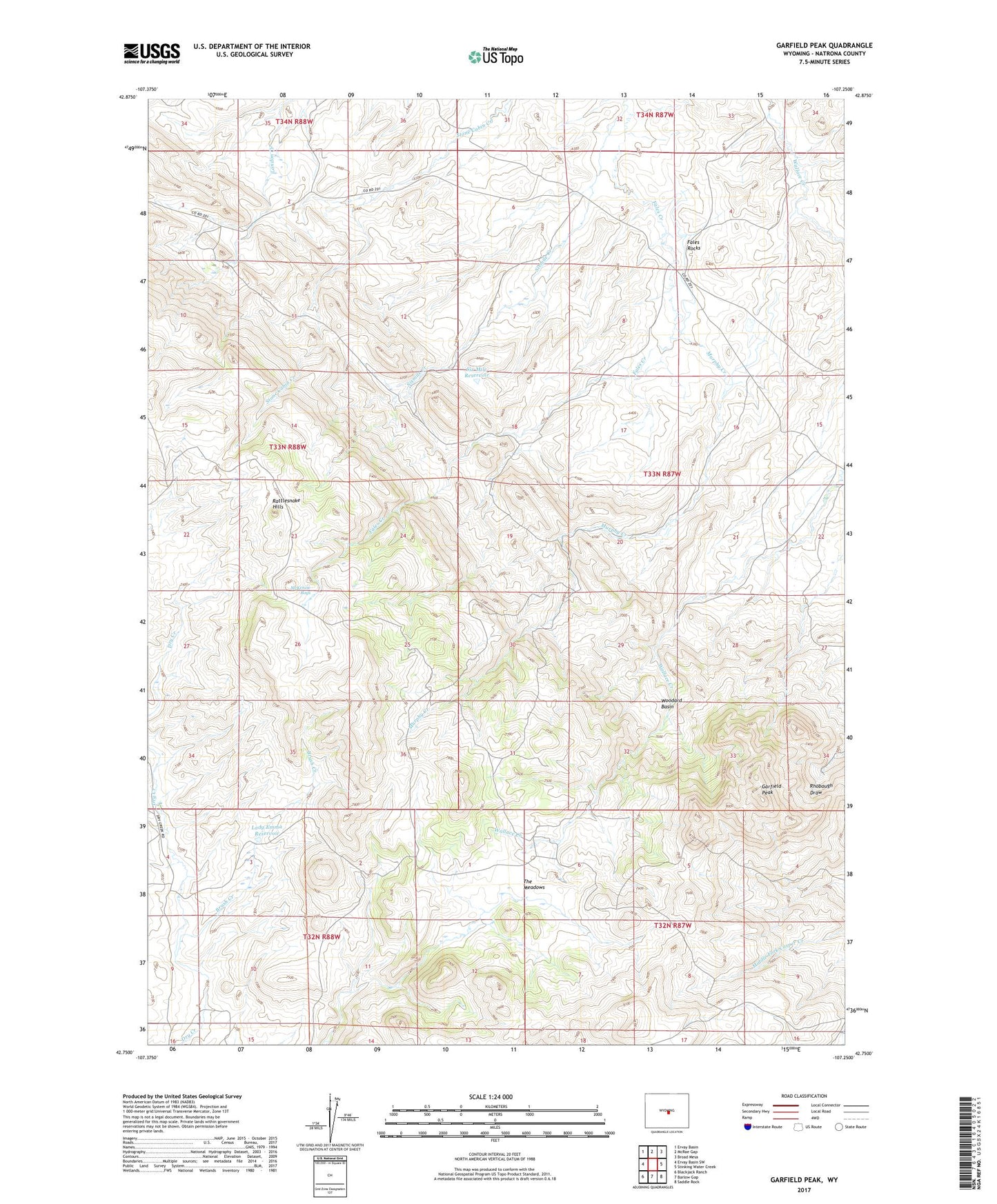
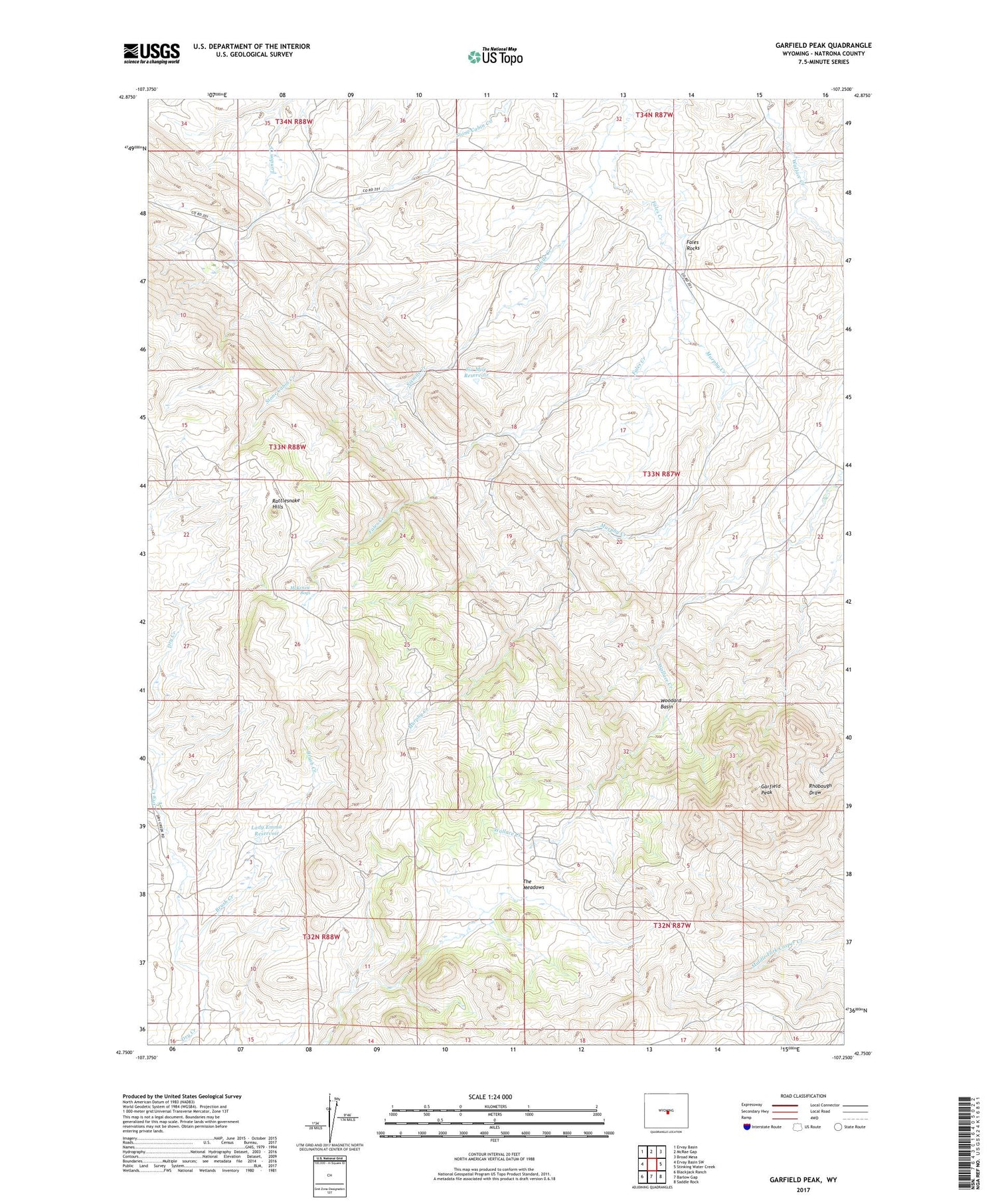
2021 topographic map quadrangle Garfield Peak in the state of Wyoming. Scale: 1:24000. Based on the newly updated USGS 7.5' US Topo map series, this map is in the following counties: Natrona. The map contains contour data, water features, and other items you are used to seeing on USGS maps, but also has updated roads and other features. This is the next generation of topographic maps. Printed on high-quality waterproof paper with UV fade-resistant inks.
Quads adjacent to this one:
West: Ervay Basin SW
Northwest: Ervay Basin
North: McRae Gap
Northeast: Broad Mesa
East: Stinking Water Creek
Southeast: Saddle Rock
South: Barlow Gap
Southwest: Blackjack Ranch
Contains the following named places: Brush Creek, Fales Rocks, Garfield Peak, Jameson Ranch, Lady Emma Reservoir, McKenzie Bogs, Murphy Creek, Rattlesnake Hills, Rattlesnake Mountains Mine, Six Mile Dam, Six Mile Reservoir, Sixmile Creek, Sixmile Ranch, The Meadows, U T Pass, Woodard Basin