MyTopo
Barlow Gap Wyoming US Topo Map
Couldn't load pickup availability
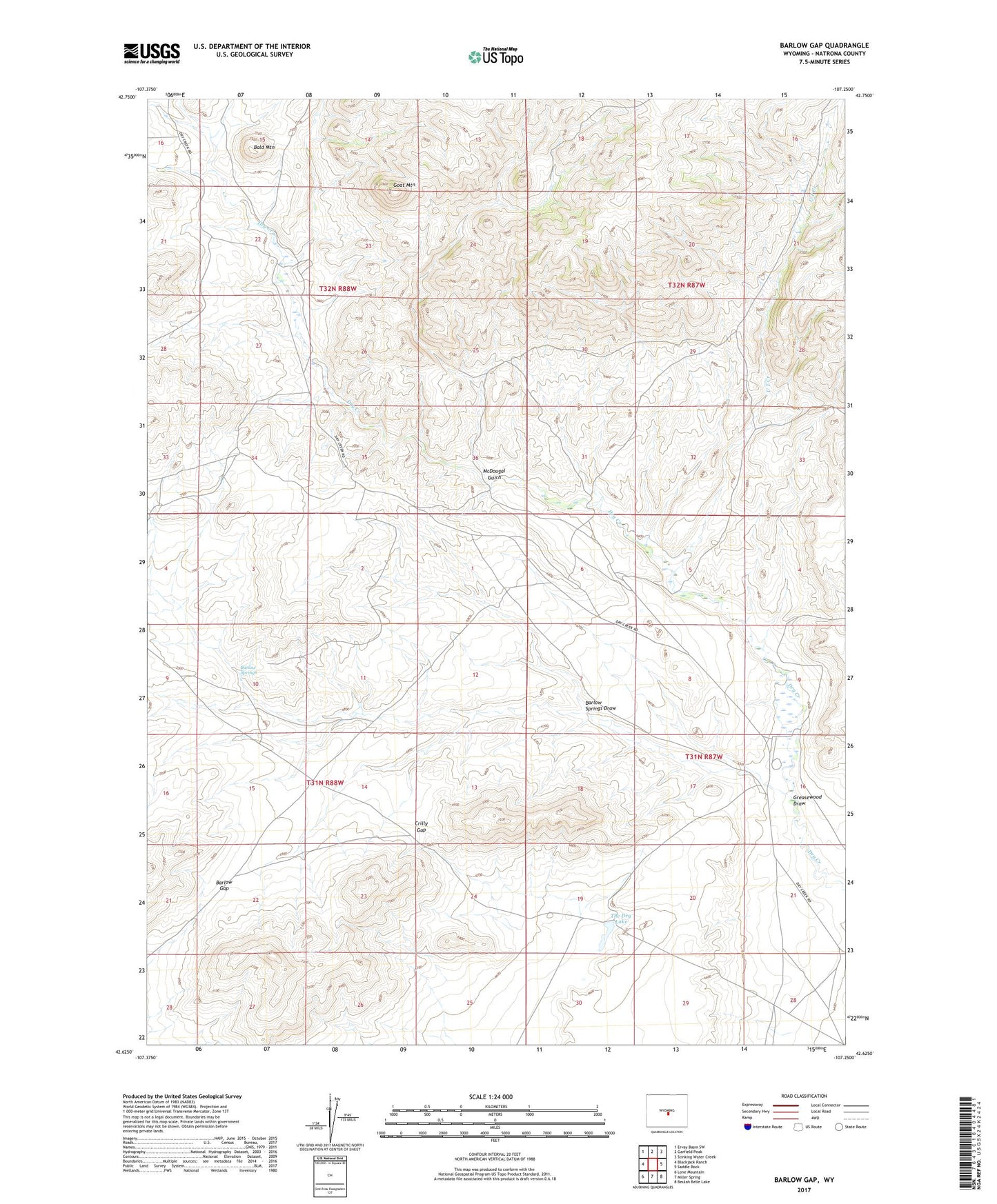
2021 topographic map quadrangle Barlow Gap in the state of Wyoming. Scale: 1:24000. Based on the newly updated USGS 7.5' US Topo map series, this map is in the following counties: Natrona. The map contains contour data, water features, and other items you are used to seeing on USGS maps, but also has updated roads and other features. This is the next generation of topographic maps. Printed on high-quality waterproof paper with UV fade-resistant inks.
Quads adjacent to this one:
West: Blackjack Ranch
Northwest: Ervay Basin SW
North: Garfield Peak
Northeast: Stinking Water Creek
East: Saddle Rock
Southeast: Beulah Belle Lake
South: Miller Spring
Southwest: Lone Mountain
This map covers the same area as the classic USGS quad with code o42107f3.
Contains the following named places: Bald Mountain, Barlow Gap, Barlow Springs, Barlow Springs Draw, Circle Bar Ranch, Claytor Ranch, Crilly Gap, Goat Mountain, Goat Mountain Area Mine, Greasewood Draw, McDougal Gulch, Seven D Ranch, The Dry Lake, U T Creek, Vide Homestead