MyTopo
Keeline Wyoming US Topo Map
Couldn't load pickup availability
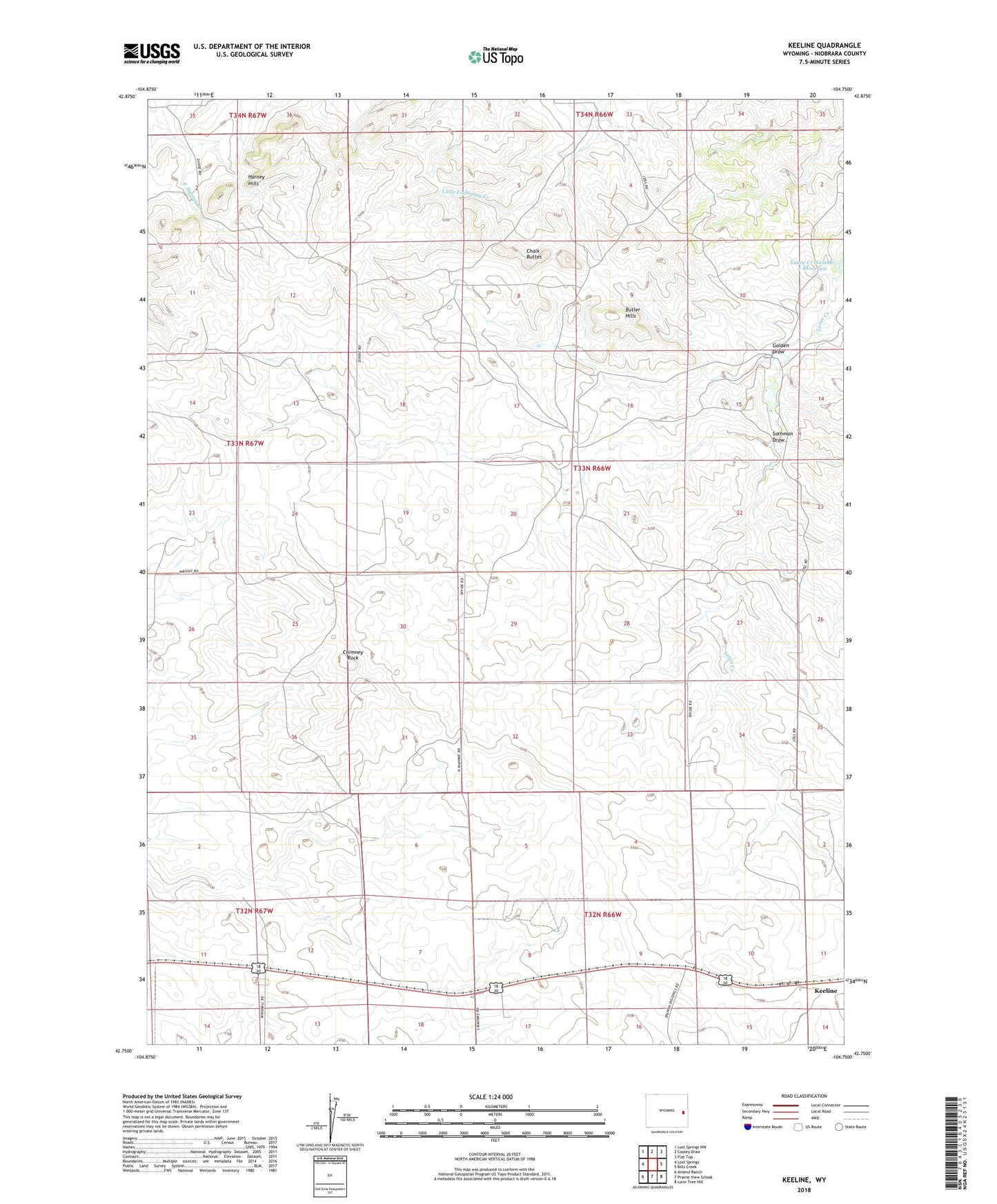
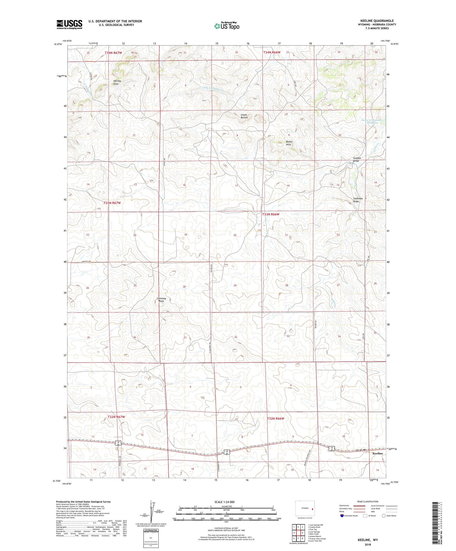
2021 topographic map quadrangle Keeline in the state of Wyoming. Scale: 1:24000. Based on the newly updated USGS 7.5' US Topo map series, this map is in the following counties: Niobrara. The map contains contour data, water features, and other items you are used to seeing on USGS maps, but also has updated roads and other features. This is the next generation of topographic maps. Printed on high-quality waterproof paper with UV fade-resistant inks.
Quads adjacent to this one:
West: Lost Springs
Northwest: Lost Springs NW
North: Cooley Draw
Northeast: Flat Top
East: Bills Creek
Southeast: Lone Tree Hill
South: Prairie View School
Southwest: Amend Ranch
Contains the following named places: Butler Hills, Chalk Buttes, Chimney Rock, Golden Draw, Harney Claim, Harney Hills, Keeline, Lance Creek Number 1 Dam, Lance Creek Number 1 Reservoir, Sothman Draw