MyTopo
Amend Ranch Wyoming US Topo Map
Couldn't load pickup availability
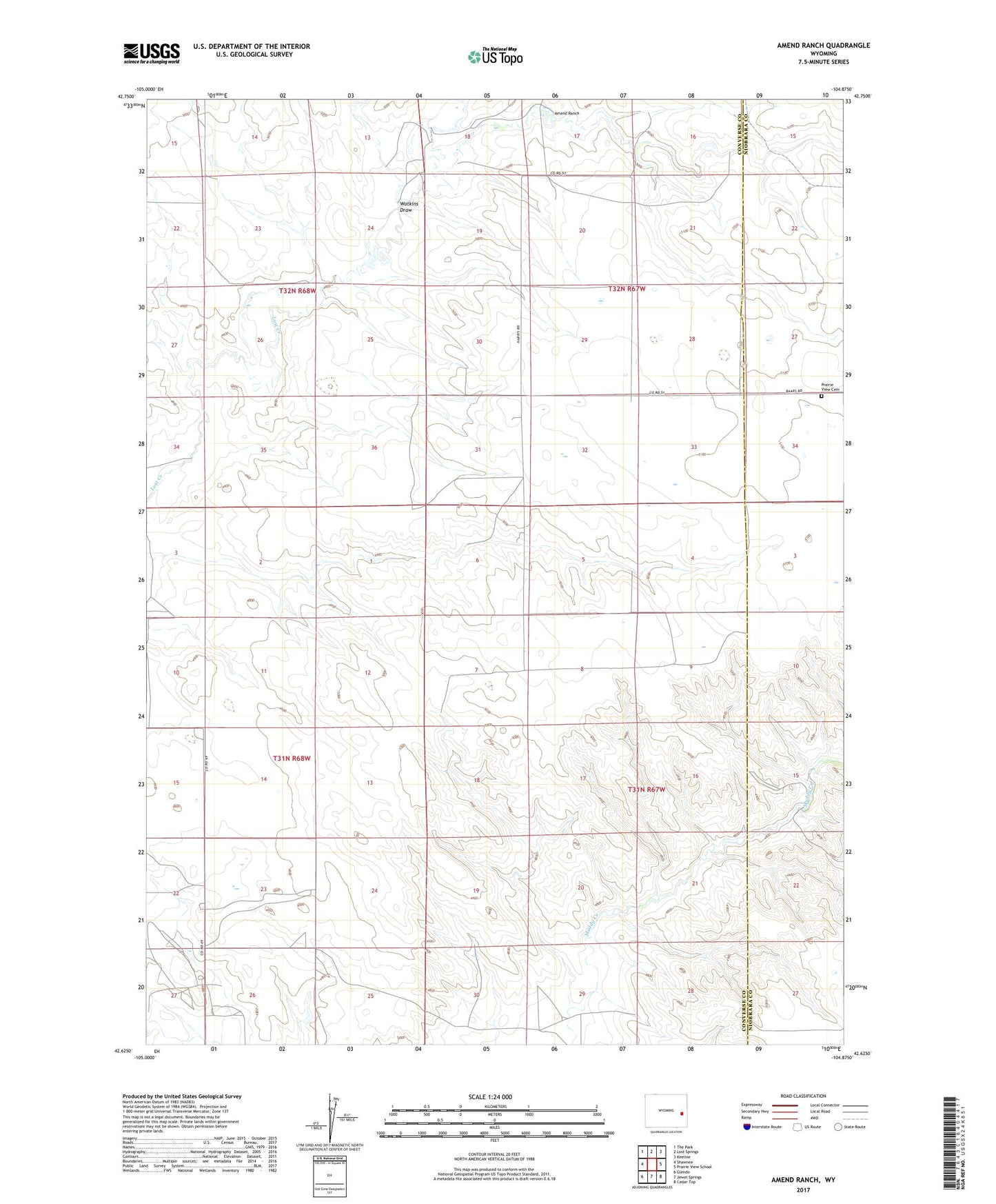
2021 topographic map quadrangle Amend Ranch in the state of Wyoming. Scale: 1:24000. Based on the newly updated USGS 7.5' US Topo map series, this map is in the following counties: Converse, Niobrara. The map contains contour data, water features, and other items you are used to seeing on USGS maps, but also has updated roads and other features. This is the next generation of topographic maps. Printed on high-quality waterproof paper with UV fade-resistant inks.
Quads adjacent to this one:
West: Shawnee
Northwest: The Park
North: Lost Springs
Northeast: Keeline
East: Prairie View School
Southeast: Cedar Top
South: Jewel Springs
Southwest: Glendo
This map covers the same area as the classic USGS quad with code o42104f8.
Contains the following named places: Amend Ranch, Camp Ranch, Card Dike, Moore Ranch, Prairie View Cemetery, Ray Reese Ranch, Reese Brothers Ranch, Stewart Ranch, Watkins Draw, Willow Dike, York Ranch