MyTopo
Lake De Smet East Wyoming US Topo Map
Couldn't load pickup availability
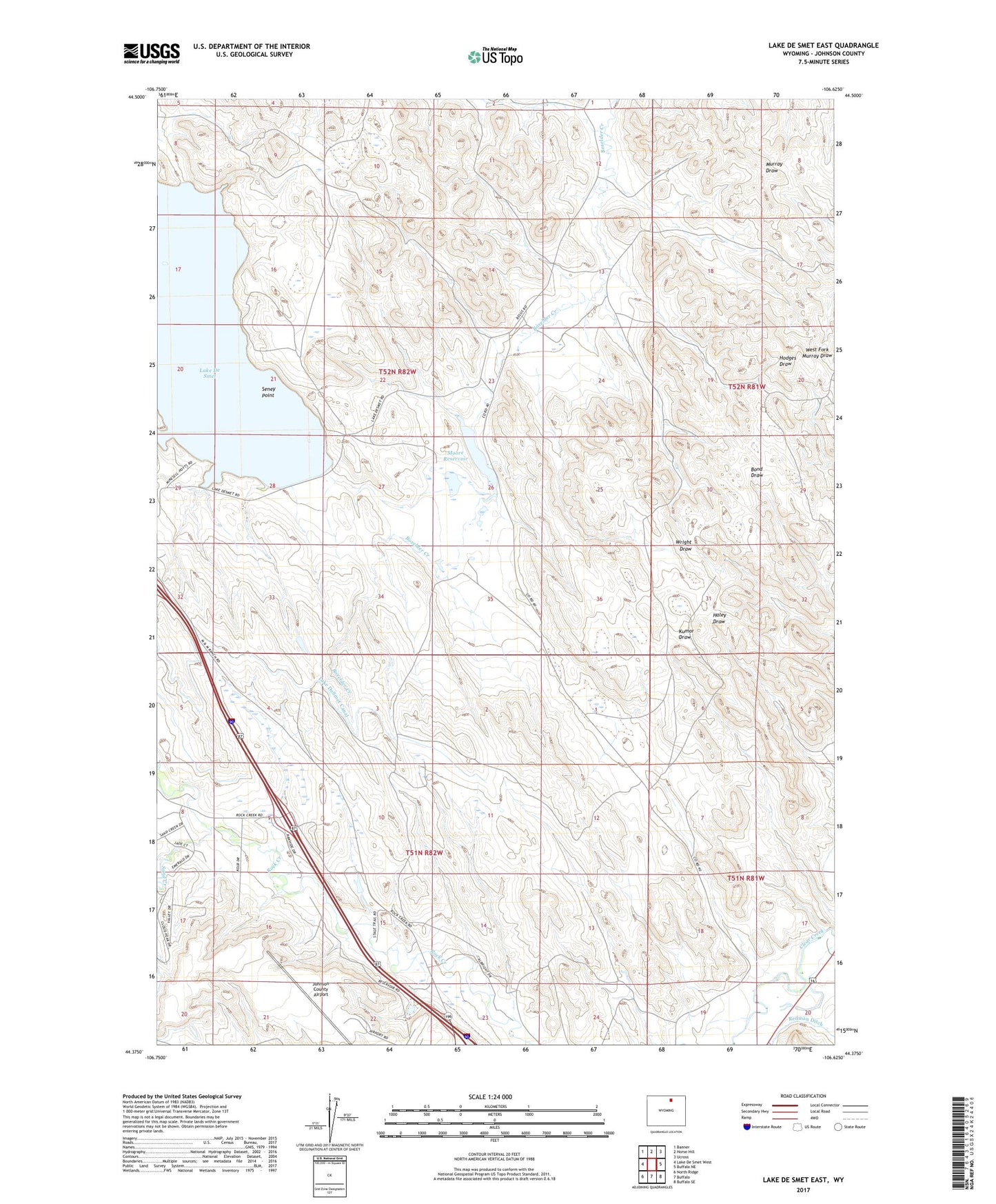
2021 topographic map quadrangle Lake De Smet East in the state of Wyoming. Scale: 1:24000. Based on the newly updated USGS 7.5' US Topo map series, this map is in the following counties: Johnson. The map contains contour data, water features, and other items you are used to seeing on USGS maps, but also has updated roads and other features. This is the next generation of topographic maps. Printed on high-quality waterproof paper with UV fade-resistant inks.
Quads adjacent to this one:
West: Lake De Smet West
Northwest: Banner
North: Horse Hill
Northeast: Ucross
East: Buffalo NE
Southeast: Buffalo SE
South: Buffalo
Southwest: North Ridge
Contains the following named places: City Pit, Husen Pit Number A, Husen Pit Number B, Huson Dam, Huson Reservoir, Johnson County Airport, Lake De Smet Mine, Last Chance Ditch, Moore Dam, Moore Reservoir, Redman Ditch, Sand Creek, Seney Point