MyTopo
Horse Hill Wyoming US Topo Map
Couldn't load pickup availability
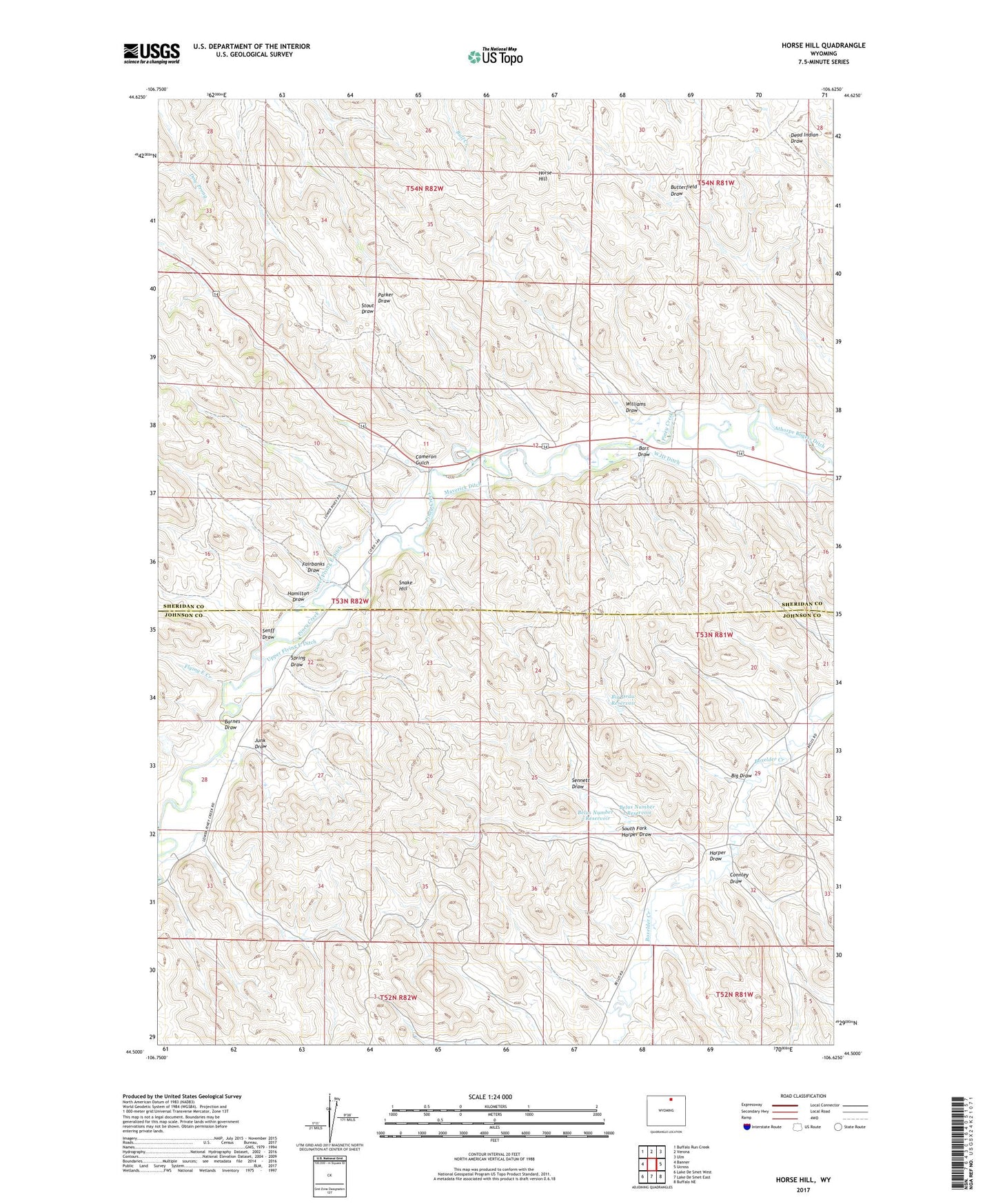
2021 topographic map quadrangle Horse Hill in the state of Wyoming. Scale: 1:24000. Based on the newly updated USGS 7.5' US Topo map series, this map is in the following counties: Sheridan, Johnson. The map contains contour data, water features, and other items you are used to seeing on USGS maps, but also has updated roads and other features. This is the next generation of topographic maps. Printed on high-quality waterproof paper with UV fade-resistant inks.
Quads adjacent to this one:
West: Banner
Northwest: Buffalo Run Creek
North: Verona
Northeast: Ulm
East: Ucross
Southeast: Buffalo NE
South: Lake De Smet East
Southwest: Lake De Smet West
This map covers the same area as the classic USGS quad with code o44106e6.
Contains the following named places: Barnes Draw, Barr Draw, Belus Number 1 Reservoir, Belus Number 2 Reservoir, Big Draw, Big Draw Reservoir, Cameron Gulch, Connley Ditch, Connley Draw, Fairbanks Draw, Flying E Creek, Grinnell Ditch, Hamilton Draw, Harper Draw, Horse Hill, Irene Dam, Irene Reservoir, Junk Draw, Kaufman Dam, Kaufman Reservoir, Krezelok Mine, Lower Flying E Ditch, Maverick Ditch, Senff Ditch, Senff Draw, Sennett Draw, Snake Hill, South Fork Harper Draw, Spring Draw, Sturdevant Ditch, Upper Flying E Ditch, Williams Draw, WJD Ditch