MyTopo
Lost Wells Butte Wyoming US Topo Map
Couldn't load pickup availability
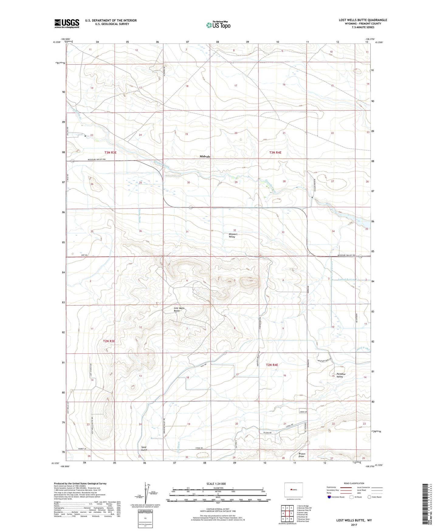
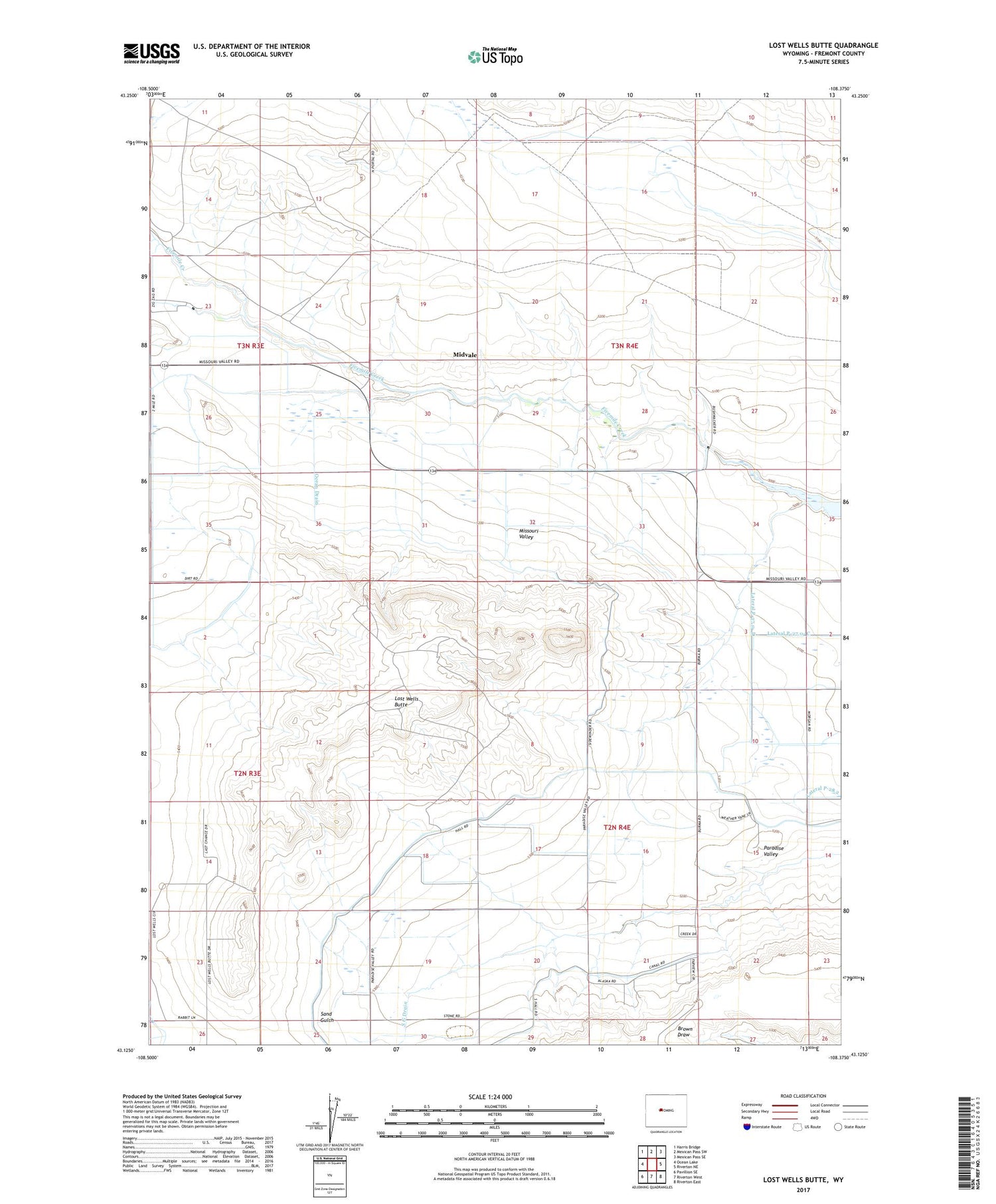
2021 topographic map quadrangle Lost Wells Butte in the state of Wyoming. Scale: 1:24000. Based on the newly updated USGS 7.5' US Topo map series, this map is in the following counties: Fremont. The map contains contour data, water features, and other items you are used to seeing on USGS maps, but also has updated roads and other features. This is the next generation of topographic maps. Printed on high-quality waterproof paper with UV fade-resistant inks.
Quads adjacent to this one:
West: Ocean Lake
Northwest: Harris Bridge
North: Mexican Pass SW
Northeast: Mexican Pass SE
East: Riverton NE
Southeast: Riverton East
South: Riverton West
Southwest: Pavillion SE
Contains the following named places: Lost Wells Butte, Lost Wells Lateral, Midvale, Ocean Drain, Paradise Valley, Paradise Valley Community House, Pavillion Drain, S G Drain, Sand Gulch Lateral, Union Church