MyTopo
Love Ranch Wyoming US Topo Map
Couldn't load pickup availability
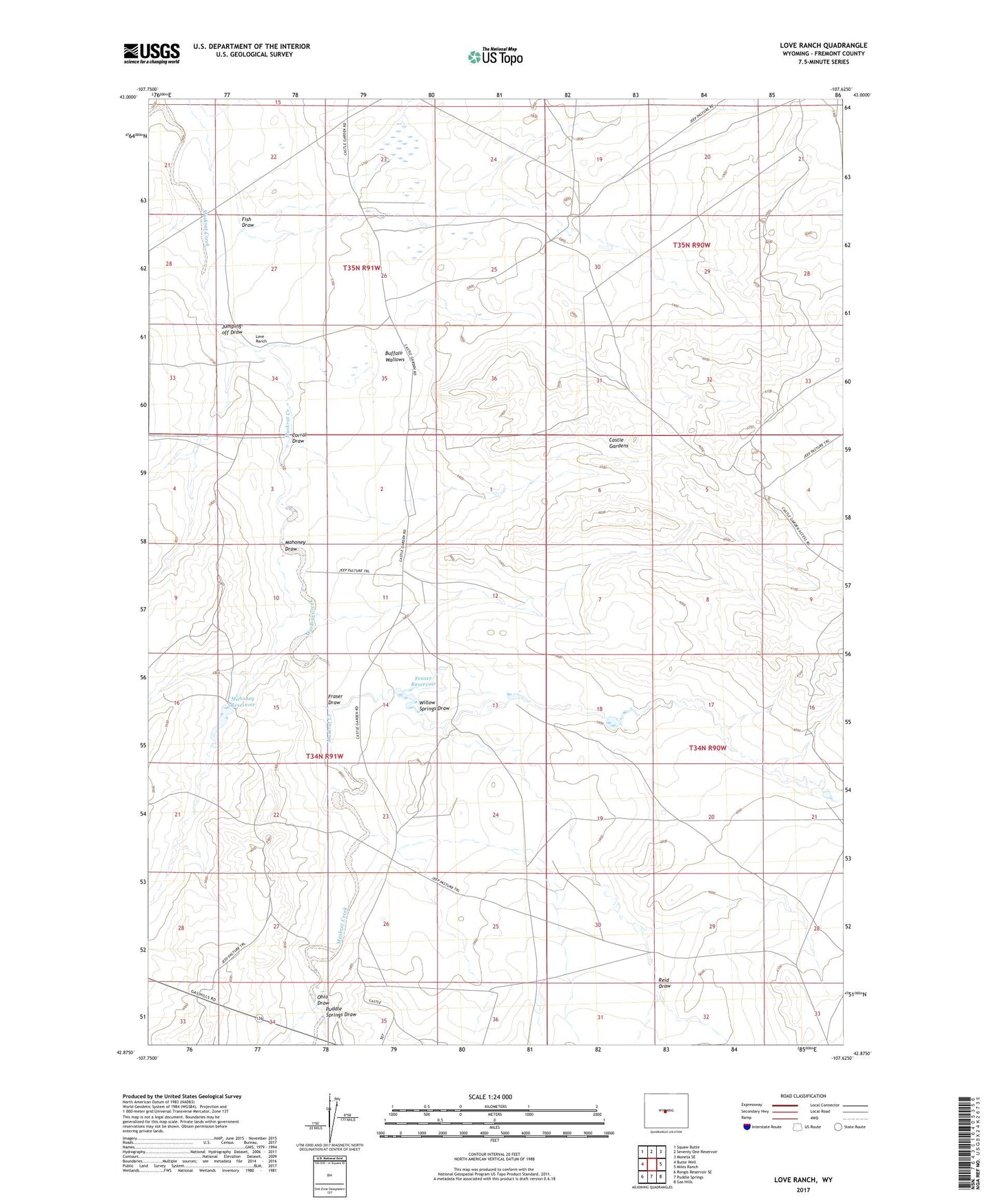
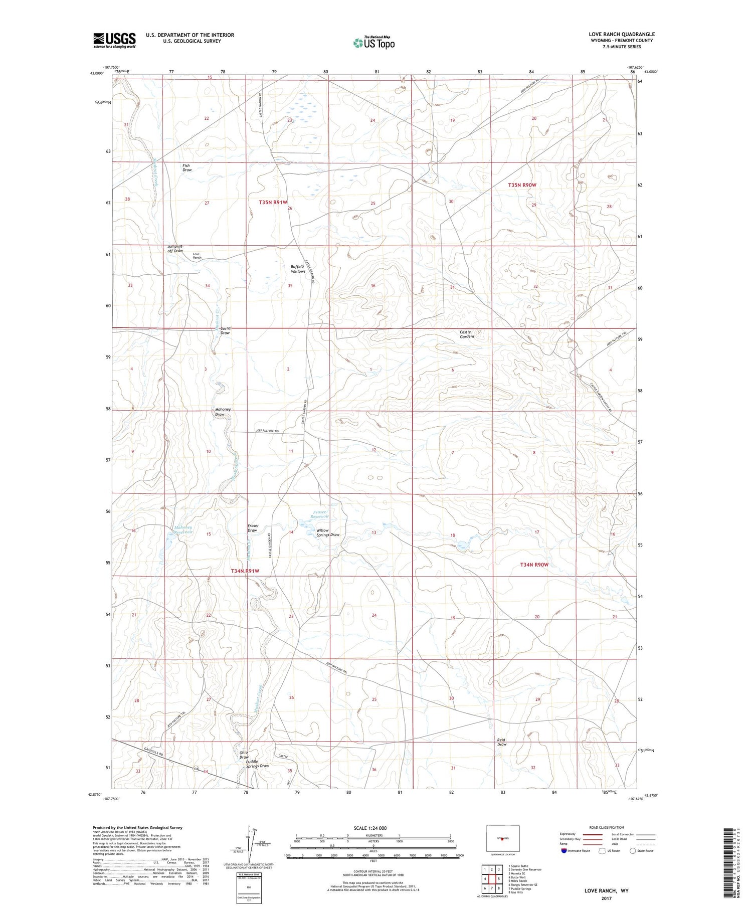
2021 topographic map quadrangle Love Ranch in the state of Wyoming. Scale: 1:24000. Based on the newly updated USGS 7.5' US Topo map series, this map is in the following counties: Fremont. The map contains contour data, water features, and other items you are used to seeing on USGS maps, but also has updated roads and other features. This is the next generation of topographic maps. Printed on high-quality waterproof paper with UV fade-resistant inks.
Quads adjacent to this one:
West: Butte Well
Northwest: Squaw Butte
North: Seventy One Reservoir
Northeast: Moneta SE
East: Miles Ranch
Southeast: Gas Hills
South: Puddle Springs
Southwest: Rongis Reservoir SE
Contains the following named places: Buffalo Wallows, Castle Gardens, Corral Draw, Fish Draw, Fraser Draw, Fraser Reservoir, Jumping-off Draw, Love Dam, Love Ranch, Love Reservoir, Mahoney Draw, Mahoney Reservoir, Ohio Draw, Puddle Springs Draw, Reid Draw, Roberts Sheep Camp, Willow Springs Draw