MyTopo
Milleson Draw Wyoming US Topo Map
Couldn't load pickup availability
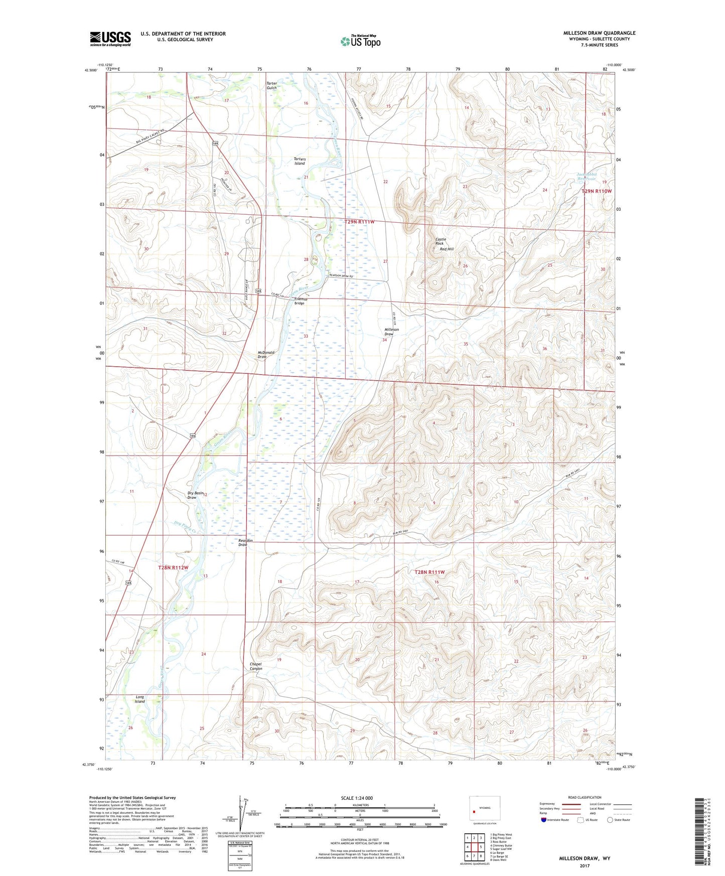
2021 topographic map quadrangle Milleson Draw in the state of Wyoming. Scale: 1:24000. Based on the newly updated USGS 7.5' US Topo map series, this map is in the following counties: Sublette. The map contains contour data, water features, and other items you are used to seeing on USGS maps, but also has updated roads and other features. This is the next generation of topographic maps. Printed on high-quality waterproof paper with UV fade-resistant inks.
Quads adjacent to this one:
West: Chimney Butte
Northwest: Big Piney West
North: Big Piney East
Northeast: Ross Butte
East: Sugar Loaf NW
Southeast: Oasis Well
South: La Barge SE
Southwest: La Barge
Contains the following named places: Blue Ridge Reservoir, Castle Rock, Chapel Canyon, Dry Basin Draw, Dry Piney Creek, Fivemile Bridge, Green River Island Ditch, Highline Canal, Horn Reservoir, Jackrabbit Reservoir, Long Island, McDonald Draw, Midmermac Ditch, Milleson Draw, Reardon Canyon Reservoir Number 2, Reardon Draw, Reardon Reservoir Number 3, Red Hill, Tarter Gulch, Tarters Island