MyTopo
La Barge Wyoming US Topo Map
Couldn't load pickup availability
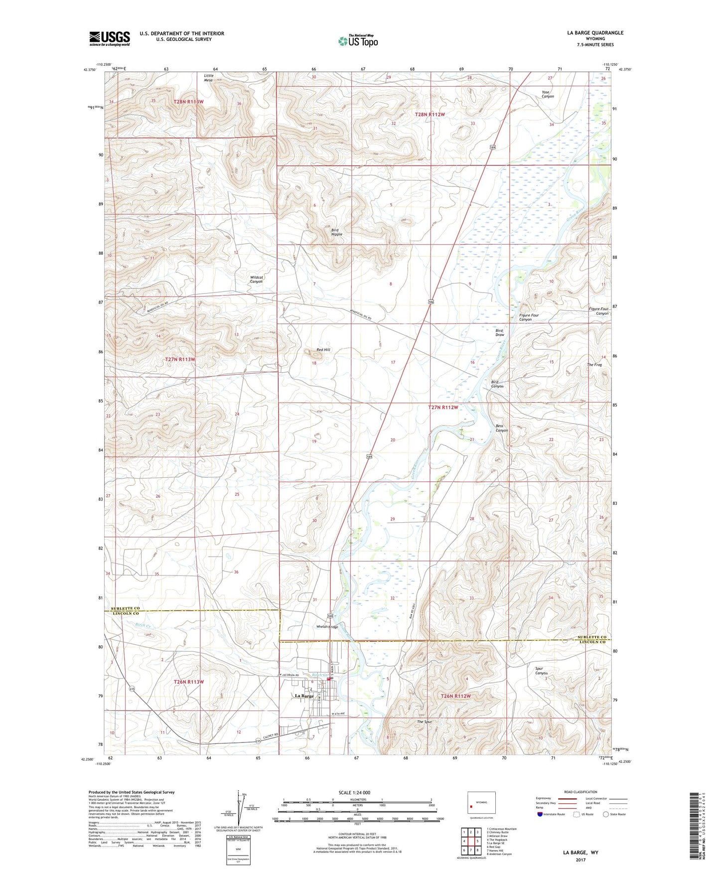
2021 topographic map quadrangle La Barge in the state of Wyoming. Scale: 1:24000. Based on the newly updated USGS 7.5' US Topo map series, this map is in the following counties: Sublette, Lincoln. The map contains contour data, water features, and other items you are used to seeing on USGS maps, but also has updated roads and other features. This is the next generation of topographic maps. Printed on high-quality waterproof paper with UV fade-resistant inks.
Quads adjacent to this one:
West: The Hogsback
Northwest: Cretaceous Mountain
North: Chimney Butte
Northeast: Milleson Draw
East: La Barge SE
Southeast: Anderson Canyon
South: Names Hill
Southwest: Red Gap
This map covers the same area as the classic USGS quad with code o42110c2.
Contains the following named places: Bess Canyon, Birch Creek, Bird Canyon, Bird Draw, Bird Nipple, Figure Four Canyon, Government Mine, La Barge, La Barge Post Office, La Barge Volunteer Fire Department, LaBarge School, Little Mesa, Red Hill, South Lincoln County Emergency Medical Services, The Frog, The Spur, Town of La Barge, Whelan Bridge, Wildcat Canyon, Yose Canyon