MyTopo
Newcastle Wyoming US Topo Map
Couldn't load pickup availability
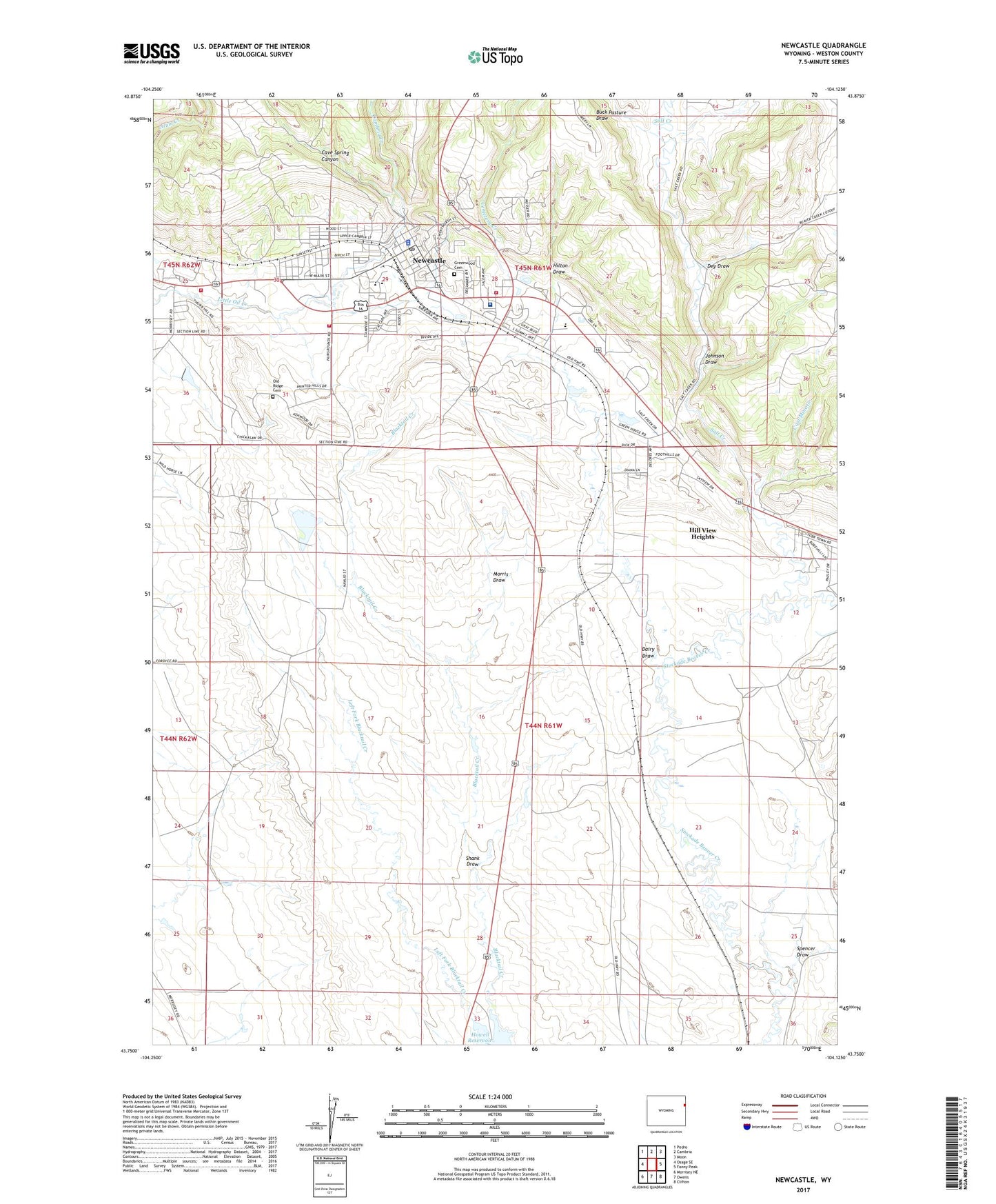
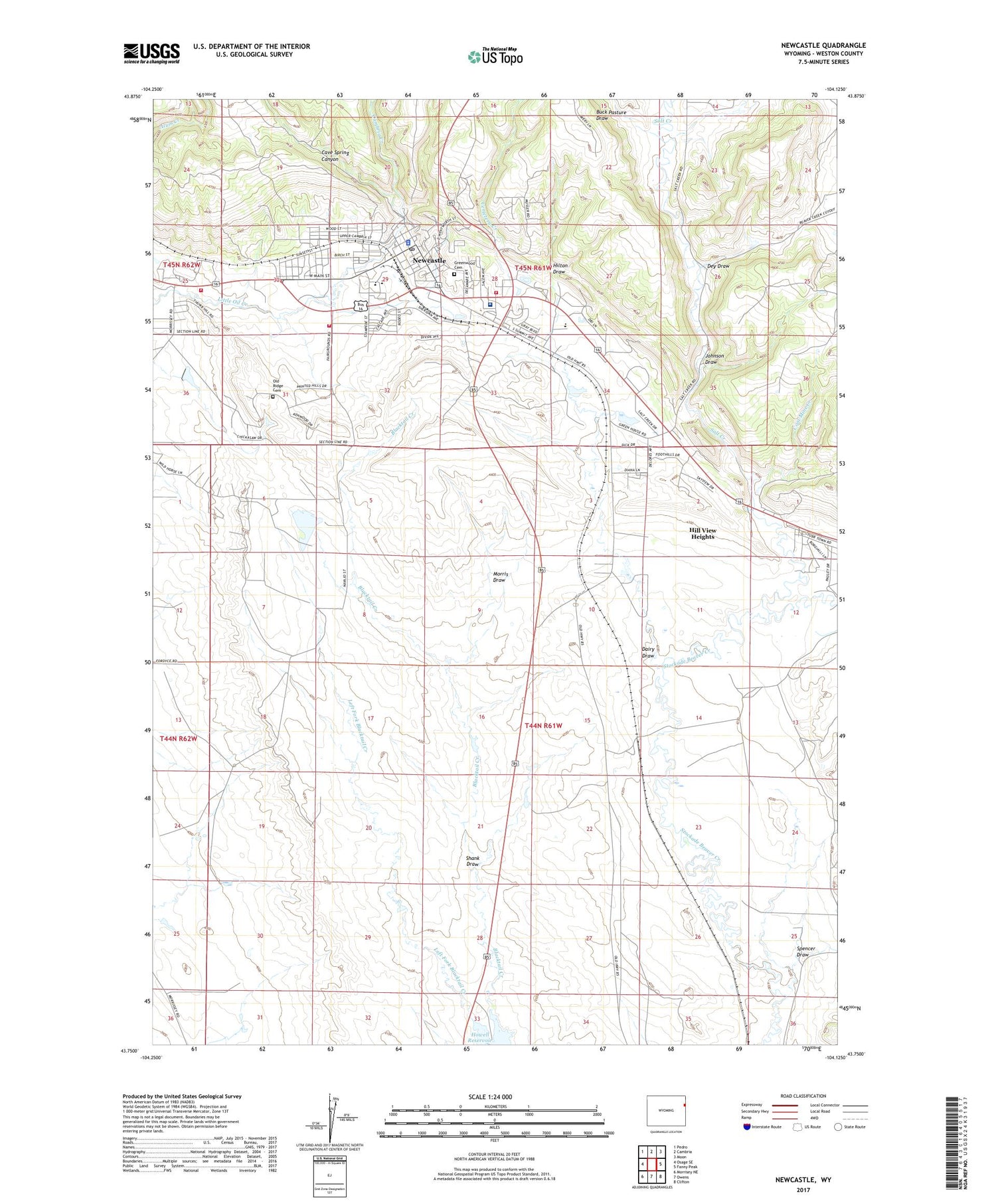
2021 topographic map quadrangle Newcastle in the state of Wyoming. Scale: 1:24000. Based on the newly updated USGS 7.5' US Topo map series, this map is in the following counties: Weston. The map contains contour data, water features, and other items you are used to seeing on USGS maps, but also has updated roads and other features. This is the next generation of topographic maps. Printed on high-quality waterproof paper with UV fade-resistant inks.
Quads adjacent to this one:
West: Osage SE
Northwest: Pedro
North: Cambria
Northeast: Moon
East: Fanny Peak
Southeast: Clifton
South: Owens
Southwest: Morrisey NE
Contains the following named places: Black Hills National Forest Hells Canyon Ranger District Fire Engine Crew, Buck Pasture Draw, Cambria Creek, Cave Spring Canyon, Cemetery Creek, City of Newcastle, Coal Mine Creek, Dairy Draw, Dey Draw, Gertrude Burns Early Childhood School, Gertrude Burns Intermediate School, Greenwood Cemetery, Hill View Heights, Hill View Heights Census Designated Place, Hilton Draw, Howell Reservoir, Johnson Draw, KASL-AM (Newcastle), Left Fork Blacktail Creek, Mondell Heights Odd Fellow/Rebekah Retirement Home, Morris Draw, Newcastle, Newcastle Ambulance Service, Newcastle High School, Newcastle Middle School, Newcastle Police Department, Newcastle Post Office, Newcastle Volunteer Fire Department, Old Ridge Cemetery, Salt Creek, Shank Draw, Spencer, Spencer Draw, Spencer Number 2 Dam, Weston County Fire Protection District Newcastle, Weston County Health Services, Weston County Manor Hospital, Weston County Memorial Hospital