MyTopo
Cambria Wyoming US Topo Map
Couldn't load pickup availability
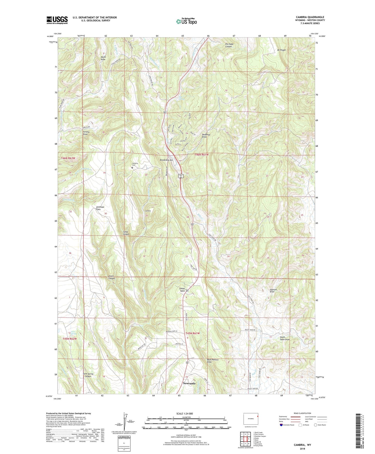
2021 topographic map quadrangle Cambria in the state of Wyoming. Scale: 1:24000. Based on the newly updated USGS 7.5' US Topo map series, this map is in the following counties: Weston. The map contains contour data, water features, and other items you are used to seeing on USGS maps, but also has updated roads and other features. This is the next generation of topographic maps. Printed on high-quality waterproof paper with UV fade-resistant inks.
Quads adjacent to this one:
West: Pedro
Northwest: Skull Creek
North: Four Corners
Northeast: Parmlee Canyon
East: Moon
Southeast: Fanny Peak
South: Newcastle
Southwest: Osage SE
This map covers the same area as the classic USGS quad with code o43104h2.
Contains the following named places: Antelope Flats, Breakneck Hill, Cambria, Cambria Cemetery, Camp Canyon, Cave Spring, Deadman Draw, Dry Gypp Canyon, Feralla Draw, Flying V Ranch, Grant Canyon, Gypsum Draw, Jumbo Table, Mount Pisgah, North Draw, Salt Spring, South Table Draw, Sweetwater Creek