MyTopo
Otto Wyoming US Topo Map
Couldn't load pickup availability
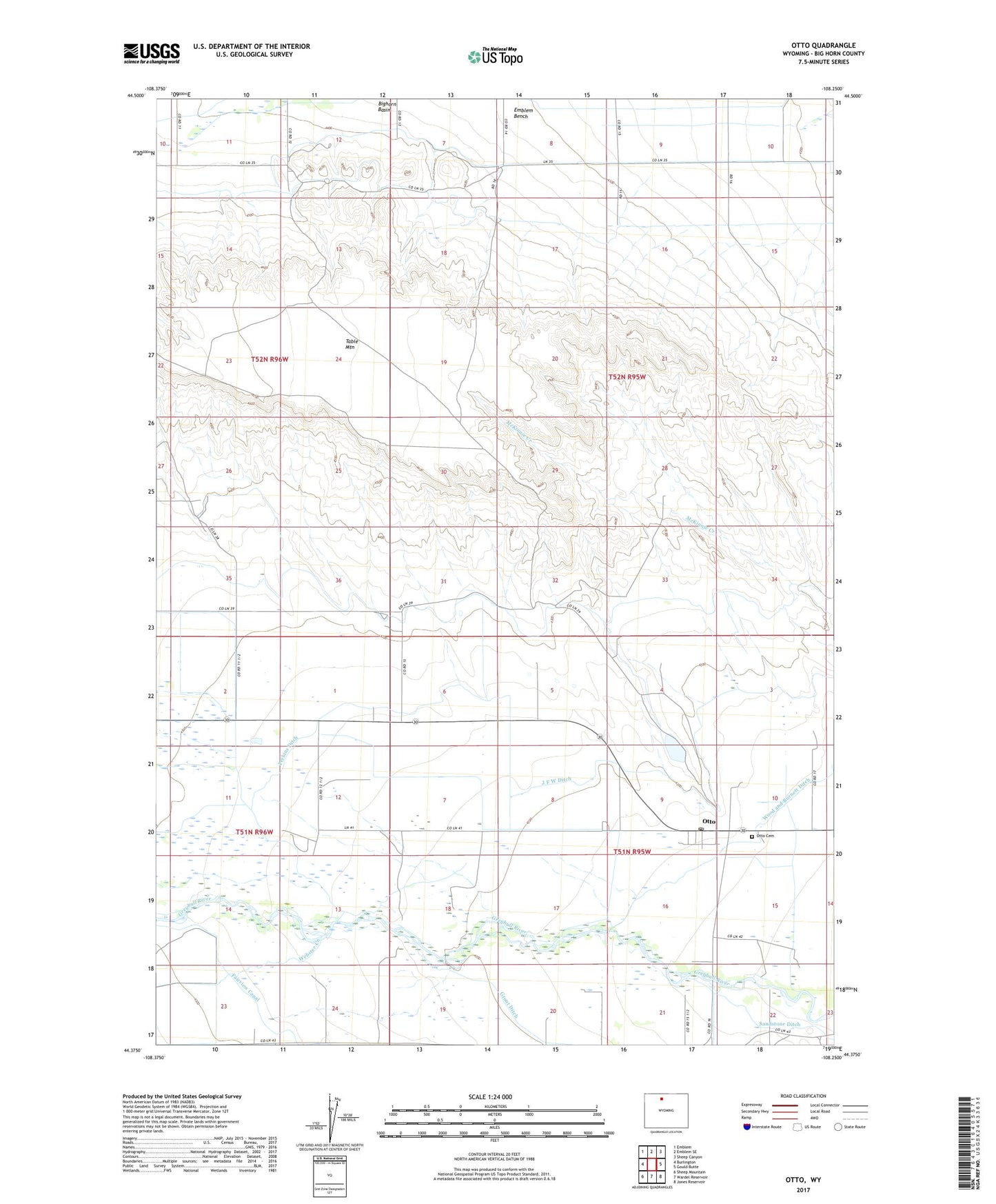
2021 topographic map quadrangle Otto in the state of Wyoming. Scale: 1:24000. Based on the newly updated USGS 7.5' US Topo map series, this map is in the following counties: Big Horn. The map contains contour data, water features, and other items you are used to seeing on USGS maps, but also has updated roads and other features. This is the next generation of topographic maps. Printed on high-quality waterproof paper with UV fade-resistant inks.
Quads adjacent to this one:
West: Burlington
Northwest: Emblem
North: Emblem SE
Northeast: Sheep Canyon
East: Gould Butte
Southeast: Jones Reservoir
South: Wardel Reservoir
Southwest: Sheep Mountain
Contains the following named places: Bench Canal Dam, Bench Canal Reservoir, Bighorn Basin, Delbert Jones Dam, Delbert Jones Reservoir, Fairview Canal, Grout Ditch, Highline Ditch, J F W Ditch, Otto, Otto Cemetery, Otto Post Office, Perkins Ditch, South Lateral Bench Canal, Stringtown School, Webster Creek, Wood and Burnett Ditch, ZIP Code: 82434