MyTopo
Gould Butte Wyoming US Topo Map
Couldn't load pickup availability
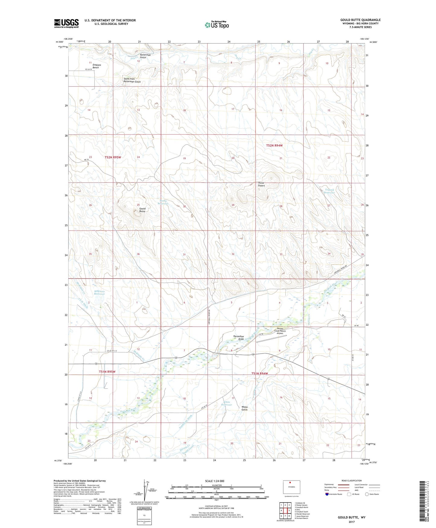
2021 topographic map quadrangle Gould Butte in the state of Wyoming. Scale: 1:24000. Based on the newly updated USGS 7.5' US Topo map series, this map is in the following counties: Big Horn. The map contains contour data, water features, and other items you are used to seeing on USGS maps, but also has updated roads and other features. This is the next generation of topographic maps. Printed on high-quality waterproof paper with UV fade-resistant inks.
Quads adjacent to this one:
West: Otto
Northwest: Emblem SE
North: Sheep Canyon
Northeast: Greybull North
East: Greybull South
Southeast: Orchard Bench
South: Jones Reservoir
Southwest: Wardel Reservoir
This map covers the same area as the classic USGS quad with code o44108d2.
Contains the following named places: Agrarian Ditch, Dorsey Creek, Dorsey Creek Ranch Airport, Farmers Canal, Gould Butte, Gould Canal, Gould Dam, Gould Reservoir, Gould School, Horseshoe Draw, Hump Reservoir, Kellerman Gulch, Lake McKinney, Lake McKinney Dam, McKinnie Creek, McKinnie Reservoir, Sandstone Ditch, South Fork Kellerman Gulch, Three Sisters, Trigood Reservoir, White Dam, White Gulch, White Reservoir